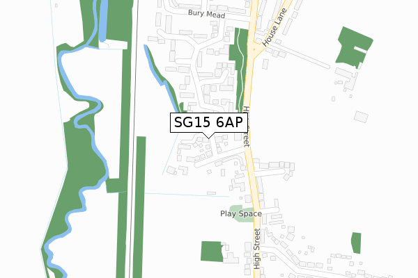
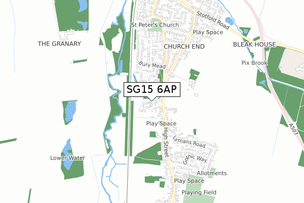
SG15 6AP is located in the Arlesey & Fairfield electoral ward, within the unitary authority of Central Bedfordshire and the English Parliamentary constituency of North East Bedfordshire. The Sub Integrated Care Board (ICB) Location is NHS Bedfordshire, Luton and Milton Keynes ICB - M1J4Y and the police force is Bedfordshire. This postcode has been in use since June 2019.


GetTheData
Source: OS Open Zoomstack (Ordnance Survey)
Licence: Open Government Licence (requires attribution)
Attribution: Contains OS data © Crown copyright and database right 2025
Source: Open Postcode Geo
Licence: Open Government Licence (requires attribution)
Attribution: Contains OS data © Crown copyright and database right 2025; Contains Royal Mail data © Royal Mail copyright and database right 2025; Source: Office for National Statistics licensed under the Open Government Licence v.3.0
| Easting | 519159 |
| Northing | 236868 |
| Latitude | 52.017460 |
| Longitude | -0.264964 |
GetTheData
Source: Open Postcode Geo
Licence: Open Government Licence
| Country | England |
| Postcode District | SG15 |
➜ See where SG15 is on a map ➜ Where is Arlesey? | |
GetTheData
Source: Land Registry Price Paid Data
Licence: Open Government Licence
| Ward | Arlesey & Fairfield |
| Constituency | North East Bedfordshire |
GetTheData
Source: ONS Postcode Database
Licence: Open Government Licence
9, TOPHAM GARDENS, ARLESEY, SG15 6AP 2021 22 JAN £449,950 |
2, TOPHAM GARDENS, ARLESEY, SG15 6AP 2020 15 OCT £559,950 |
15, TOPHAM GARDENS, ARLESEY, SG15 6AP 2020 14 AUG £427,950 |
1, TOPHAM GARDENS, ARLESEY, SG15 6AP 2020 11 AUG £548,000 |
11, TOPHAM GARDENS, ARLESEY, SG15 6AP 2020 31 JUL £499,950 |
3, TOPHAM GARDENS, ARLESEY, SG15 6AP 2020 29 JUL £419,950 |
7, TOPHAM GARDENS, ARLESEY, SG15 6AP 2020 30 MAR £562,950 |
5, TOPHAM GARDENS, ARLESEY, SG15 6AP 2020 6 MAR £435,000 |
4, TOPHAM GARDENS, ARLESEY, SG15 6AP 2020 6 MAR £549,950 |
6, TOPHAM GARDENS, ARLESEY, SG15 6AP 2019 28 OCT £475,000 |
GetTheData
Source: HM Land Registry Price Paid Data
Licence: Contains HM Land Registry data © Crown copyright and database right 2025. This data is licensed under the Open Government Licence v3.0.
| The Memorial (High Street) | Arlesey | 210m |
| The White Horse (High Street) | Arlesey | 221m |
| The White Horse (High Street) | Arlesey | 224m |
| The Memorial (High Street) | Arlesey | 271m |
| Glebe Avenue (Church Lane) | Arlesey | 560m |
| Arlesey Station | 1km |
| Letchworth Station | 4.8km |
GetTheData
Source: NaPTAN
Licence: Open Government Licence
GetTheData
Source: ONS Postcode Database
Licence: Open Government Licence


➜ Get more ratings from the Food Standards Agency
GetTheData
Source: Food Standards Agency
Licence: FSA terms & conditions
| Last Collection | |||
|---|---|---|---|
| Location | Mon-Fri | Sat | Distance |
| High Street North | 16:00 | 09:45 | 221m |
| Church Lane | 16:00 | 09:45 | 541m |
| Gothic Way | 16:00 | 09:30 | 595m |
GetTheData
Source: Dracos
Licence: Creative Commons Attribution-ShareAlike
The below table lists the International Territorial Level (ITL) codes (formerly Nomenclature of Territorial Units for Statistics (NUTS) codes) and Local Administrative Units (LAU) codes for SG15 6AP:
| ITL 1 Code | Name |
|---|---|
| TLH | East |
| ITL 2 Code | Name |
| TLH2 | Bedfordshire and Hertfordshire |
| ITL 3 Code | Name |
| TLH25 | Central Bedfordshire |
| LAU 1 Code | Name |
| E06000056 | Central Bedfordshire |
GetTheData
Source: ONS Postcode Directory
Licence: Open Government Licence
The below table lists the Census Output Area (OA), Lower Layer Super Output Area (LSOA), and Middle Layer Super Output Area (MSOA) for SG15 6AP:
| Code | Name | |
|---|---|---|
| OA | E00087769 | |
| LSOA | E01017378 | Central Bedfordshire 010C |
| MSOA | E02003608 | Central Bedfordshire 010 |
GetTheData
Source: ONS Postcode Directory
Licence: Open Government Licence
| SG15 6TA | High Street | 82m |
| SG15 6UD | Chase Hill Road | 133m |
| SG15 6FB | Lewis Lane | 169m |
| SG15 6UF | Chase Hill Road | 183m |
| SG15 6TD | High Street | 187m |
| SG15 6UA | High Street | 242m |
| SG15 6UE | Chase Hill Road | 286m |
| SG15 6UB | Bury Mead | 337m |
| SG15 6UG | Carters Way | 370m |
| SG15 6TB | High Street | 388m |
GetTheData
Source: Open Postcode Geo; Land Registry Price Paid Data
Licence: Open Government Licence