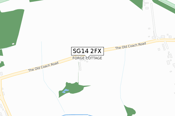
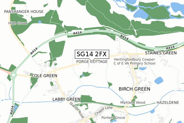
SG14 2FX is located in the Hertford Rural electoral ward, within the local authority district of East Hertfordshire and the English Parliamentary constituency of North East Hertfordshire. The Sub Integrated Care Board (ICB) Location is NHS Hertfordshire and West Essex ICB - 06K and the police force is Hertfordshire. This postcode has been in use since May 2018.


GetTheData
Source: OS Open Zoomstack (Ordnance Survey)
Licence: Open Government Licence (requires attribution)
Attribution: Contains OS data © Crown copyright and database right 2025
Source: Open Postcode Geo
Licence: Open Government Licence (requires attribution)
Attribution: Contains OS data © Crown copyright and database right 2025; Contains Royal Mail data © Royal Mail copyright and database right 2025; Source: Office for National Statistics licensed under the Open Government Licence v.3.0
| Easting | 528700 |
| Northing | 211669 |
| Latitude | 51.788888 |
| Longitude | -0.135406 |
GetTheData
Source: Open Postcode Geo
Licence: Open Government Licence
| Country | England |
| Postcode District | SG14 |
➜ See where SG14 is on a map | |
GetTheData
Source: Land Registry Price Paid Data
Licence: Open Government Licence
| Ward | Hertford Rural |
| Constituency | North East Hertfordshire |
GetTheData
Source: ONS Postcode Database
Licence: Open Government Licence
| War Memorial (The Old Coach Road) | Birch Green | 437m |
| War Memorial (The Old Coach Road) | Birch Green | 496m |
| Lodge Gates (Hatfield Road) | Cole Green | 514m |
| Lodge Gates (Hatfield Road) | Cole Green | 547m |
| Foxdells (The Green) | Birch Green | 676m |
| Hertford North Station | 3.2km |
| Bayford Station | 4.4km |
| Hertford East Station | 4.5km |
GetTheData
Source: NaPTAN
Licence: Open Government Licence
| Percentage of properties with Next Generation Access | 100.0% |
| Percentage of properties with Superfast Broadband | 100.0% |
| Percentage of properties with Ultrafast Broadband | 0.0% |
| Percentage of properties with Full Fibre Broadband | 0.0% |
Superfast Broadband is between 30Mbps and 300Mbps
Ultrafast Broadband is > 300Mbps
| Percentage of properties unable to receive 2Mbps | 0.0% |
| Percentage of properties unable to receive 5Mbps | 0.0% |
| Percentage of properties unable to receive 10Mbps | 0.0% |
| Percentage of properties unable to receive 30Mbps | 0.0% |
GetTheData
Source: Ofcom
Licence: Ofcom Terms of Use (requires attribution)
GetTheData
Source: ONS Postcode Database
Licence: Open Government Licence


➜ Get more ratings from the Food Standards Agency
GetTheData
Source: Food Standards Agency
Licence: FSA terms & conditions
| Last Collection | |||
|---|---|---|---|
| Location | Mon-Fri | Sat | Distance |
| Cole Green | 16:45 | 08:15 | 576m |
| Birch Green | 16:45 | 09:00 | 630m |
| Letty Green | 16:45 | 09:00 | 828m |
GetTheData
Source: Dracos
Licence: Creative Commons Attribution-ShareAlike
The below table lists the International Territorial Level (ITL) codes (formerly Nomenclature of Territorial Units for Statistics (NUTS) codes) and Local Administrative Units (LAU) codes for SG14 2FX:
| ITL 1 Code | Name |
|---|---|
| TLH | East |
| ITL 2 Code | Name |
| TLH2 | Bedfordshire and Hertfordshire |
| ITL 3 Code | Name |
| TLH23 | Hertfordshire CC |
| LAU 1 Code | Name |
| E07000242 | East Hertfordshire |
GetTheData
Source: ONS Postcode Directory
Licence: Open Government Licence
The below table lists the Census Output Area (OA), Lower Layer Super Output Area (LSOA), and Middle Layer Super Output Area (MSOA) for SG14 2FX:
| Code | Name | |
|---|---|---|
| OA | E00119292 | |
| LSOA | E01023486 | East Hertfordshire 010B |
| MSOA | E02004887 | East Hertfordshire 010 |
GetTheData
Source: ONS Postcode Directory
Licence: Open Government Licence
| SG14 2LP | Birch Green | 427m |
| SG14 2NL | 572m | |
| SG14 2LU | Birch Green | 596m |
| SG14 2NN | 619m | |
| SG14 2LR | Birch Green | 679m |
| SG14 2PA | Chapel Lane | 697m |
| SG14 2NS | Station Road | 732m |
| SG14 2NP | The Old Coach Road | 805m |
| SG14 2LS | Foxdells | 815m |
| SG14 2NZ | 875m |
GetTheData
Source: Open Postcode Geo; Land Registry Price Paid Data
Licence: Open Government Licence