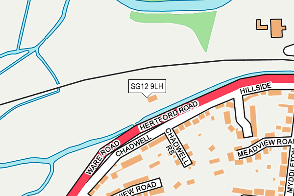
SG12 9LH is located in the Ware Priory electoral ward, within the local authority district of East Hertfordshire and the English Parliamentary constituency of Hertford and Stortford. The Sub Integrated Care Board (ICB) Location is NHS Hertfordshire and West Essex ICB - 06K and the police force is Hertfordshire. This postcode has been in use since July 2017.


GetTheData
Source: OS OpenMap – Local (Ordnance Survey)
Source: OS VectorMap District (Ordnance Survey)
Licence: Open Government Licence (requires attribution)
| Easting | 535308 |
| Northing | 213974 |
| Latitude | 51.808042 |
| Longitude | -0.038759 |
GetTheData
Source: Open Postcode Geo
Licence: Open Government Licence
| Country | England |
| Postcode District | SG12 |
➜ See where SG12 is on a map | |
GetTheData
Source: Land Registry Price Paid Data
Licence: Open Government Licence
| Ward | Ware Priory |
| Constituency | Hertford And Stortford |
GetTheData
Source: ONS Postcode Database
Licence: Open Government Licence
| Pumping Station (Hertford Road) | Chadwell | 47m |
| Pumping Station (Hertford Road) | Chadwell | 61m |
| Springs (Ware Road) | Chadwell | 450m |
| Hertford Regional College (Hertford Road) | Ware | 483m |
| Hertford Regional College (Hertford Road) | Ware | 489m |
| Ware Station | 0.7km |
| Hertford East Station | 2.6km |
| St Margarets (Herts) Station | 3.6km |
GetTheData
Source: NaPTAN
Licence: Open Government Licence
GetTheData
Source: ONS Postcode Database
Licence: Open Government Licence


➜ Get more ratings from the Food Standards Agency
GetTheData
Source: Food Standards Agency
Licence: FSA terms & conditions
| Last Collection | |||
|---|---|---|---|
| Location | Mon-Fri | Sat | Distance |
| Myddleton Road | 17:15 | 12:00 | 309m |
| Warner Road | 17:15 | 12:00 | 515m |
| High Street | 18:30 | 13:00 | 528m |
GetTheData
Source: Dracos
Licence: Creative Commons Attribution-ShareAlike
| Risk of SG12 9LH flooding from rivers and sea | Medium |
| ➜ SG12 9LH flood map | |
GetTheData
Source: Open Flood Risk by Postcode
Licence: Open Government Licence
The below table lists the International Territorial Level (ITL) codes (formerly Nomenclature of Territorial Units for Statistics (NUTS) codes) and Local Administrative Units (LAU) codes for SG12 9LH:
| ITL 1 Code | Name |
|---|---|
| TLH | East |
| ITL 2 Code | Name |
| TLH2 | Bedfordshire and Hertfordshire |
| ITL 3 Code | Name |
| TLH23 | Hertfordshire CC |
| LAU 1 Code | Name |
| E07000242 | East Hertfordshire |
GetTheData
Source: ONS Postcode Directory
Licence: Open Government Licence
The below table lists the Census Output Area (OA), Lower Layer Super Output Area (LSOA), and Middle Layer Super Output Area (MSOA) for SG12 9LH:
| Code | Name | |
|---|---|---|
| OA | E00119413 | |
| LSOA | E01023510 | East Hertfordshire 013A |
| MSOA | E02004890 | East Hertfordshire 013 |
GetTheData
Source: ONS Postcode Directory
Licence: Open Government Licence
| SG12 9JX | Chadwell | 99m |
| SG12 9JY | Chadwell | 140m |
| SG12 9LA | Chadwell Rise | 142m |
| SG12 9LB | Spring View Road | 210m |
| SG12 9JZ | Hillside | 214m |
| SG12 9JU | Meadview Road | 253m |
| SG12 9LD | Chadwell | 285m |
| SG12 9JN | Warner Road | 300m |
| SG12 9JP | Fairway | 329m |
| SG12 9JT | Myddleton Road | 331m |
GetTheData
Source: Open Postcode Geo; Land Registry Price Paid Data
Licence: Open Government Licence