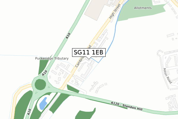
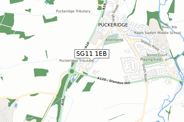
SG11 1EB is located in the Braughing & Standon electoral ward, within the local authority district of East Hertfordshire and the English Parliamentary constituency of North East Hertfordshire. The Sub Integrated Care Board (ICB) Location is NHS Hertfordshire and West Essex ICB - 06K and the police force is Hertfordshire. This postcode has been in use since September 2019.


GetTheData
Source: OS Open Zoomstack (Ordnance Survey)
Licence: Open Government Licence (requires attribution)
Attribution: Contains OS data © Crown copyright and database right 2024
Source: Open Postcode Geo
Licence: Open Government Licence (requires attribution)
Attribution: Contains OS data © Crown copyright and database right 2024; Contains Royal Mail data © Royal Mail copyright and database right 2024; Source: Office for National Statistics licensed under the Open Government Licence v.3.0
| Easting | 538331 |
| Northing | 222779 |
| Latitude | 51.886421 |
| Longitude | 0.008580 |
GetTheData
Source: Open Postcode Geo
Licence: Open Government Licence
| Country | England |
| Postcode District | SG11 |
➜ See where SG11 is on a map ➜ Where is Puckeridge? | |
GetTheData
Source: Land Registry Price Paid Data
Licence: Open Government Licence
| Ward | Braughing & Standon |
| Constituency | North East Hertfordshire |
GetTheData
Source: ONS Postcode Database
Licence: Open Government Licence
7, SHENLEYS, PUCKERIDGE, WARE, SG11 1EB 2021 5 FEB £595,000 |
GetTheData
Source: HM Land Registry Price Paid Data
Licence: Contains HM Land Registry data © Crown copyright and database right 2024. This data is licensed under the Open Government Licence v3.0.
| Cambridge Road (Standon Hill) | Puckeridge | 204m |
| Cambridge Road (Standon Hill) | Puckeridge | 222m |
| The Crown & Falcon Ph (Station Road) | Puckeridge | 572m |
| The Crown & Falcon Ph (Station Road) | Puckeridge | 587m |
| Chapel Hall (Station Road) | Puckeridge | 642m |
GetTheData
Source: NaPTAN
Licence: Open Government Licence
GetTheData
Source: ONS Postcode Database
Licence: Open Government Licence


➜ Get more ratings from the Food Standards Agency
GetTheData
Source: Food Standards Agency
Licence: FSA terms & conditions
| Last Collection | |||
|---|---|---|---|
| Location | Mon-Fri | Sat | Distance |
| Stanelow Crescent | 16:00 | 08:30 | 500m |
| Station Road | 16:00 | 09:45 | 600m |
| Puckeridge | 16:15 | 10:45 | 601m |
GetTheData
Source: Dracos
Licence: Creative Commons Attribution-ShareAlike
The below table lists the International Territorial Level (ITL) codes (formerly Nomenclature of Territorial Units for Statistics (NUTS) codes) and Local Administrative Units (LAU) codes for SG11 1EB:
| ITL 1 Code | Name |
|---|---|
| TLH | East |
| ITL 2 Code | Name |
| TLH2 | Bedfordshire and Hertfordshire |
| ITL 3 Code | Name |
| TLH23 | Hertfordshire CC |
| LAU 1 Code | Name |
| E07000242 | East Hertfordshire |
GetTheData
Source: ONS Postcode Directory
Licence: Open Government Licence
The below table lists the Census Output Area (OA), Lower Layer Super Output Area (LSOA), and Middle Layer Super Output Area (MSOA) for SG11 1EB:
| Code | Name | |
|---|---|---|
| OA | E00119351 | |
| LSOA | E01023498 | East Hertfordshire 006A |
| MSOA | E02004883 | East Hertfordshire 006 |
GetTheData
Source: ONS Postcode Directory
Licence: Open Government Licence
| SG11 1SB | Cambridge Road | 62m |
| SG11 1SA | Cambridge Road | 116m |
| SG11 1RY | Cambridge Road | 258m |
| SG11 1PZ | Aston Road | 424m |
| SG11 1PY | Aston Road | 432m |
| SG11 1UT | Lunardi Court | 438m |
| SG11 1RX | High Street | 448m |
| SG11 1SW | Roundhaye | 509m |
| SG11 1QE | Plashes Close | 509m |
| SG11 1PG | Hammarsfield Close | 538m |
GetTheData
Source: Open Postcode Geo; Land Registry Price Paid Data
Licence: Open Government Licence