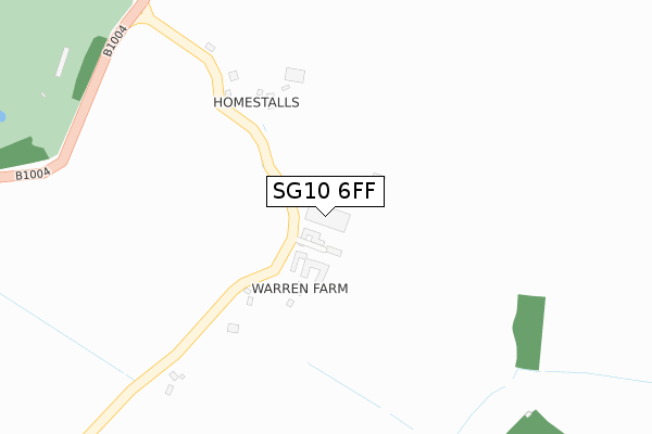
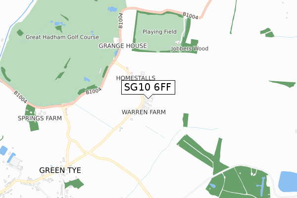
SG10 6FF is located in the Much Hadham electoral ward, within the local authority district of East Hertfordshire and the English Parliamentary constituency of Hertford and Stortford. The Sub Integrated Care Board (ICB) Location is NHS Hertfordshire and West Essex ICB - 06K and the police force is Hertfordshire. This postcode has been in use since December 2018.


GetTheData
Source: OS Open Zoomstack (Ordnance Survey)
Licence: Open Government Licence (requires attribution)
Attribution: Contains OS data © Crown copyright and database right 2025
Source: Open Postcode Geo
Licence: Open Government Licence (requires attribution)
Attribution: Contains OS data © Crown copyright and database right 2025; Contains Royal Mail data © Royal Mail copyright and database right 2025; Source: Office for National Statistics licensed under the Open Government Licence v.3.0
| Easting | 545349 |
| Northing | 219123 |
| Latitude | 51.851789 |
| Longitude | 0.108939 |
GetTheData
Source: Open Postcode Geo
Licence: Open Government Licence
| Country | England |
| Postcode District | SG10 |
➜ See where SG10 is on a map | |
GetTheData
Source: Land Registry Price Paid Data
Licence: Open Government Licence
| Ward | Much Hadham |
| Constituency | Hertford And Stortford |
GetTheData
Source: ONS Postcode Database
Licence: Open Government Licence
| Ducketts Lane (Unknown) | Green Tye | 975m |
| Ducketts Lane (Unknown) | Green Tye | 999m |
| Prince Of Wales Ph (Unknown) | Green Tye | 1,163m |
| Prince Of Wales Ph (Unknown) | Green Tye | 1,177m |
| Bishops Stortford Station | 4.2km |
| Sawbridgeworth Station | 5.5km |
GetTheData
Source: NaPTAN
Licence: Open Government Licence
GetTheData
Source: ONS Postcode Database
Licence: Open Government Licence


➜ Get more ratings from the Food Standards Agency
GetTheData
Source: Food Standards Agency
Licence: FSA terms & conditions
| Last Collection | |||
|---|---|---|---|
| Location | Mon-Fri | Sat | Distance |
| Green Tye | 17:00 | 10:30 | 1,071m |
| Dane Bridge | 17:00 | 09:00 | 1,606m |
| Perry Green | 17:00 | 11:00 | 2,044m |
GetTheData
Source: Dracos
Licence: Creative Commons Attribution-ShareAlike
The below table lists the International Territorial Level (ITL) codes (formerly Nomenclature of Territorial Units for Statistics (NUTS) codes) and Local Administrative Units (LAU) codes for SG10 6FF:
| ITL 1 Code | Name |
|---|---|
| TLH | East |
| ITL 2 Code | Name |
| TLH2 | Bedfordshire and Hertfordshire |
| ITL 3 Code | Name |
| TLH23 | Hertfordshire CC |
| LAU 1 Code | Name |
| E07000242 | East Hertfordshire |
GetTheData
Source: ONS Postcode Directory
Licence: Open Government Licence
The below table lists the Census Output Area (OA), Lower Layer Super Output Area (LSOA), and Middle Layer Super Output Area (MSOA) for SG10 6FF:
| Code | Name | |
|---|---|---|
| OA | E00119347 | |
| LSOA | E01023496 | East Hertfordshire 009C |
| MSOA | E02004886 | East Hertfordshire 009 |
GetTheData
Source: ONS Postcode Directory
Licence: Open Government Licence
| SG10 6JD | 79m | |
| SG10 6JE | Great Hadham Road | 555m |
| SG10 6JQ | 705m | |
| SG10 6JH | 879m | |
| SG10 6JL | 960m | |
| SG10 6JG | 994m | |
| SG10 6JN | Ducketts Lane | 1042m |
| SG10 6JW | Ducketts Lane | 1050m |
| SG10 6JP | 1226m | |
| SG10 6JJ | 1397m |
GetTheData
Source: Open Postcode Geo; Land Registry Price Paid Data
Licence: Open Government Licence