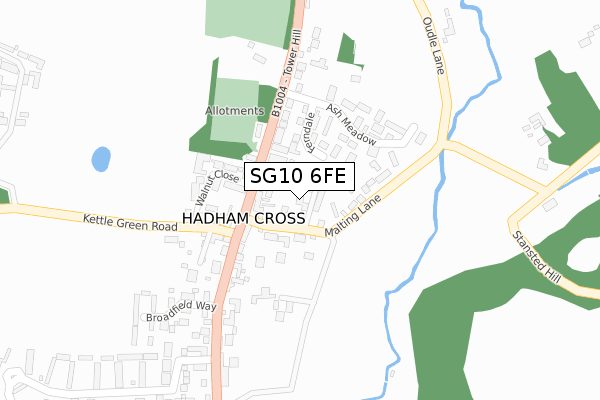
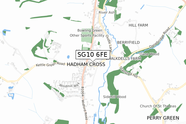
SG10 6FE is located in the Much Hadham electoral ward, within the local authority district of East Hertfordshire and the English Parliamentary constituency of Hertford and Stortford. The Sub Integrated Care Board (ICB) Location is NHS Hertfordshire and West Essex ICB - 06K and the police force is Hertfordshire. This postcode has been in use since November 2017.


GetTheData
Source: OS Open Zoomstack (Ordnance Survey)
Licence: Open Government Licence (requires attribution)
Attribution: Contains OS data © Crown copyright and database right 2025
Source: Open Postcode Geo
Licence: Open Government Licence (requires attribution)
Attribution: Contains OS data © Crown copyright and database right 2025; Contains Royal Mail data © Royal Mail copyright and database right 2025; Source: Office for National Statistics licensed under the Open Government Licence v.3.0
| Easting | 542759 |
| Northing | 218569 |
| Latitude | 51.847479 |
| Longitude | 0.071134 |
GetTheData
Source: Open Postcode Geo
Licence: Open Government Licence
| Country | England |
| Postcode District | SG10 |
➜ See where SG10 is on a map ➜ Where is Hadham Cross? | |
GetTheData
Source: Land Registry Price Paid Data
Licence: Open Government Licence
| Ward | Much Hadham |
| Constituency | Hertford And Stortford |
GetTheData
Source: ONS Postcode Database
Licence: Open Government Licence
2024 18 JAN £630,000 |
DOULTON HOUSE, FREDERICK COURT, MUCH HADHAM, SG10 6FE 2020 24 SEP £825,000 |
2018 26 NOV £750,000 |
APPLE TREE HOUSE, FREDERICK COURT, MUCH HADHAM, SG10 6FE 2017 22 DEC £415,200 |
GetTheData
Source: HM Land Registry Price Paid Data
Licence: Contains HM Land Registry data © Crown copyright and database right 2025. This data is licensed under the Open Government Licence v3.0.
| Ash Meadow (Tower Hill) | Hadham Cross | 158m |
| Broadfield Way (Tower Hill) | Hadham Cross | 166m |
| Broadfield Way (Tower Hill) | Hadham Cross | 216m |
| Almshouses (Tower Hill) | Much Hadham | 376m |
| Almshouses (Tower Hill) | Much Hadham | 380m |
GetTheData
Source: NaPTAN
Licence: Open Government Licence
| Percentage of properties with Next Generation Access | 100.0% |
| Percentage of properties with Superfast Broadband | 100.0% |
| Percentage of properties with Ultrafast Broadband | 0.0% |
| Percentage of properties with Full Fibre Broadband | 0.0% |
Superfast Broadband is between 30Mbps and 300Mbps
Ultrafast Broadband is > 300Mbps
| Percentage of properties unable to receive 2Mbps | 0.0% |
| Percentage of properties unable to receive 5Mbps | 0.0% |
| Percentage of properties unable to receive 10Mbps | 0.0% |
| Percentage of properties unable to receive 30Mbps | 0.0% |
GetTheData
Source: Ofcom
Licence: Ofcom Terms of Use (requires attribution)
GetTheData
Source: ONS Postcode Database
Licence: Open Government Licence

➜ Get more ratings from the Food Standards Agency
GetTheData
Source: Food Standards Agency
Licence: FSA terms & conditions
| Last Collection | |||
|---|---|---|---|
| Location | Mon-Fri | Sat | Distance |
| Much Hadham Post Office | 17:00 | 12:00 | 89m |
| Windmill Way | 16:30 | 07:30 | 556m |
| Village Hall | 16:45 | 08:30 | 688m |
GetTheData
Source: Dracos
Licence: Creative Commons Attribution-ShareAlike
The below table lists the International Territorial Level (ITL) codes (formerly Nomenclature of Territorial Units for Statistics (NUTS) codes) and Local Administrative Units (LAU) codes for SG10 6FE:
| ITL 1 Code | Name |
|---|---|
| TLH | East |
| ITL 2 Code | Name |
| TLH2 | Bedfordshire and Hertfordshire |
| ITL 3 Code | Name |
| TLH23 | Hertfordshire CC |
| LAU 1 Code | Name |
| E07000242 | East Hertfordshire |
GetTheData
Source: ONS Postcode Directory
Licence: Open Government Licence
The below table lists the Census Output Area (OA), Lower Layer Super Output Area (LSOA), and Middle Layer Super Output Area (MSOA) for SG10 6FE:
| Code | Name | |
|---|---|---|
| OA | E00119345 | |
| LSOA | E01023497 | East Hertfordshire 009D |
| MSOA | E02004886 | East Hertfordshire 009 |
GetTheData
Source: ONS Postcode Directory
Licence: Open Government Licence
| SG10 6DF | Hadham Cross | 69m |
| SG10 6AN | Malting Lane | 73m |
| SG10 6DW | Ferndale | 94m |
| SG10 6AW | Malting Lane | 111m |
| SG10 6AL | Hadham Cross | 138m |
| SG10 6DE | Hadham Cross | 141m |
| SG10 6AJ | Kettle Green Road | 164m |
| SG10 6DP | Ash Meadow | 178m |
| SG10 6AR | Broadfield Way | 264m |
| SG10 6AP | Hadham Cross | 319m |
GetTheData
Source: Open Postcode Geo; Land Registry Price Paid Data
Licence: Open Government Licence