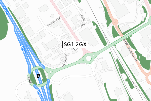
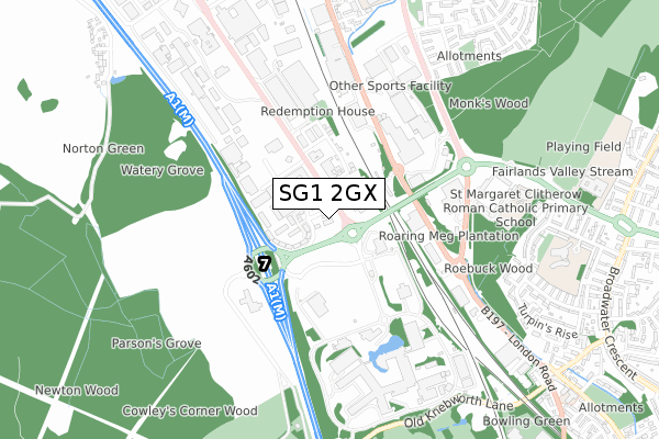
SG1 2GX is located in the Roebuck electoral ward, within the local authority district of Stevenage and the English Parliamentary constituency of Stevenage. The Sub Integrated Care Board (ICB) Location is NHS Hertfordshire and West Essex ICB - 06K and the police force is Hertfordshire. This postcode has been in use since September 2019.


GetTheData
Source: OS Open Zoomstack (Ordnance Survey)
Licence: Open Government Licence (requires attribution)
Attribution: Contains OS data © Crown copyright and database right 2025
Source: Open Postcode Geo
Licence: Open Government Licence (requires attribution)
Attribution: Contains OS data © Crown copyright and database right 2025; Contains Royal Mail data © Royal Mail copyright and database right 2025; Source: Office for National Statistics licensed under the Open Government Licence v.3.0
| Easting | 523781 |
| Northing | 222696 |
| Latitude | 51.889092 |
| Longitude | -0.202748 |
GetTheData
Source: Open Postcode Geo
Licence: Open Government Licence
| Country | England |
| Postcode District | SG1 |
➜ See where SG1 is on a map ➜ Where is Stevenage? | |
GetTheData
Source: Land Registry Price Paid Data
Licence: Open Government Licence
| Ward | Roebuck |
| Constituency | Stevenage |
GetTheData
Source: ONS Postcode Database
Licence: Open Government Licence
| Broadhall Way (Gunnels Wood Road) | Stevenage | 66m |
| Leyden Road (Gunnels Wood Road) | Stevenage | 100m |
| Leyden Road (Gunnels Wood Road) | Stevenage | 233m |
| Retail Park (London Road) | Monk's Wood | 375m |
| Retail Park (London Road) | Monk's Wood | 377m |
| Stevenage Station | 1.4km |
| Knebworth Station | 2.7km |
GetTheData
Source: NaPTAN
Licence: Open Government Licence
GetTheData
Source: ONS Postcode Database
Licence: Open Government Licence


➜ Get more ratings from the Food Standards Agency
GetTheData
Source: Food Standards Agency
Licence: FSA terms & conditions
| Last Collection | |||
|---|---|---|---|
| Location | Mon-Fri | Sat | Distance |
| Gunnelswood Road | 18:30 | 10:45 | 625m |
| Stevenage Mail Centre | 19:30 | 13:30 | 821m |
| Stevenage Mail Centre | 19:30 | 822m | |
GetTheData
Source: Dracos
Licence: Creative Commons Attribution-ShareAlike
The below table lists the International Territorial Level (ITL) codes (formerly Nomenclature of Territorial Units for Statistics (NUTS) codes) and Local Administrative Units (LAU) codes for SG1 2GX:
| ITL 1 Code | Name |
|---|---|
| TLH | East |
| ITL 2 Code | Name |
| TLH2 | Bedfordshire and Hertfordshire |
| ITL 3 Code | Name |
| TLH23 | Hertfordshire CC |
| LAU 1 Code | Name |
| E07000243 | Stevenage |
GetTheData
Source: ONS Postcode Directory
Licence: Open Government Licence
The below table lists the Census Output Area (OA), Lower Layer Super Output Area (LSOA), and Middle Layer Super Output Area (MSOA) for SG1 2GX:
| Code | Name | |
|---|---|---|
| OA | E00120776 | |
| LSOA | E01023786 | Stevenage 011D |
| MSOA | E02004954 | Stevenage 011 |
GetTheData
Source: ONS Postcode Directory
Licence: Open Government Licence
| SG1 2FP | Whittle Way | 143m |
| SG1 2BP | Leyden Road | 180m |
| SG1 2BD | Whittle Way | 214m |
| SG1 2AX | Knebworth Park | 436m |
| SG1 1SA | Jennings Close | 736m |
| SG1 1XR | Tippett Court | 759m |
| SG2 8QZ | Turpins Rise | 762m |
| SG2 8RA | Broad Oak Way | 763m |
| SG1 1XW | London Road | 770m |
| SG1 1SB | Dunn Close | 781m |
GetTheData
Source: Open Postcode Geo; Land Registry Price Paid Data
Licence: Open Government Licence