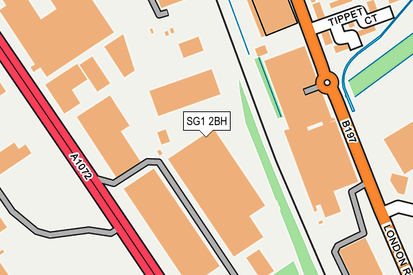
SG1 2BH is located in the Roebuck electoral ward, within the local authority district of Stevenage and the English Parliamentary constituency of Stevenage. The Sub Integrated Care Board (ICB) Location is NHS Hertfordshire and West Essex ICB - 06K and the police force is Hertfordshire. This postcode has been in use since April 1985.


GetTheData
Source: OS OpenMap – Local (Ordnance Survey)
Source: OS VectorMap District (Ordnance Survey)
Licence: Open Government Licence (requires attribution)
| Easting | 523647 |
| Northing | 223245 |
| Latitude | 51.894055 |
| Longitude | -0.204498 |
GetTheData
Source: Open Postcode Geo
Licence: Open Government Licence
| Country | England |
| Postcode District | SG1 |
➜ See where SG1 is on a map ➜ Where is Stevenage? | |
GetTheData
Source: Land Registry Price Paid Data
Licence: Open Government Licence
Elevation or altitude of SG1 2BH as distance above sea level:
| Metres | Feet | |
|---|---|---|
| Elevation | 90m | 295ft |
Elevation is measured from the approximate centre of the postcode, to the nearest point on an OS contour line from OS Terrain 50, which has contour spacing of ten vertical metres.
➜ How high above sea level am I? Find the elevation of your current position using your device's GPS.
GetTheData
Source: Open Postcode Elevation
Licence: Open Government Licence
| Ward | Roebuck |
| Constituency | Stevenage |
GetTheData
Source: ONS Postcode Database
Licence: Open Government Licence
| Gunnels Wood Park (Gunnels Wood Road) | Stevenage | 162m |
| Gunnels Wood Park (Gunnels Wood Road) | Stevenage | 162m |
| Norton Green Road (Gunnels Wood Road) | Stevenage | 286m |
| Roaring Meg Retail Park (London Road) | Monk's Wood | 312m |
| Leyden Road (Gunnels Wood Road) | Stevenage | 334m |
| Stevenage Station | 0.9km |
| Knebworth Station | 3.2km |
GetTheData
Source: NaPTAN
Licence: Open Government Licence
| Median download speed | 40.9Mbps |
| Average download speed | 36.8Mbps |
| Maximum download speed | 59.43Mbps |
| Median upload speed | 8.2Mbps |
| Average upload speed | 6.8Mbps |
| Maximum upload speed | 10.00Mbps |
GetTheData
Source: Ofcom
Licence: Ofcom Terms of Use (requires attribution)
Estimated total energy consumption in SG1 2BH by fuel type, 2015.
| Consumption (kWh) | 352,601 |
|---|---|
| Meter count | 25 |
| Mean (kWh/meter) | 14,104 |
| Median (kWh/meter) | 2,677 |
GetTheData
Source: Postcode level gas estimates: 2015 (experimental)
Source: Postcode level electricity estimates: 2015 (experimental)
Licence: Open Government Licence
GetTheData
Source: ONS Postcode Database
Licence: Open Government Licence


➜ Get more ratings from the Food Standards Agency
GetTheData
Source: Food Standards Agency
Licence: FSA terms & conditions
| Last Collection | |||
|---|---|---|---|
| Location | Mon-Fri | Sat | Distance |
| Gunnelswood Road | 18:30 | 10:45 | 161m |
| Stevenage Mail Centre | 19:30 | 13:30 | 287m |
| Stevenage Mail Centre | 19:30 | 288m | |
GetTheData
Source: Dracos
Licence: Creative Commons Attribution-ShareAlike
The below table lists the International Territorial Level (ITL) codes (formerly Nomenclature of Territorial Units for Statistics (NUTS) codes) and Local Administrative Units (LAU) codes for SG1 2BH:
| ITL 1 Code | Name |
|---|---|
| TLH | East |
| ITL 2 Code | Name |
| TLH2 | Bedfordshire and Hertfordshire |
| ITL 3 Code | Name |
| TLH23 | Hertfordshire CC |
| LAU 1 Code | Name |
| E07000243 | Stevenage |
GetTheData
Source: ONS Postcode Directory
Licence: Open Government Licence
The below table lists the Census Output Area (OA), Lower Layer Super Output Area (LSOA), and Middle Layer Super Output Area (MSOA) for SG1 2BH:
| Code | Name | |
|---|---|---|
| OA | E00120776 | |
| LSOA | E01023786 | Stevenage 011D |
| MSOA | E02004954 | Stevenage 011 |
GetTheData
Source: ONS Postcode Directory
Licence: Open Government Licence
| SG1 1XW | London Road | 279m |
| SG1 1XR | Tippett Court | 300m |
| SG1 2BA | Norton Green Road | 407m |
| SG1 2BP | Leyden Road | 411m |
| SG1 2BD | Whittle Way | 512m |
| SG1 1SA | Jennings Close | 531m |
| SG1 1SD | Elder Way | 556m |
| SG1 1TN | Buckthorn Avenue | 564m |
| SG1 1TS | Farm Close | 590m |
| SG1 2FP | Whittle Way | 599m |
GetTheData
Source: Open Postcode Geo; Land Registry Price Paid Data
Licence: Open Government Licence