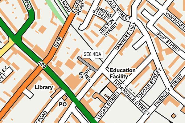
SE8 4DA is located in the Brockley electoral ward, within the London borough of Lewisham and the English Parliamentary constituency of Lewisham, Deptford. The Sub Integrated Care Board (ICB) Location is NHS South East London ICB - 72Q and the police force is Metropolitan Police. This postcode has been in use since August 2016.


GetTheData
Source: OS OpenMap – Local (Ordnance Survey)
Source: OS VectorMap District (Ordnance Survey)
Licence: Open Government Licence (requires attribution)
| Easting | 536984 |
| Northing | 176658 |
| Latitude | 51.472311 |
| Longitude | -0.029061 |
GetTheData
Source: Open Postcode Geo
Licence: Open Government Licence
| Country | England |
| Postcode District | SE8 |
➜ See where SE8 is on a map ➜ Where is London? | |
GetTheData
Source: Land Registry Price Paid Data
Licence: Open Government Licence
Elevation or altitude of SE8 4DA as distance above sea level:
| Metres | Feet | |
|---|---|---|
| Elevation | 20m | 66ft |
Elevation is measured from the approximate centre of the postcode, to the nearest point on an OS contour line from OS Terrain 50, which has contour spacing of ten vertical metres.
➜ How high above sea level am I? Find the elevation of your current position using your device's GPS.
GetTheData
Source: Open Postcode Elevation
Licence: Open Government Licence
| Ward | Brockley |
| Constituency | Lewisham, Deptford |
GetTheData
Source: ONS Postcode Database
Licence: Open Government Licence
| Malpas Road (Lewisham Way) | New Cross | 118m |
| Malpas Road (Lewisham Way) | New Cross | 132m |
| Lucas Street (Lewisham Way) | St John's | 181m |
| Lucas Street (Lewisham Way) | St John's | 209m |
| Amersham Road | New Cross | 241m |
| Deptford Bridge Dlr Station (Deptford Bridge) | Deptford Bridge | 508m |
| Elverson Road Dlr Station (Elverson Road) | Elverson Road | 931m |
| Greenwich Dlr Station (Greenwich High Road) | Greenwich | 1,249m |
| Lewisham Dlr Station (Loampit Vale) | Lewisham | 1,412m |
| Cutty Sark (For Maritime Greenwich) Dlr Station (Creek Road) | Greenwich | 1,642m |
| New Cross ELL Station | 0.5km |
| St Johns (London) Station | 0.5km |
| Deptford Station | 0.8km |
GetTheData
Source: NaPTAN
Licence: Open Government Licence
| Percentage of properties with Next Generation Access | 100.0% |
| Percentage of properties with Superfast Broadband | 100.0% |
| Percentage of properties with Ultrafast Broadband | 0.0% |
| Percentage of properties with Full Fibre Broadband | 0.0% |
Superfast Broadband is between 30Mbps and 300Mbps
Ultrafast Broadband is > 300Mbps
| Median download speed | 45.7Mbps |
| Average download speed | 49.4Mbps |
| Maximum download speed | 80.00Mbps |
| Median upload speed | 10.0Mbps |
| Average upload speed | 11.4Mbps |
| Maximum upload speed | 20.00Mbps |
| Percentage of properties unable to receive 2Mbps | 0.0% |
| Percentage of properties unable to receive 5Mbps | 0.0% |
| Percentage of properties unable to receive 10Mbps | 0.0% |
| Percentage of properties unable to receive 30Mbps | 0.0% |
GetTheData
Source: Ofcom
Licence: Ofcom Terms of Use (requires attribution)
GetTheData
Source: ONS Postcode Database
Licence: Open Government Licence


➜ Get more ratings from the Food Standards Agency
GetTheData
Source: Food Standards Agency
Licence: FSA terms & conditions
| Last Collection | |||
|---|---|---|---|
| Location | Mon-Fri | Sat | Distance |
| Post Office | 17:30 | 12:00 | 131m |
| Tanners Hill | 17:30 | 12:00 | 202m |
| Friendly Street | 17:30 | 12:00 | 233m |
GetTheData
Source: Dracos
Licence: Creative Commons Attribution-ShareAlike
The below table lists the International Territorial Level (ITL) codes (formerly Nomenclature of Territorial Units for Statistics (NUTS) codes) and Local Administrative Units (LAU) codes for SE8 4DA:
| ITL 1 Code | Name |
|---|---|
| TLI | London |
| ITL 2 Code | Name |
| TLI4 | Inner London - East |
| ITL 3 Code | Name |
| TLI44 | Lewisham and Southwark |
| LAU 1 Code | Name |
| E09000023 | Lewisham |
GetTheData
Source: ONS Postcode Directory
Licence: Open Government Licence
The below table lists the Census Output Area (OA), Lower Layer Super Output Area (LSOA), and Middle Layer Super Output Area (MSOA) for SE8 4DA:
| Code | Name | |
|---|---|---|
| OA | E00016236 | |
| LSOA | E01003210 | Lewisham 005C |
| MSOA | E02000657 | Lewisham 005 |
GetTheData
Source: ONS Postcode Directory
Licence: Open Government Licence
| SE8 4QD | Tanners Hill | 70m |
| SE8 4QB | Thornville Street | 71m |
| SE14 6QP | Lewisham Way | 89m |
| SE14 6TT | Heston Street | 96m |
| SE8 4QF | St Nicholas Street | 104m |
| SE8 4PU | Tanners Hill | 105m |
| SE8 4PX | Tanners Hill | 105m |
| SE8 4QE | Tanners Mews | 112m |
| SE14 6QL | Florence Road | 118m |
| SE8 4PY | Tanners Hill | 122m |
GetTheData
Source: Open Postcode Geo; Land Registry Price Paid Data
Licence: Open Government Licence