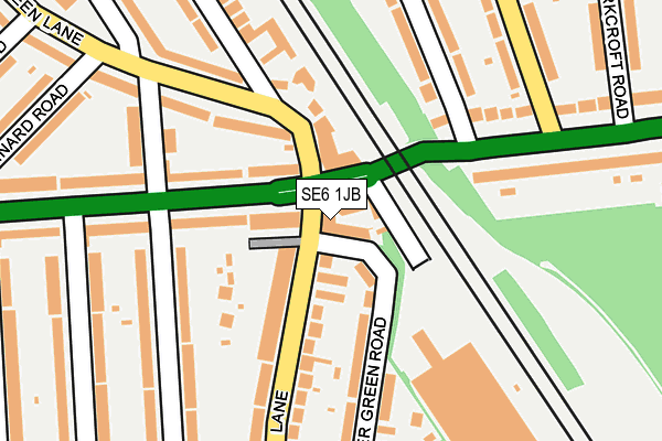
SE6 1JB is located in the Hither Green electoral ward, within the London borough of Lewisham and the English Parliamentary constituency of Lewisham East. The Sub Integrated Care Board (ICB) Location is NHS South East London ICB - 72Q and the police force is Metropolitan Police. This postcode has been in use since January 1980.


GetTheData
Source: OS OpenMap – Local (Ordnance Survey)
Source: OS VectorMap District (Ordnance Survey)
Licence: Open Government Licence (requires attribution)
| Easting | 539410 |
| Northing | 173683 |
| Latitude | 51.444986 |
| Longitude | 0.004675 |
GetTheData
Source: Open Postcode Geo
Licence: Open Government Licence
| Country | England |
| Postcode District | SE6 |
➜ See where SE6 is on a map ➜ Where is Catford? | |
GetTheData
Source: Land Registry Price Paid Data
Licence: Open Government Licence
Elevation or altitude of SE6 1JB as distance above sea level:
| Metres | Feet | |
|---|---|---|
| Elevation | 30m | 98ft |
Elevation is measured from the approximate centre of the postcode, to the nearest point on an OS contour line from OS Terrain 50, which has contour spacing of ten vertical metres.
➜ How high above sea level am I? Find the elevation of your current position using your device's GPS.
GetTheData
Source: Open Postcode Elevation
Licence: Open Government Licence
| Ward | Hither Green |
| Constituency | Lewisham East |
GetTheData
Source: ONS Postcode Database
Licence: Open Government Licence
| Brownhill Rd Wellmeadow Rd (Brownhill Road) | Hither Green | 102m |
| Parkcroft Road | Hither Green | 251m |
| Parkcroft Road | Hither Green | 263m |
| Sandhurst Road Verdant Lane | Hither Green | 322m |
| Sandhurst Road Verdant Lane | Hither Green | 331m |
| Lee Station | 0.8km |
| Hither Green Station | 0.9km |
| Grove Park Station | 2km |
GetTheData
Source: NaPTAN
Licence: Open Government Licence
GetTheData
Source: ONS Postcode Database
Licence: Open Government Licence


➜ Get more ratings from the Food Standards Agency
GetTheData
Source: Food Standards Agency
Licence: FSA terms & conditions
| Last Collection | |||
|---|---|---|---|
| Location | Mon-Fri | Sat | Distance |
| Verdant Lane | 17:30 | 12:00 | 92m |
| Milborough Crescent | 17:30 | 12:00 | 239m |
| 313 Brownhill Road | 17:30 | 12:00 | 259m |
GetTheData
Source: Dracos
Licence: Creative Commons Attribution-ShareAlike
The below table lists the International Territorial Level (ITL) codes (formerly Nomenclature of Territorial Units for Statistics (NUTS) codes) and Local Administrative Units (LAU) codes for SE6 1JB:
| ITL 1 Code | Name |
|---|---|
| TLI | London |
| ITL 2 Code | Name |
| TLI4 | Inner London - East |
| ITL 3 Code | Name |
| TLI44 | Lewisham and Southwark |
| LAU 1 Code | Name |
| E09000023 | Lewisham |
GetTheData
Source: ONS Postcode Directory
Licence: Open Government Licence
The below table lists the Census Output Area (OA), Lower Layer Super Output Area (LSOA), and Middle Layer Super Output Area (MSOA) for SE6 1JB:
| Code | Name | |
|---|---|---|
| OA | E00016940 | |
| LSOA | E01003354 | Lewisham 026D |
| MSOA | E02000678 | Lewisham 026 |
GetTheData
Source: ONS Postcode Directory
Licence: Open Government Licence
| SE6 1LE | Verdant Lane | 12m |
| SE12 0RG | St Mildreds Road | 13m |
| SE12 0RL | St Mildreds Road | 62m |
| SE6 1AY | Brownhill Road | 128m |
| SE13 6TR | Hither Green Lane | 133m |
| SE6 1JH | Further Green Road | 156m |
| SE6 1JD | Verdant Lane | 161m |
| SE6 1LF | Verdant Lane | 177m |
| SE6 1HL | Wellmeadow Road | 191m |
| SE12 0RE | St Mildreds Road | 204m |
GetTheData
Source: Open Postcode Geo; Land Registry Price Paid Data
Licence: Open Government Licence