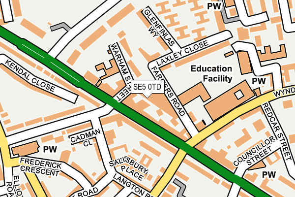
SE5 0TD is located in the Camberwell Green electoral ward, within the London borough of Southwark and the English Parliamentary constituency of Camberwell and Peckham. The Sub Integrated Care Board (ICB) Location is NHS South East London ICB - 72Q and the police force is Metropolitan Police. This postcode has been in use since June 1996.


GetTheData
Source: OS OpenMap – Local (Ordnance Survey)
Source: OS VectorMap District (Ordnance Survey)
Licence: Open Government Licence (requires attribution)
| Easting | 531863 |
| Northing | 177202 |
| Latitude | 51.478416 |
| Longitude | -0.102546 |
GetTheData
Source: Open Postcode Geo
Licence: Open Government Licence
| Country | England |
| Postcode District | SE5 |
➜ See where SE5 is on a map ➜ Where is London? | |
GetTheData
Source: Land Registry Price Paid Data
Licence: Open Government Licence
Elevation or altitude of SE5 0TD as distance above sea level:
| Metres | Feet | |
|---|---|---|
| Elevation | 10m | 33ft |
Elevation is measured from the approximate centre of the postcode, to the nearest point on an OS contour line from OS Terrain 50, which has contour spacing of ten vertical metres.
➜ How high above sea level am I? Find the elevation of your current position using your device's GPS.
GetTheData
Source: Open Postcode Elevation
Licence: Open Government Licence
| Ward | Camberwell Green |
| Constituency | Camberwell And Peckham |
GetTheData
Source: ONS Postcode Database
Licence: Open Government Licence
| Vassall Road (Se5) | Camberwell | 49m |
| Vassall Road (Se5) | Camberwell | 51m |
| Vassall Rd Camberwell New Rd (Vassall Road) | Camberwell | 110m |
| St John's School (Camberwell New Road) | Camberwell | 127m |
| Wyndham Rd Camberwell New Rd (Camberwell New Road) | Camberwell | 165m |
| Oval Underground Station | Oval | 785m |
| Kennington Underground Station | Kennington | 1,128m |
| Stockwell Underground Station | Stockwell | 1,557m |
| Loughborough Junction Station | 1.3km |
| Denmark Hill Station | 1.5km |
| Vauxhall Station | 1.7km |
GetTheData
Source: NaPTAN
Licence: Open Government Licence
GetTheData
Source: ONS Postcode Database
Licence: Open Government Licence


➜ Get more ratings from the Food Standards Agency
GetTheData
Source: Food Standards Agency
Licence: FSA terms & conditions
| Last Collection | |||
|---|---|---|---|
| Location | Mon-Fri | Sat | Distance |
| Post Office | 17:30 | 12:00 | 72m |
| John Ruskin Street | 17:30 | 12:00 | 306m |
| County Grove | 17:30 | 12:00 | 370m |
GetTheData
Source: Dracos
Licence: Creative Commons Attribution-ShareAlike
| Risk of SE5 0TD flooding from rivers and sea | Very Low |
| ➜ SE5 0TD flood map | |
GetTheData
Source: Open Flood Risk by Postcode
Licence: Open Government Licence
The below table lists the International Territorial Level (ITL) codes (formerly Nomenclature of Territorial Units for Statistics (NUTS) codes) and Local Administrative Units (LAU) codes for SE5 0TD:
| ITL 1 Code | Name |
|---|---|
| TLI | London |
| ITL 2 Code | Name |
| TLI4 | Inner London - East |
| ITL 3 Code | Name |
| TLI44 | Lewisham and Southwark |
| LAU 1 Code | Name |
| E09000028 | Southwark |
GetTheData
Source: ONS Postcode Directory
Licence: Open Government Licence
The below table lists the Census Output Area (OA), Lower Layer Super Output Area (LSOA), and Middle Layer Super Output Area (MSOA) for SE5 0TD:
| Code | Name | |
|---|---|---|
| OA | E00019762 | |
| LSOA | E01003926 | Southwark 021F |
| MSOA | E02000827 | Southwark 021 |
GetTheData
Source: ONS Postcode Directory
Licence: Open Government Licence
| SE5 0TJ | Camberwell New Road | 39m |
| SE5 0SX | Warham Street | 58m |
| SE5 0TW | Farmers Road | 91m |
| SW9 6JB | Vassall Road | 93m |
| SE5 0TB | Grimsel Path | 97m |
| SE5 0SU | Camberwell New Road | 101m |
| SW9 6XD | The Woodlands | 101m |
| SW9 6XB | The Caxtons | 106m |
| SE5 0RR | Camberwell New Road | 124m |
| SW9 6UW | Salisbury Place | 125m |
GetTheData
Source: Open Postcode Geo; Land Registry Price Paid Data
Licence: Open Government Licence