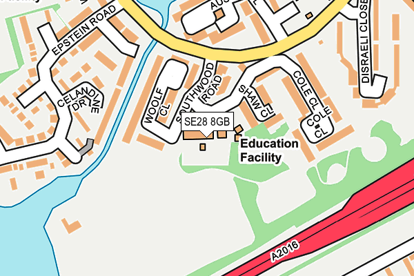
SE28 8GB is located in the Thamesmead Moorings electoral ward, within the London borough of Greenwich and the English Parliamentary constituency of Erith and Thamesmead. The Sub Integrated Care Board (ICB) Location is NHS South East London ICB - 72Q and the police force is Metropolitan Police. This postcode has been in use since June 2001.


GetTheData
Source: OS OpenMap – Local (Ordnance Survey)
Source: OS VectorMap District (Ordnance Survey)
Licence: Open Government Licence (requires attribution)
| Easting | 546783 |
| Northing | 180120 |
| Latitude | 51.500963 |
| Longitude | 0.113338 |
GetTheData
Source: Open Postcode Geo
Licence: Open Government Licence
| Country | England |
| Postcode District | SE28 |
➜ See where SE28 is on a map ➜ Where is London? | |
GetTheData
Source: Land Registry Price Paid Data
Licence: Open Government Licence
Elevation or altitude of SE28 8GB as distance above sea level:
| Metres | Feet | |
|---|---|---|
| Elevation | 0m | 0ft |
Elevation is measured from the approximate centre of the postcode, to the nearest point on an OS contour line from OS Terrain 50, which has contour spacing of ten vertical metres.
➜ How high above sea level am I? Find the elevation of your current position using your device's GPS.
GetTheData
Source: Open Postcode Elevation
Licence: Open Government Licence
| Ward | Thamesmead Moorings |
| Constituency | Erith And Thamesmead |
GetTheData
Source: ONS Postcode Database
Licence: Open Government Licence
| Southwood Road (Bentham Road) | Thamesmead | 137m |
| Southwood Road (Bentham Road) | Thamesmead | 150m |
| Titmuss Avenue (Bentham Road) | Thamesmead | 315m |
| Abbey Wood Pumping Station | Thamesmead | 346m |
| Hawksmoor School (Bentham Road) | Thamesmead | 346m |
| Abbey Wood (London) Station | 1.2km |
| Plumstead Station | 2.4km |
| Belvedere Station | 2.9km |
GetTheData
Source: NaPTAN
Licence: Open Government Licence
GetTheData
Source: ONS Postcode Database
Licence: Open Government Licence


➜ Get more ratings from the Food Standards Agency
GetTheData
Source: Food Standards Agency
Licence: FSA terms & conditions
| Last Collection | |||
|---|---|---|---|
| Location | Mon-Fri | Sat | Distance |
| Post Office | 17:30 | 12:00 | 397m |
| Grovebury Road | 17:30 | 12:00 | 413m |
| Sewell Road | 17:30 | 12:00 | 513m |
GetTheData
Source: Dracos
Licence: Creative Commons Attribution-ShareAlike
| Risk of SE28 8GB flooding from rivers and sea | Very Low |
| ➜ SE28 8GB flood map | |
GetTheData
Source: Open Flood Risk by Postcode
Licence: Open Government Licence
The below table lists the International Territorial Level (ITL) codes (formerly Nomenclature of Territorial Units for Statistics (NUTS) codes) and Local Administrative Units (LAU) codes for SE28 8GB:
| ITL 1 Code | Name |
|---|---|
| TLI | London |
| ITL 2 Code | Name |
| TLI5 | Outer London - East and North East |
| ITL 3 Code | Name |
| TLI51 | Bexley and Greenwich |
| LAU 1 Code | Name |
| E09000011 | Greenwich |
GetTheData
Source: ONS Postcode Directory
Licence: Open Government Licence
The below table lists the Census Output Area (OA), Lower Layer Super Output Area (LSOA), and Middle Layer Super Output Area (MSOA) for SE28 8GB:
| Code | Name | |
|---|---|---|
| OA | E00008417 | |
| LSOA | E01001694 | Greenwich 001D |
| MSOA | E02000313 | Greenwich 001 |
GetTheData
Source: ONS Postcode Directory
Licence: Open Government Licence
| SE28 8DG | Woolf Close | 83m |
| SE28 8DE | Shaw Close | 105m |
| SE28 8DF | Woolf Close | 108m |
| SE28 8AU | Cole Close | 139m |
| SE28 8EP | Celandine Drive | 150m |
| SE28 8DB | Galsworthy Close | 158m |
| SE28 8AY | Austen Close | 158m |
| SE28 8EQ | Chervil Mews | 180m |
| SE28 8AX | Cole Close | 183m |
| SE28 8DQ | Epstein Road | 192m |
GetTheData
Source: Open Postcode Geo; Land Registry Price Paid Data
Licence: Open Government Licence