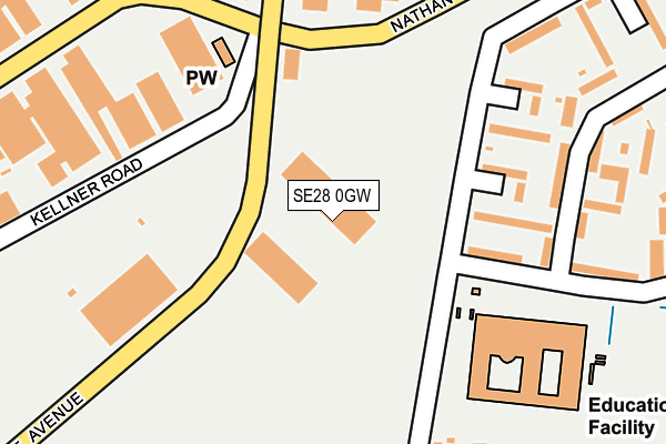
SE28 0GW is located in the Plumstead & Glyndon electoral ward, within the London borough of Greenwich and the English Parliamentary constituency of Erith and Thamesmead. The Sub Integrated Care Board (ICB) Location is NHS South East London ICB - 72Q and the police force is Metropolitan Police. This postcode has been in use since May 2005.


GetTheData
Source: OS OpenMap – Local (Ordnance Survey)
Source: OS VectorMap District (Ordnance Survey)
Licence: Open Government Licence (requires attribution)
| Easting | 545944 |
| Northing | 179244 |
| Latitude | 51.493310 |
| Longitude | 0.100925 |
GetTheData
Source: Open Postcode Geo
Licence: Open Government Licence
| Country | England |
| Postcode District | SE28 |
➜ See where SE28 is on a map ➜ Where is London? | |
GetTheData
Source: Land Registry Price Paid Data
Licence: Open Government Licence
Elevation or altitude of SE28 0GW as distance above sea level:
| Metres | Feet | |
|---|---|---|
| Elevation | 10m | 33ft |
Elevation is measured from the approximate centre of the postcode, to the nearest point on an OS contour line from OS Terrain 50, which has contour spacing of ten vertical metres.
➜ How high above sea level am I? Find the elevation of your current position using your device's GPS.
GetTheData
Source: Open Postcode Elevation
Licence: Open Government Licence
| Ward | Plumstead & Glyndon |
| Constituency | Erith And Thamesmead |
GetTheData
Source: ONS Postcode Database
Licence: Open Government Licence
| St Pauls Academy (Finchale Road) | Thamesmead | 183m |
| Purland Road | Plumstead | 211m |
| Purland Road | Plumstead | 258m |
| Purland Road (Nathan Way) | Plumstead | 286m |
| Purland Road West (Nathan Way) | Plumstead | 300m |
| Plumstead Station | 1.2km |
| Abbey Wood (London) Station | 1.4km |
| Woolwich Arsenal Station | 2.2km |
GetTheData
Source: NaPTAN
Licence: Open Government Licence
GetTheData
Source: ONS Postcode Database
Licence: Open Government Licence


➜ Get more ratings from the Food Standards Agency
GetTheData
Source: Food Standards Agency
Licence: FSA terms & conditions
| Last Collection | |||
|---|---|---|---|
| Location | Mon-Fri | Sat | Distance |
| Mottisfont Road | 17:30 | 12:00 | 321m |
| Panfield Road | 17:30 | 12:00 | 361m |
| Church Manorway | 17:30 | 12:00 | 426m |
GetTheData
Source: Dracos
Licence: Creative Commons Attribution-ShareAlike
The below table lists the International Territorial Level (ITL) codes (formerly Nomenclature of Territorial Units for Statistics (NUTS) codes) and Local Administrative Units (LAU) codes for SE28 0GW:
| ITL 1 Code | Name |
|---|---|
| TLI | London |
| ITL 2 Code | Name |
| TLI5 | Outer London - East and North East |
| ITL 3 Code | Name |
| TLI51 | Bexley and Greenwich |
| LAU 1 Code | Name |
| E09000011 | Greenwich |
GetTheData
Source: ONS Postcode Directory
Licence: Open Government Licence
The below table lists the Census Output Area (OA), Lower Layer Super Output Area (LSOA), and Middle Layer Super Output Area (MSOA) for SE28 0GW:
| Code | Name | |
|---|---|---|
| OA | E00008328 | |
| LSOA | E01001672 | Greenwich 006A |
| MSOA | E02000318 | Greenwich 006 |
GetTheData
Source: ONS Postcode Directory
Licence: Open Government Licence
| SE2 9DP | Church Manorway | 225m |
| SE2 9LX | Church Manorway | 254m |
| SE2 9DN | Church Manorway | 270m |
| SE2 9DW | Panfield Road | 286m |
| SE2 9LY | Mottisfont Road | 299m |
| SE2 9LU | Mottisfont Road | 321m |
| SE2 9DL | Sewell Road | 323m |
| SE28 0AB | Nathan Way | 330m |
| SE28 0AU | Nathan Way | 336m |
| SE2 9PW | Finchale Road | 339m |
GetTheData
Source: Open Postcode Geo; Land Registry Price Paid Data
Licence: Open Government Licence