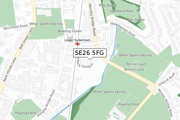
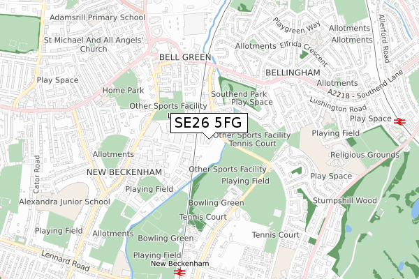
SE26 5FG is located in the Beckenham Town & Copers Cope electoral ward, within the London borough of Bromley and the English Parliamentary constituency of Beckenham. The Sub Integrated Care Board (ICB) Location is NHS South East London ICB - 72Q and the police force is Metropolitan Police. This postcode has been in use since August 2018.


GetTheData
Source: OS Open Zoomstack (Ordnance Survey)
Licence: Open Government Licence (requires attribution)
Attribution: Contains OS data © Crown copyright and database right 2025
Source: Open Postcode Geo
Licence: Open Government Licence (requires attribution)
Attribution: Contains OS data © Crown copyright and database right 2025; Contains Royal Mail data © Royal Mail copyright and database right 2025; Source: Office for National Statistics licensed under the Open Government Licence v.3.0
| Easting | 536901 |
| Northing | 171268 |
| Latitude | 51.423895 |
| Longitude | -0.032338 |
GetTheData
Source: Open Postcode Geo
Licence: Open Government Licence
| Country | England |
| Postcode District | SE26 |
➜ See where SE26 is on a map ➜ Where is Beckenham? | |
GetTheData
Source: Land Registry Price Paid Data
Licence: Open Government Licence
| Ward | Beckenham Town & Copers Cope |
| Constituency | Beckenham |
GetTheData
Source: ONS Postcode Database
Licence: Open Government Licence
| Lower Sydenham (Worsley Bridge Road) | Lower Sydenham | 105m |
| Lower Sydenham (Worsley Bridge Road) | Lower Sydenham | 201m |
| Greycot Road (Worsley Bridge Road) | New Beckenham | 320m |
| Greycot Road (Worsley Bridge Road) | New Beckenham | 355m |
| Worsley Bridge Rdsouthend Ln (Worsley Bridge Road) | Bell Green | 361m |
| Beckenham Junction Tram Stop (Rectory Road) | Beckenham | 1,522m |
| Lower Sydenham Station | 0.1km |
| New Beckenham Station | 0.8km |
| Beckenham Hill Station | 1.1km |
GetTheData
Source: NaPTAN
Licence: Open Government Licence
| Percentage of properties with Next Generation Access | 100.0% |
| Percentage of properties with Superfast Broadband | 100.0% |
| Percentage of properties with Ultrafast Broadband | 100.0% |
| Percentage of properties with Full Fibre Broadband | 100.0% |
Superfast Broadband is between 30Mbps and 300Mbps
Ultrafast Broadband is > 300Mbps
Ofcom does not currently provide download speed data for SE26 5FG. This is because there are less than four broadband connections in this postcode.
Ofcom does not currently provide upload speed data for SE26 5FG. This is because there are less than four broadband connections in this postcode.
| Percentage of properties unable to receive 2Mbps | 0.0% |
| Percentage of properties unable to receive 5Mbps | 0.0% |
| Percentage of properties unable to receive 10Mbps | 0.0% |
| Percentage of properties unable to receive 30Mbps | 0.0% |
GetTheData
Source: Ofcom
Licence: Ofcom Terms of Use (requires attribution)
GetTheData
Source: ONS Postcode Database
Licence: Open Government Licence


➜ Get more ratings from the Food Standards Agency
GetTheData
Source: Food Standards Agency
Licence: FSA terms & conditions
| Last Collection | |||
|---|---|---|---|
| Location | Mon-Fri | Sat | Distance |
| Worsley Bridge Road | 17:30 | 12:00 | 57m |
| Kangley Bridge Road | 17:30 | 12:00 | 137m |
| Meadowview Road | 17:30 | 12:00 | 450m |
GetTheData
Source: Dracos
Licence: Creative Commons Attribution-ShareAlike
The below table lists the International Territorial Level (ITL) codes (formerly Nomenclature of Territorial Units for Statistics (NUTS) codes) and Local Administrative Units (LAU) codes for SE26 5FG:
| ITL 1 Code | Name |
|---|---|
| TLI | London |
| ITL 2 Code | Name |
| TLI6 | Outer London - South |
| ITL 3 Code | Name |
| TLI61 | Bromley |
| LAU 1 Code | Name |
| E09000006 | Bromley |
GetTheData
Source: ONS Postcode Directory
Licence: Open Government Licence
The below table lists the Census Output Area (OA), Lower Layer Super Output Area (LSOA), and Middle Layer Super Output Area (MSOA) for SE26 5FG:
| Code | Name | |
|---|---|---|
| OA | E00003464 | |
| LSOA | E01000710 | Bromley 006B |
| MSOA | E02000132 | Bromley 006 |
GetTheData
Source: ONS Postcode Directory
Licence: Open Government Licence
| SE26 5BG | Montana Gardens | 93m |
| SE26 5BN | Broomsleigh Business Park | 131m |
| SE26 5BF | Montana Gardens | 166m |
| SE26 5DD | Kangley Bridge Road | 198m |
| SE6 3NG | Meadowview Road | 221m |
| SE6 3NH | Meadowview Road | 268m |
| SE6 3NQ | Meadowview Road | 300m |
| SE26 5BW | Metro Business Centre | 308m |
| SE26 5BE | Worsley Bridge Road | 322m |
| SE26 5BA | Kangley Bridge Road | 336m |
GetTheData
Source: Open Postcode Geo; Land Registry Price Paid Data
Licence: Open Government Licence