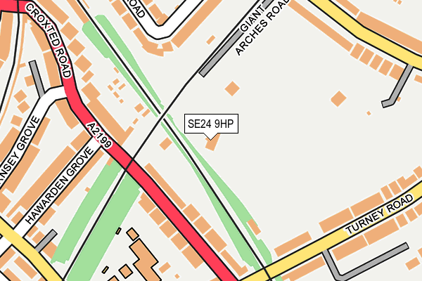
SE24 9HP is located in the Dulwich Village electoral ward, within the London borough of Southwark and the English Parliamentary constituency of Dulwich and West Norwood. The Sub Integrated Care Board (ICB) Location is NHS South East London ICB - 72Q and the police force is Metropolitan Police. This postcode has been in use since January 1992.


GetTheData
Source: OS OpenMap – Local (Ordnance Survey)
Source: OS VectorMap District (Ordnance Survey)
Licence: Open Government Licence (requires attribution)
| Easting | 532377 |
| Northing | 173890 |
| Latitude | 51.448532 |
| Longitude | -0.096414 |
GetTheData
Source: Open Postcode Geo
Licence: Open Government Licence
| Country | England |
| Postcode District | SE24 |
➜ See where SE24 is on a map ➜ Where is London? | |
GetTheData
Source: Land Registry Price Paid Data
Licence: Open Government Licence
Elevation or altitude of SE24 9HP as distance above sea level:
| Metres | Feet | |
|---|---|---|
| Elevation | 30m | 98ft |
Elevation is measured from the approximate centre of the postcode, to the nearest point on an OS contour line from OS Terrain 50, which has contour spacing of ten vertical metres.
➜ How high above sea level am I? Find the elevation of your current position using your device's GPS.
GetTheData
Source: Open Postcode Elevation
Licence: Open Government Licence
| Ward | Dulwich Village |
| Constituency | Dulwich And West Norwood |
GetTheData
Source: ONS Postcode Database
Licence: Open Government Licence
| Croxted Close | Herne Hill | 120m |
| Turney Road Croxted Road | Herne Hill | 173m |
| Guernsey Grove | Herne Hill | 237m |
| Turney Road Croxted Road | Herne Hill | 266m |
| Norwood Road (Se24) | Herne Hill | 339m |
| Herne Hill Station | 0.7km |
| North Dulwich Station | 0.9km |
| West Dulwich Station | 0.9km |
GetTheData
Source: NaPTAN
Licence: Open Government Licence
GetTheData
Source: ONS Postcode Database
Licence: Open Government Licence


➜ Get more ratings from the Food Standards Agency
GetTheData
Source: Food Standards Agency
Licence: FSA terms & conditions
| Last Collection | |||
|---|---|---|---|
| Location | Mon-Fri | Sat | Distance |
| Stradella Road | 17:30 | 12:00 | 225m |
| Post Office | 17:30 | 12:00 | 306m |
| 61 Norwood Road | 17:30 | 12:00 | 408m |
GetTheData
Source: Dracos
Licence: Creative Commons Attribution-ShareAlike
The below table lists the International Territorial Level (ITL) codes (formerly Nomenclature of Territorial Units for Statistics (NUTS) codes) and Local Administrative Units (LAU) codes for SE24 9HP:
| ITL 1 Code | Name |
|---|---|
| TLI | London |
| ITL 2 Code | Name |
| TLI4 | Inner London - East |
| ITL 3 Code | Name |
| TLI44 | Lewisham and Southwark |
| LAU 1 Code | Name |
| E09000028 | Southwark |
GetTheData
Source: ONS Postcode Directory
Licence: Open Government Licence
The below table lists the Census Output Area (OA), Lower Layer Super Output Area (LSOA), and Middle Layer Super Output Area (MSOA) for SE24 9HP:
| Code | Name | |
|---|---|---|
| OA | E00020501 | |
| LSOA | E01004069 | Southwark 031A |
| MSOA | E02000837 | Southwark 031 |
GetTheData
Source: ONS Postcode Directory
Licence: Open Government Licence
| SE21 8NW | Croxted Road | 109m |
| SE21 8NN | Croxted Road | 140m |
| SE24 9DG | Croxted Road | 158m |
| SE24 9HL | Stradella Road | 178m |
| SE21 7JA | Turney Road | 185m |
| SE24 9DQ | Hawarden Grove | 210m |
| SE21 8LX | Turney Road | 219m |
| SE21 7JH | Turney Road | 229m |
| SE24 9HB | Burbage Road | 230m |
| SE24 9DH | Hawarden Grove | 237m |
GetTheData
Source: Open Postcode Geo; Land Registry Price Paid Data
Licence: Open Government Licence