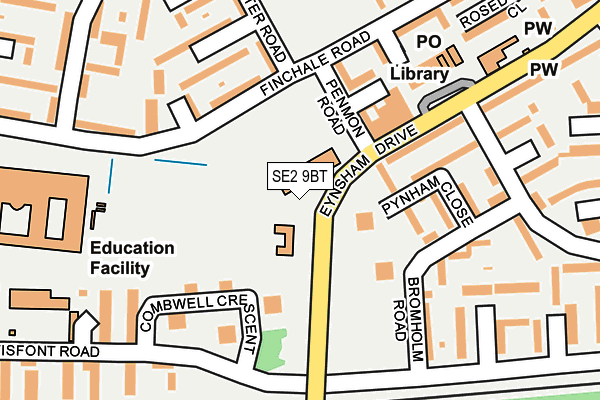
SE2 9BT is located in the Abbey Wood electoral ward, within the London borough of Greenwich and the English Parliamentary constituency of Erith and Thamesmead. The Sub Integrated Care Board (ICB) Location is NHS South East London ICB - 72Q and the police force is Metropolitan Police. This postcode has been in use since January 2014.


GetTheData
Source: OS OpenMap – Local (Ordnance Survey)
Source: OS VectorMap District (Ordnance Survey)
Licence: Open Government Licence (requires attribution)
| Easting | 546432 |
| Northing | 179167 |
| Latitude | 51.492492 |
| Longitude | 0.107918 |
GetTheData
Source: Open Postcode Geo
Licence: Open Government Licence
| Country | England |
| Postcode District | SE2 |
➜ See where SE2 is on a map ➜ Where is London? | |
GetTheData
Source: Land Registry Price Paid Data
Licence: Open Government Licence
Elevation or altitude of SE2 9BT as distance above sea level:
| Metres | Feet | |
|---|---|---|
| Elevation | 10m | 33ft |
Elevation is measured from the approximate centre of the postcode, to the nearest point on an OS contour line from OS Terrain 50, which has contour spacing of ten vertical metres.
➜ How high above sea level am I? Find the elevation of your current position using your device's GPS.
GetTheData
Source: Open Postcode Elevation
Licence: Open Government Licence
| Ward | Abbey Wood |
| Constituency | Erith And Thamesmead |
GetTheData
Source: ONS Postcode Database
Licence: Open Government Licence
| Penmon Road (Finchale Road) | Thamesmead | 93m |
| St Pauls Academy (Finchale Road) | Thamesmead | 172m |
| Felixstowe Road (Eynsham Drive) | Abbey Wood | 192m |
| Penmon Road (Finchale Road) | Thamesmead | 201m |
| Felixstowe Road (Eynsham Drive) | Abbey Wood | 241m |
| Abbey Wood (London) Station | 1km |
| Plumstead Station | 1.7km |
| Woolwich Arsenal Station | 2.7km |
GetTheData
Source: NaPTAN
Licence: Open Government Licence
GetTheData
Source: ONS Postcode Database
Licence: Open Government Licence


➜ Get more ratings from the Food Standards Agency
GetTheData
Source: Food Standards Agency
Licence: FSA terms & conditions
| Last Collection | |||
|---|---|---|---|
| Location | Mon-Fri | Sat | Distance |
| Panfield Road | 17:30 | 12:00 | 282m |
| Mottisfont Road | 17:30 | 12:00 | 302m |
| Sewell Road | 17:30 | 12:00 | 451m |
GetTheData
Source: Dracos
Licence: Creative Commons Attribution-ShareAlike
| Risk of SE2 9BT flooding from rivers and sea | Very Low |
| ➜ SE2 9BT flood map | |
GetTheData
Source: Open Flood Risk by Postcode
Licence: Open Government Licence
The below table lists the International Territorial Level (ITL) codes (formerly Nomenclature of Territorial Units for Statistics (NUTS) codes) and Local Administrative Units (LAU) codes for SE2 9BT:
| ITL 1 Code | Name |
|---|---|
| TLI | London |
| ITL 2 Code | Name |
| TLI5 | Outer London - East and North East |
| ITL 3 Code | Name |
| TLI51 | Bexley and Greenwich |
| LAU 1 Code | Name |
| E09000011 | Greenwich |
GetTheData
Source: ONS Postcode Directory
Licence: Open Government Licence
The below table lists the Census Output Area (OA), Lower Layer Super Output Area (LSOA), and Middle Layer Super Output Area (MSOA) for SE2 9BT:
| Code | Name | |
|---|---|---|
| OA | E00007798 | |
| LSOA | E01001579 | Greenwich 003E |
| MSOA | E02000315 | Greenwich 003 |
GetTheData
Source: ONS Postcode Directory
Licence: Open Government Licence
| SE2 9QN | Pynham Close | 69m |
| SE2 9NB | Combwell Crescent | 103m |
| SE2 9ND | Bromholm Road | 109m |
| SE2 9PS | Eynsham Drive | 128m |
| SE2 9QL | Pynham Close | 131m |
| SE2 9PJ | Manister Road | 157m |
| SE2 9NE | Bromholm Road | 164m |
| SE2 9PQ | Byland Close | 168m |
| SE2 9LZ | Combwell Crescent | 173m |
| SE2 9PW | Finchale Road | 176m |
GetTheData
Source: Open Postcode Geo; Land Registry Price Paid Data
Licence: Open Government Licence