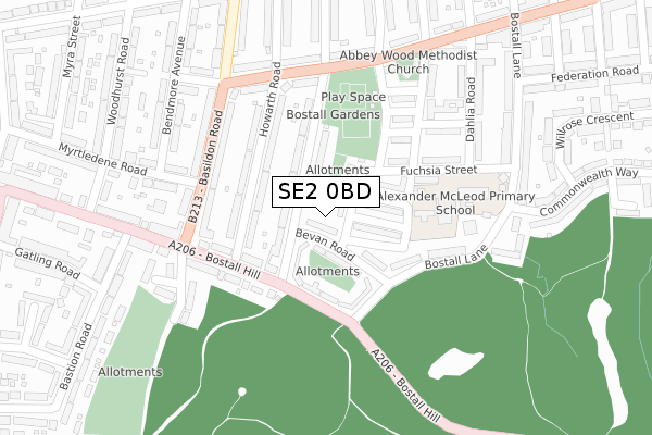
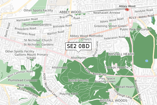
SE2 0BD is located in the Abbey Wood electoral ward, within the London borough of Greenwich and the English Parliamentary constituency of Erith and Thamesmead. The Sub Integrated Care Board (ICB) Location is NHS South East London ICB - 72Q and the police force is Metropolitan Police. This postcode has been in use since December 2019.


GetTheData
Source: OS Open Zoomstack (Ordnance Survey)
Licence: Open Government Licence (requires attribution)
Attribution: Contains OS data © Crown copyright and database right 2025
Source: Open Postcode Geo
Licence: Open Government Licence (requires attribution)
Attribution: Contains OS data © Crown copyright and database right 2025; Contains Royal Mail data © Royal Mail copyright and database right 2025; Source: Office for National Statistics licensed under the Open Government Licence v.3.0
| Easting | 546577 |
| Northing | 178339 |
| Latitude | 51.485014 |
| Longitude | 0.109661 |
GetTheData
Source: Open Postcode Geo
Licence: Open Government Licence
| Country | England |
| Postcode District | SE2 |
➜ See where SE2 is on a map ➜ Where is London? | |
GetTheData
Source: Land Registry Price Paid Data
Licence: Open Government Licence
| Ward | Abbey Wood |
| Constituency | Erith And Thamesmead |
GetTheData
Source: ONS Postcode Database
Licence: Open Government Licence
| Bostall Hill Bostall Lane (Bostall Hill) | Abbey Wood | 197m |
| Basildon Road Bostall Hill (Basildon Road) | Abbey Wood | 202m |
| Basildon Road Bostall Hill (Basildon Road) | Abbey Wood | 213m |
| Cassilda Road (Basildon Road) | Abbey Wood | 228m |
| Bostall Gardens (Mcleod Road) | Abbey Wood | 236m |
| Abbey Wood (London) Station | 1.1km |
| Plumstead Station | 1.8km |
| Welling Station | 2.3km |
GetTheData
Source: NaPTAN
Licence: Open Government Licence
GetTheData
Source: ONS Postcode Database
Licence: Open Government Licence


➜ Get more ratings from the Food Standards Agency
GetTheData
Source: Food Standards Agency
Licence: FSA terms & conditions
| Last Collection | |||
|---|---|---|---|
| Location | Mon-Fri | Sat | Distance |
| Bevan Road | 17:30 | 12:00 | 50m |
| Rochdale Road | 17:30 | 12:00 | 232m |
| Post Office | 17:30 | 12:00 | 239m |
GetTheData
Source: Dracos
Licence: Creative Commons Attribution-ShareAlike
The below table lists the International Territorial Level (ITL) codes (formerly Nomenclature of Territorial Units for Statistics (NUTS) codes) and Local Administrative Units (LAU) codes for SE2 0BD:
| ITL 1 Code | Name |
|---|---|
| TLI | London |
| ITL 2 Code | Name |
| TLI5 | Outer London - East and North East |
| ITL 3 Code | Name |
| TLI51 | Bexley and Greenwich |
| LAU 1 Code | Name |
| E09000011 | Greenwich |
GetTheData
Source: ONS Postcode Directory
Licence: Open Government Licence
The below table lists the Census Output Area (OA), Lower Layer Super Output Area (LSOA), and Middle Layer Super Output Area (MSOA) for SE2 0BD:
| Code | Name | |
|---|---|---|
| OA | E00007818 | |
| LSOA | E01001574 | Greenwich 008D |
| MSOA | E02000320 | Greenwich 008 |
GetTheData
Source: ONS Postcode Directory
Licence: Open Government Licence
| SE2 0UU | Bevan Road | 22m |
| SE2 0UZ | Carnation Street | 45m |
| SE2 0UT | Bevan Road | 69m |
| SE2 0UX | Dianthus Close | 73m |
| SE2 0XA | Rochdale Road | 75m |
| SE2 0UY | Coltness Crescent | 76m |
| SE2 0UR | Rochdale Road | 84m |
| SE2 0XB | Rochdale Road | 100m |
| SE2 0QX | Bostall Hill | 113m |
| SE2 0UW | Howarth Road | 114m |
GetTheData
Source: Open Postcode Geo; Land Registry Price Paid Data
Licence: Open Government Licence