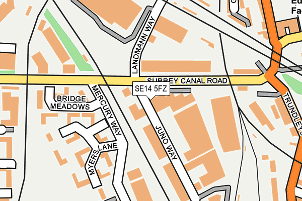
SE14 5FZ is located in the New Cross Gate electoral ward, within the London borough of Lewisham and the English Parliamentary constituency of Lewisham, Deptford. The Sub Integrated Care Board (ICB) Location is NHS South East London ICB - 72Q and the police force is Metropolitan Police. This postcode has been in use since May 2017.


GetTheData
Source: OS OpenMap – Local (Ordnance Survey)
Source: OS VectorMap District (Ordnance Survey)
Licence: Open Government Licence (requires attribution)
| Easting | 535830 |
| Northing | 177924 |
| Latitude | 51.483966 |
| Longitude | -0.045179 |
GetTheData
Source: Open Postcode Geo
Licence: Open Government Licence
| Country | England |
| Postcode District | SE14 |
➜ See where SE14 is on a map ➜ Where is London? | |
GetTheData
Source: Land Registry Price Paid Data
Licence: Open Government Licence
| Ward | New Cross Gate |
| Constituency | Lewisham, Deptford |
GetTheData
Source: ONS Postcode Database
Licence: Open Government Licence
| Surrey Canal Road (Trundley's Road) | New Cross | 241m |
| Grinstead Road | Deptford | 250m |
| Grinstead Road | Deptford | 274m |
| Cold Blow Lane (Sanford Street) | New Cross | 282m |
| Cold Blow Lane (Sanford Street) | New Cross | 369m |
| South Bermondsey Station | 0.8km |
| New Cross Gate ELL Station | 1km |
| Surrey Quays Station | 1km |
GetTheData
Source: NaPTAN
Licence: Open Government Licence
GetTheData
Source: ONS Postcode Database
Licence: Open Government Licence

➜ Get more ratings from the Food Standards Agency
GetTheData
Source: Food Standards Agency
Licence: FSA terms & conditions
| Last Collection | |||
|---|---|---|---|
| Location | Mon-Fri | Sat | Distance |
| Trundleys Road | 17:30 | 12:00 | 357m |
| John Williams Close | 17:30 | 12:00 | 404m |
| Sanford Street | 17:30 | 12:00 | 487m |
GetTheData
Source: Dracos
Licence: Creative Commons Attribution-ShareAlike
| Risk of SE14 5FZ flooding from rivers and sea | Very Low |
| ➜ SE14 5FZ flood map | |
GetTheData
Source: Open Flood Risk by Postcode
Licence: Open Government Licence
The below table lists the International Territorial Level (ITL) codes (formerly Nomenclature of Territorial Units for Statistics (NUTS) codes) and Local Administrative Units (LAU) codes for SE14 5FZ:
| ITL 1 Code | Name |
|---|---|
| TLI | London |
| ITL 2 Code | Name |
| TLI4 | Inner London - East |
| ITL 3 Code | Name |
| TLI44 | Lewisham and Southwark |
| LAU 1 Code | Name |
| E09000023 | Lewisham |
GetTheData
Source: ONS Postcode Directory
Licence: Open Government Licence
The below table lists the Census Output Area (OA), Lower Layer Super Output Area (LSOA), and Middle Layer Super Output Area (MSOA) for SE14 5FZ:
| Code | Name | |
|---|---|---|
| OA | E00016724 | |
| LSOA | E01003298 | Lewisham 039A |
| MSOA | E02006798 | Lewisham 039 |
GetTheData
Source: ONS Postcode Directory
Licence: Open Government Licence
| SE14 5RZ | Myers Lane | 158m |
| SE14 5ST | Bridge Meadows | 170m |
| SE14 5RU | Myers Lane | 193m |
| SE14 5SU | Bridge Meadows | 213m |
| SE14 5RT | Orion Business Centre | 213m |
| SE8 5JL | Trundleys Road | 220m |
| SE14 5RX | Myers Lane | 225m |
| SE8 5JN | Greenland Mews | 238m |
| SE8 5JW | Greenland Mews | 246m |
| SE14 5RY | Myers Lane | 255m |
GetTheData
Source: Open Postcode Geo; Land Registry Price Paid Data
Licence: Open Government Licence