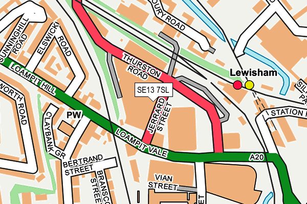
SE13 7SL is located in the Lewisham Central electoral ward, within the London borough of Lewisham and the English Parliamentary constituency of Lewisham, Deptford. The Sub Integrated Care Board (ICB) Location is NHS South East London ICB - 72Q and the police force is Metropolitan Police. This postcode has been in use since June 2016.


GetTheData
Source: OS OpenMap – Local (Ordnance Survey)
Source: OS VectorMap District (Ordnance Survey)
Licence: Open Government Licence (requires attribution)
| Easting | 537890 |
| Northing | 175927 |
| Latitude | 51.465522 |
| Longitude | -0.016335 |
GetTheData
Source: Open Postcode Geo
Licence: Open Government Licence
| Country | England |
| Postcode District | SE13 |
➜ See where SE13 is on a map ➜ Where is Lewisham? | |
GetTheData
Source: Land Registry Price Paid Data
Licence: Open Government Licence
Elevation or altitude of SE13 7SL as distance above sea level:
| Metres | Feet | |
|---|---|---|
| Elevation | 10m | 33ft |
Elevation is measured from the approximate centre of the postcode, to the nearest point on an OS contour line from OS Terrain 50, which has contour spacing of ten vertical metres.
➜ How high above sea level am I? Find the elevation of your current position using your device's GPS.
GetTheData
Source: Open Postcode Elevation
Licence: Open Government Licence
| Ward | Lewisham Central |
| Constituency | Lewisham, Deptford |
GetTheData
Source: ONS Postcode Database
Licence: Open Government Licence
| Jerrard Street | Lewisham | 33m |
| Jerrard Street (Thurston Road) | Lewisham | 72m |
| Loampit Vale Jerrard Street | Lewisham | 92m |
| Loampit Vale Jerrard Street (Loampit Vale) | Lewisham | 98m |
| Loampit Vale (Thurston Road) | Lewisham | 127m |
| Lewisham Dlr Station (Loampit Vale) | Lewisham | 259m |
| Elverson Road Dlr Station (Elverson Road) | Elverson Road | 396m |
| Deptford Bridge Dlr Station (Deptford Bridge) | Deptford Bridge | 1,056m |
| Greenwich Dlr Station (Greenwich High Road) | Greenwich | 1,410m |
| Lewisham Station | 0.2km |
| St Johns (London) Station | 0.6km |
| Ladywell Station | 1km |
GetTheData
Source: NaPTAN
Licence: Open Government Licence
| Median download speed | 10.5Mbps |
| Average download speed | 11.9Mbps |
| Maximum download speed | 39.06Mbps |
| Median upload speed | 1.1Mbps |
| Average upload speed | 1.8Mbps |
| Maximum upload speed | 9.76Mbps |
GetTheData
Source: Ofcom
Licence: Ofcom Terms of Use (requires attribution)
GetTheData
Source: ONS Postcode Database
Licence: Open Government Licence


➜ Get more ratings from the Food Standards Agency
GetTheData
Source: Food Standards Agency
Licence: FSA terms & conditions
| Last Collection | |||
|---|---|---|---|
| Location | Mon-Fri | Sat | Distance |
| 78 Loampit Vale | 17:30 | 12:00 | 106m |
| Shell Road | 17:30 | 12:00 | 177m |
| Lewisham Junction | 17:30 | 12:00 | 184m |
GetTheData
Source: Dracos
Licence: Creative Commons Attribution-ShareAlike
| Risk of SE13 7SL flooding from rivers and sea | High |
| ➜ SE13 7SL flood map | |
GetTheData
Source: Open Flood Risk by Postcode
Licence: Open Government Licence
The below table lists the International Territorial Level (ITL) codes (formerly Nomenclature of Territorial Units for Statistics (NUTS) codes) and Local Administrative Units (LAU) codes for SE13 7SL:
| ITL 1 Code | Name |
|---|---|
| TLI | London |
| ITL 2 Code | Name |
| TLI4 | Inner London - East |
| ITL 3 Code | Name |
| TLI44 | Lewisham and Southwark |
| LAU 1 Code | Name |
| E09000023 | Lewisham |
GetTheData
Source: ONS Postcode Directory
Licence: Open Government Licence
The below table lists the Census Output Area (OA), Lower Layer Super Output Area (LSOA), and Middle Layer Super Output Area (MSOA) for SE13 7SL:
| Code | Name | |
|---|---|---|
| OA | E00016638 | |
| LSOA | E01003296 | Lewisham 012E |
| MSOA | E02000664 | Lewisham 012 |
GetTheData
Source: ONS Postcode Directory
Licence: Open Government Licence
| SE13 7FA | Loampit Vale | 107m |
| SE13 7SN | Loampit Vale | 118m |
| SE8 4LH | Armoury Road | 134m |
| SE13 7FR | Loampit Vale | 135m |
| SE13 7TG | Loampit Vale | 141m |
| SE13 7SD | Thurston Road | 150m |
| SE8 4LJ | Armoury Road | 151m |
| SE13 7FS | Algernon Road | 155m |
| SE13 7AX | Bertrand Street | 156m |
| SE13 7GP | Elmira Street | 157m |
GetTheData
Source: Open Postcode Geo; Land Registry Price Paid Data
Licence: Open Government Licence