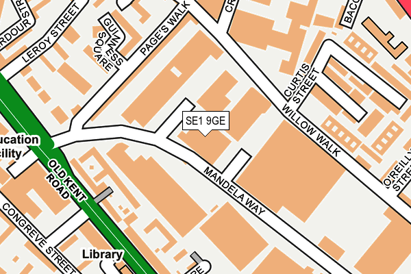
SE1 9GE is located in the Borough & Bankside electoral ward, within the London borough of Southwark and the English Parliamentary constituency of Bermondsey and Old Southwark. The Sub Integrated Care Board (ICB) Location is NHS South East London ICB - 72Q and the police force is Metropolitan Police. This postcode has been in use since December 2021.


GetTheData
Source: OS OpenMap – Local (Ordnance Survey)
Source: OS VectorMap District (Ordnance Survey)
Licence: Open Government Licence (requires attribution)
| Easting | 531457 |
| Northing | 180444 |
| Latitude | 51.507646 |
| Longitude | -0.107183 |
GetTheData
Source: Open Postcode Geo
Licence: Open Government Licence
| Country | England |
| Postcode District | SE1 |
➜ See where SE1 is on a map ➜ Where is Southwark? | |
GetTheData
Source: Land Registry Price Paid Data
Licence: Open Government Licence
| Ward | Borough & Bankside |
| Constituency | Bermondsey And Old Southwark |
GetTheData
Source: ONS Postcode Database
Licence: Open Government Licence
| Kings Reach Building (Stamford Street) | Southwark | 61m |
| Oxo Tower (Broadwall) | Southwark | 78m |
| Kings Reach Building (Stamford Street) | Southwark | 80m |
| Oxo Tower (Upper Ground) | Southwark | 129m |
| Blackfriars Bridge (Blackfriars Road) | Southwark | 186m |
| Southwark Underground Station | Southwark | 438m |
| Blackfriars Underground Station | Blackfriars | 502m |
| Temple Underground Station | Temple | 616m |
| Waterloo Underground Station | Waterloo | 714m |
| Mansion House Underground Station | Mansion House | 1,043m |
| London Waterloo East Station | 0.4km |
| London Blackfriars Station | 0.5km |
| London Waterloo Station | 0.6km |
GetTheData
Source: NaPTAN
Licence: Open Government Licence
GetTheData
Source: ONS Postcode Database
Licence: Open Government Licence


➜ Get more ratings from the Food Standards Agency
GetTheData
Source: Food Standards Agency
Licence: FSA terms & conditions
| Last Collection | |||
|---|---|---|---|
| Location | Mon-Fri | Sat | Distance |
| Stamford Street | 18:30 | 61m | |
| Stamford Street | 18:30 | 13:00 | 122m |
| 9 Blackfriars Road | 18:30 | 13:00 | 183m |
GetTheData
Source: Dracos
Licence: Creative Commons Attribution-ShareAlike
| Risk of SE1 9GE flooding from rivers and sea | Very Low |
| ➜ SE1 9GE flood map | |
GetTheData
Source: Open Flood Risk by Postcode
Licence: Open Government Licence
The below table lists the International Territorial Level (ITL) codes (formerly Nomenclature of Territorial Units for Statistics (NUTS) codes) and Local Administrative Units (LAU) codes for SE1 9GE:
| ITL 1 Code | Name |
|---|---|
| TLI | London |
| ITL 2 Code | Name |
| TLI4 | Inner London - East |
| ITL 3 Code | Name |
| TLI44 | Lewisham and Southwark |
| LAU 1 Code | Name |
| E09000028 | Southwark |
GetTheData
Source: ONS Postcode Directory
Licence: Open Government Licence
The below table lists the Census Output Area (OA), Lower Layer Super Output Area (LSOA), and Middle Layer Super Output Area (MSOA) for SE1 9GE:
| Code | Name | |
|---|---|---|
| OA | E00019774 | |
| LSOA | E01003934 | Southwark 002C |
| MSOA | E02000808 | Southwark 002 |
GetTheData
Source: ONS Postcode Directory
Licence: Open Government Licence
| SE1 9EY | Upper Ground | 0m |
| SE1 9RB | Upper Ground | 0m |
| SE1 9PL | Broadwall | 70m |
| SE1 9PS | Broadwall | 71m |
| SE1 9LP | Upper Ground | 80m |
| SE1 9NZ | Upper Ground | 80m |
| SE1 9PB | Upper Ground | 167m |
| SE1 9PE | Upper Ground | 167m |
| SE1 8AF | Duchy Street | 195m |
| SE1 9NB | Stamford Street | 205m |
GetTheData
Source: Open Postcode Geo; Land Registry Price Paid Data
Licence: Open Government Licence