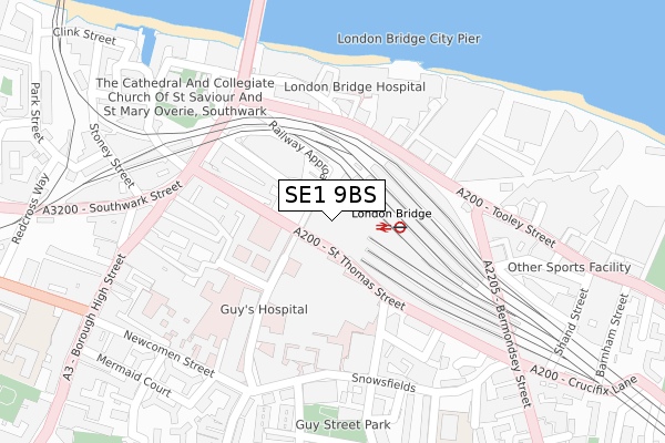
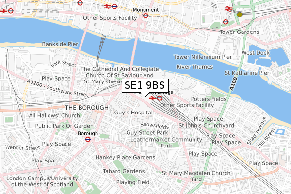
SE1 9BS is located in the London Bridge & West Bermondsey electoral ward, within the London borough of Southwark and the English Parliamentary constituency of Bermondsey and Old Southwark. The Sub Integrated Care Board (ICB) Location is NHS South East London ICB - 72Q and the police force is Metropolitan Police. This postcode has been in use since July 2018.


GetTheData
Source: OS Open Zoomstack (Ordnance Survey)
Licence: Open Government Licence (requires attribution)
Attribution: Contains OS data © Crown copyright and database right 2025
Source: Open Postcode Geo
Licence: Open Government Licence (requires attribution)
Attribution: Contains OS data © Crown copyright and database right 2025; Contains Royal Mail data © Royal Mail copyright and database right 2025; Source: Office for National Statistics licensed under the Open Government Licence v.3.0
| Easting | 532907 |
| Northing | 180125 |
| Latitude | 51.504440 |
| Longitude | -0.086422 |
GetTheData
Source: Open Postcode Geo
Licence: Open Government Licence
| Country | England |
| Postcode District | SE1 |
➜ See where SE1 is on a map ➜ Where is Bermondsey? | |
GetTheData
Source: Land Registry Price Paid Data
Licence: Open Government Licence
| Ward | London Bridge & West Bermondsey |
| Constituency | Bermondsey And Old Southwark |
GetTheData
Source: ONS Postcode Database
Licence: Open Government Licence
| London Bridge Bus Station | London Bridge | 78m |
| London Bridge Bus Station (London Bridge Street) | London Bridge | 82m |
| London Bridge Bus Station (London Bridge Street) | London Bridge | 94m |
| London Bridge Bus Station | London Bridge | 129m |
| London Bridge Station Tooley Street | London Bridge | 151m |
| London Bridge Underground Station | London Bridge | 221m |
| Borough Underground Station | The Borough | 601m |
| Monument Underground Station | Monument | 697m |
| Cannon Street Underground Station | Cannon Street | 834m |
| Tower Hill Underground Station | Tower Hill | 922m |
| London Bridge Station | 0.1km |
| London Cannon Street Station | 0.8km |
| London Fenchurch Street Station | 1km |
GetTheData
Source: NaPTAN
Licence: Open Government Licence
GetTheData
Source: ONS Postcode Database
Licence: Open Government Licence


➜ Get more ratings from the Food Standards Agency
GetTheData
Source: Food Standards Agency
Licence: FSA terms & conditions
| Last Collection | |||
|---|---|---|---|
| Location | Mon-Fri | Sat | Distance |
| Guys Tower | 18:30 | 13:00 | 137m |
| Tooley Street | 18:30 | 164m | |
| 61 Tooley Street | 18:30 | 13:00 | 167m |
GetTheData
Source: Dracos
Licence: Creative Commons Attribution-ShareAlike
| Risk of SE1 9BS flooding from rivers and sea | Very Low |
| ➜ SE1 9BS flood map | |
GetTheData
Source: Open Flood Risk by Postcode
Licence: Open Government Licence
The below table lists the International Territorial Level (ITL) codes (formerly Nomenclature of Territorial Units for Statistics (NUTS) codes) and Local Administrative Units (LAU) codes for SE1 9BS:
| ITL 1 Code | Name |
|---|---|
| TLI | London |
| ITL 2 Code | Name |
| TLI4 | Inner London - East |
| ITL 3 Code | Name |
| TLI44 | Lewisham and Southwark |
| LAU 1 Code | Name |
| E09000028 | Southwark |
GetTheData
Source: ONS Postcode Directory
Licence: Open Government Licence
The below table lists the Census Output Area (OA), Lower Layer Super Output Area (LSOA), and Middle Layer Super Output Area (MSOA) for SE1 9BS:
| Code | Name | |
|---|---|---|
| OA | E00020008 | |
| LSOA | E01003981 | Southwark 006F |
| MSOA | E02000812 | Southwark 006 |
GetTheData
Source: ONS Postcode Directory
Licence: Open Government Licence
| SE1 9RY | St Thomas Street | 140m |
| SE1 3QQ | Melior Street | 199m |
| SE1 1NA | Kings Head Yard | 213m |
| SE1 3QJ | Weston Street | 221m |
| SE1 1LZ | Borough High Street | 224m |
| SE1 1NE | Borough High Street | 240m |
| SE1 9QG | Borough High Street | 241m |
| SE1 3QP | Melior Street | 243m |
| SE1 3SU | Snowsfields | 243m |
| SE1 2FB | Oxford Drive | 245m |
GetTheData
Source: Open Postcode Geo; Land Registry Price Paid Data
Licence: Open Government Licence