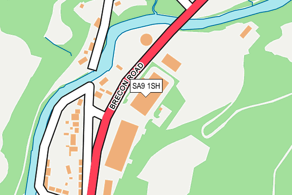
SA9 1SH is located in the Aber-craf and Ystradgynlais electoral ward, within the unitary authority of Powys and the Welsh Parliamentary constituency of Brecon and Radnorshire. The Local Health Board is Powys Teaching and the police force is Dyfed-Powys. This postcode has been in use since June 1998.


GetTheData
Source: OS OpenMap – Local (Ordnance Survey)
Source: OS VectorMap District (Ordnance Survey)
Licence: Open Government Licence (requires attribution)
| Easting | 280341 |
| Northing | 211934 |
| Latitude | 51.793219 |
| Longitude | -3.736447 |
GetTheData
Source: Open Postcode Geo
Licence: Open Government Licence
| Country | Wales |
| Postcode District | SA9 |
➜ See where SA9 is on a map ➜ Where is Ystradgynlais? | |
GetTheData
Source: Land Registry Price Paid Data
Licence: Open Government Licence
Elevation or altitude of SA9 1SH as distance above sea level:
| Metres | Feet | |
|---|---|---|
| Elevation | 110m | 361ft |
Elevation is measured from the approximate centre of the postcode, to the nearest point on an OS contour line from OS Terrain 50, which has contour spacing of ten vertical metres.
➜ How high above sea level am I? Find the elevation of your current position using your device's GPS.
GetTheData
Source: Open Postcode Elevation
Licence: Open Government Licence
| Ward | Aber-craf And Ystradgynlais |
| Constituency | Brecon And Radnorshire |
GetTheData
Source: ONS Postcode Database
Licence: Open Government Licence
| Enterprise Park (Brecon Road) | Cae'r-bont | 179m |
| Garage (Brecon Road) | Cae'r-bont | 204m |
| Caerlan (Brecon Road) | Cae'r-bont | 220m |
| Brickyard Cottages (Brecon Road) | Cae'r-bont | 232m |
| Rheolau Arms (Heol Rheolau) | Cae'r-lan | 776m |
GetTheData
Source: NaPTAN
Licence: Open Government Licence
GetTheData
Source: ONS Postcode Database
Licence: Open Government Licence


➜ Get more ratings from the Food Standards Agency
GetTheData
Source: Food Standards Agency
Licence: FSA terms & conditions
| Last Collection | |||
|---|---|---|---|
| Location | Mon-Fri | Sat | Distance |
| Ystradgynlais P O | 17:30 | 12:00 | 2,318m |
| Lower Cwmtwrch P O | 17:00 | 10:45 | 4,084m |
| Gurnos P O | 17:30 | 12:00 | 4,228m |
GetTheData
Source: Dracos
Licence: Creative Commons Attribution-ShareAlike
The below table lists the International Territorial Level (ITL) codes (formerly Nomenclature of Territorial Units for Statistics (NUTS) codes) and Local Administrative Units (LAU) codes for SA9 1SH:
| ITL 1 Code | Name |
|---|---|
| TLL | Wales |
| ITL 2 Code | Name |
| TLL2 | East Wales |
| ITL 3 Code | Name |
| TLL24 | Powys |
| LAU 1 Code | Name |
| W06000023 | Powys |
GetTheData
Source: ONS Postcode Directory
Licence: Open Government Licence
The below table lists the Census Output Area (OA), Lower Layer Super Output Area (LSOA), and Middle Layer Super Output Area (MSOA) for SA9 1SH:
| Code | Name | |
|---|---|---|
| OA | W00002269 | |
| LSOA | W01000426 | Powys 021A |
| MSOA | W02000416 | Powys 021 |
GetTheData
Source: ONS Postcode Directory
Licence: Open Government Licence
| SA9 1ST | Llundainfach | 87m |
| SA9 1SW | 142m | |
| SA9 1SU | 238m | |
| SA9 1SS | Is Y Rhos | 257m |
| SA9 1SX | Troedyrhiw | 269m |
| SA9 1SP | 282m | |
| SA9 1SZ | Caerlan Cottages | 288m |
| SA9 1SR | Watkins Terrace | 331m |
| SA9 1SY | 337m | |
| SA9 1TA | Tan Y Graig | 404m |
GetTheData
Source: Open Postcode Geo; Land Registry Price Paid Data
Licence: Open Government Licence