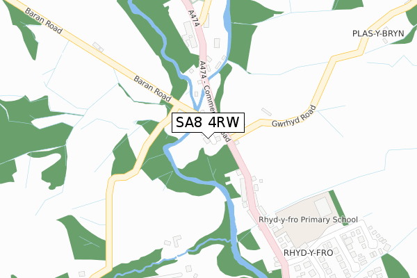
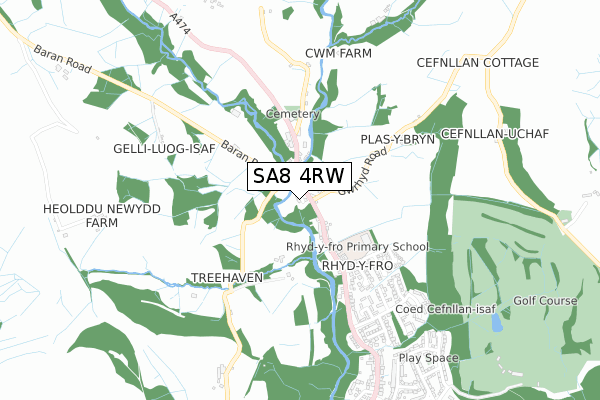
SA8 4RW is located in the Pontardawe electoral ward, within the unitary authority of Neath Port Talbot and the Welsh Parliamentary constituency of Neath. The Local Health Board is Swansea Bay University and the police force is South Wales. This postcode has been in use since June 2018.


GetTheData
Source: OS Open Zoomstack (Ordnance Survey)
Licence: Open Government Licence (requires attribution)
Attribution: Contains OS data © Crown copyright and database right 2025
Source: Open Postcode Geo
Licence: Open Government Licence (requires attribution)
Attribution: Contains OS data © Crown copyright and database right 2025; Contains Royal Mail data © Royal Mail copyright and database right 2025; Source: Office for National Statistics licensed under the Open Government Licence v.3.0
| Easting | 271276 |
| Northing | 205677 |
| Latitude | 51.734984 |
| Longitude | -3.865513 |
GetTheData
Source: Open Postcode Geo
Licence: Open Government Licence
| Country | Wales |
| Postcode District | SA8 |
➜ See where SA8 is on a map ➜ Where is Pontardawe? | |
GetTheData
Source: Land Registry Price Paid Data
Licence: Open Government Licence
| Ward | Pontardawe |
| Constituency | Neath |
GetTheData
Source: ONS Postcode Database
Licence: Open Government Licence
3, LLYS BARAN, RHYDYFRO, SWANSEA, SA8 4RW 2020 12 NOV £70,000 |
GetTheData
Source: HM Land Registry Price Paid Data
Licence: Contains HM Land Registry data © Crown copyright and database right 2025. This data is licensed under the Open Government Licence v3.0.
| Royal Oak (Commercial Road) | Rhyd-y-fro | 156m |
| Cwm Cartref Nursing Home (Commercial Road) | Rhyd-y-fro | 297m |
| Cwm Cartref Nursing Home (A474) | Rhyd-y-fro | 319m |
| Waunsterw (Gelligron Road) | Gelli-gron | 531m |
| Waunsterw (Gelli-gron Road) | Gelli-gron | 565m |
GetTheData
Source: NaPTAN
Licence: Open Government Licence
| Percentage of properties with Next Generation Access | 100.0% |
| Percentage of properties with Superfast Broadband | 100.0% |
| Percentage of properties with Ultrafast Broadband | 0.0% |
| Percentage of properties with Full Fibre Broadband | 0.0% |
Superfast Broadband is between 30Mbps and 300Mbps
Ultrafast Broadband is > 300Mbps
| Percentage of properties unable to receive 2Mbps | 0.0% |
| Percentage of properties unable to receive 5Mbps | 0.0% |
| Percentage of properties unable to receive 10Mbps | 0.0% |
| Percentage of properties unable to receive 30Mbps | 0.0% |
GetTheData
Source: Ofcom
Licence: Ofcom Terms of Use (requires attribution)
GetTheData
Source: ONS Postcode Database
Licence: Open Government Licence


➜ Get more ratings from the Food Standards Agency
GetTheData
Source: Food Standards Agency
Licence: FSA terms & conditions
| Last Collection | |||
|---|---|---|---|
| Location | Mon-Fri | Sat | Distance |
| Rhyd Y Fro P O | 16:45 | 11:15 | 860m |
| Pontardawe P O | 18:00 | 11:30 | 1,878m |
| Public Hall | 18:00 | 12:15 | 2,005m |
GetTheData
Source: Dracos
Licence: Creative Commons Attribution-ShareAlike
The below table lists the International Territorial Level (ITL) codes (formerly Nomenclature of Territorial Units for Statistics (NUTS) codes) and Local Administrative Units (LAU) codes for SA8 4RW:
| ITL 1 Code | Name |
|---|---|
| TLL | Wales |
| ITL 2 Code | Name |
| TLL1 | West Wales and The Valleys |
| ITL 3 Code | Name |
| TLL17 | Bridgend and Neath Port Talbot |
| LAU 1 Code | Name |
| W06000012 | Neath Port Talbot |
GetTheData
Source: ONS Postcode Directory
Licence: Open Government Licence
The below table lists the Census Output Area (OA), Lower Layer Super Output Area (LSOA), and Middle Layer Super Output Area (MSOA) for SA8 4RW:
| Code | Name | |
|---|---|---|
| OA | W00005034 | |
| LSOA | W01000946 | Neath Port Talbot 004B |
| MSOA | W02000202 | Neath Port Talbot 004 |
GetTheData
Source: ONS Postcode Directory
Licence: Open Government Licence
| SA8 4TH | Gwrhyd Road | 90m |
| SA8 4SL | Commercial Road | 223m |
| SA8 3BB | Waun Penlan | 423m |
| SA8 4RP | Penlan Road | 444m |
| SA8 4TJ | Gwrhyd Road | 481m |
| SA8 4SJ | Gelligron Road | 501m |
| SA8 4NF | Waun Sterw | 629m |
| SA8 4TE | Cwmclyd Road | 633m |
| SA8 4NX | Alltywaun | 655m |
| SA8 4NG | Godrer Fro | 687m |
GetTheData
Source: Open Postcode Geo; Land Registry Price Paid Data
Licence: Open Government Licence