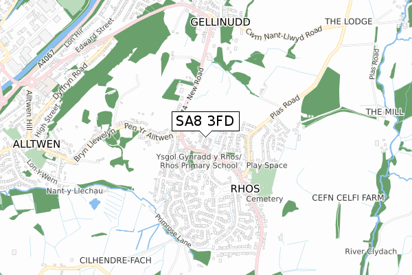
SA8 3FD is located in the Rhos electoral ward, within the unitary authority of Neath Port Talbot and the Welsh Parliamentary constituency of Neath. The Local Health Board is Swansea Bay University and the police force is South Wales. This postcode has been in use since December 2019.


GetTheData
Source: OS Open Zoomstack (Ordnance Survey)
Licence: Open Government Licence (requires attribution)
Attribution: Contains OS data © Crown copyright and database right 2025
Source: Open Postcode Geo
Licence: Open Government Licence (requires attribution)
Attribution: Contains OS data © Crown copyright and database right 2025; Contains Royal Mail data © Royal Mail copyright and database right 2025; Source: Office for National Statistics licensed under the Open Government Licence v.3.0
| Easting | 273665 |
| Northing | 203359 |
| Latitude | 51.714696 |
| Longitude | -3.830093 |
GetTheData
Source: Open Postcode Geo
Licence: Open Government Licence
| Country | Wales |
| Postcode District | SA8 |
➜ See where SA8 is on a map ➜ Where is Gellinudd? | |
GetTheData
Source: Land Registry Price Paid Data
Licence: Open Government Licence
| Ward | Rhos |
| Constituency | Neath |
GetTheData
Source: ONS Postcode Database
Licence: Open Government Licence
| Neath Road Bend (New Road) | Rhos | 146m |
| Neath Road Bend (New Road) | Pen Yr Alltwen | 146m |
| Pen Yr Alltwen Turn (Pen Yr Alltwen) | Rhos | 170m |
| Primary School (Delffordd) | Rhos | 173m |
| Village Hall (Plas Road) | Rhos | 293m |
GetTheData
Source: NaPTAN
Licence: Open Government Licence
GetTheData
Source: ONS Postcode Database
Licence: Open Government Licence


➜ Get more ratings from the Food Standards Agency
GetTheData
Source: Food Standards Agency
Licence: FSA terms & conditions
| Last Collection | |||
|---|---|---|---|
| Location | Mon-Fri | Sat | Distance |
| Rhos P O | 17:30 | 11:45 | 359m |
| Public Hall | 18:00 | 12:15 | 1,496m |
| Tesco Pontardawe | 17:45 | 12:30 | 1,543m |
GetTheData
Source: Dracos
Licence: Creative Commons Attribution-ShareAlike
The below table lists the International Territorial Level (ITL) codes (formerly Nomenclature of Territorial Units for Statistics (NUTS) codes) and Local Administrative Units (LAU) codes for SA8 3FD:
| ITL 1 Code | Name |
|---|---|
| TLL | Wales |
| ITL 2 Code | Name |
| TLL1 | West Wales and The Valleys |
| ITL 3 Code | Name |
| TLL17 | Bridgend and Neath Port Talbot |
| LAU 1 Code | Name |
| W06000012 | Neath Port Talbot |
GetTheData
Source: ONS Postcode Directory
Licence: Open Government Licence
The below table lists the Census Output Area (OA), Lower Layer Super Output Area (LSOA), and Middle Layer Super Output Area (MSOA) for SA8 3FD:
| Code | Name | |
|---|---|---|
| OA | W00005076 | |
| LSOA | W01000955 | Neath Port Talbot 004E |
| MSOA | W02000202 | Neath Port Talbot 004 |
GetTheData
Source: ONS Postcode Directory
Licence: Open Government Licence
| SA8 3HG | Delffordd | 177m |
| SA8 3EB | Neath Road | 181m |
| SA8 3DR | Maes Y Cornel | 188m |
| SA8 3ED | Delffordd | 189m |
| SA8 3HH | Maeslan | 194m |
| SA8 3EQ | Heol Y Nant | 243m |
| SA8 3EE | Lon Yr Ysgol | 253m |
| SA8 3HD | Plas Road | 281m |
| SA8 3HT | Maes Rhosyn | 282m |
| SA8 3EG | Tirbach Drive | 285m |
GetTheData
Source: Open Postcode Geo; Land Registry Price Paid Data
Licence: Open Government Licence