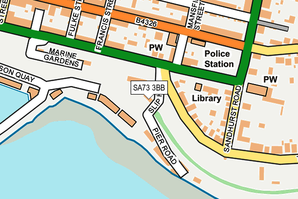
SA73 3BB is located in the Milford: Central electoral ward, within the unitary authority of Pembrokeshire and the Welsh Parliamentary constituency of Preseli Pembrokeshire. The Local Health Board is Hywel Dda University and the police force is Dyfed-Powys. This postcode has been in use since October 2015.


GetTheData
Source: OS OpenMap – Local (Ordnance Survey)
Source: OS VectorMap District (Ordnance Survey)
Licence: Open Government Licence (requires attribution)
| Easting | 190647 |
| Northing | 205735 |
| Latitude | 51.711181 |
| Longitude | -5.031723 |
GetTheData
Source: Open Postcode Geo
Licence: Open Government Licence
| Country | Wales |
| Postcode District | SA73 |
➜ See where SA73 is on a map ➜ Where is Milford Haven? | |
GetTheData
Source: Land Registry Price Paid Data
Licence: Open Government Licence
Elevation or altitude of SA73 3BB as distance above sea level:
| Metres | Feet | |
|---|---|---|
| Elevation | 20m | 66ft |
Elevation is measured from the approximate centre of the postcode, to the nearest point on an OS contour line from OS Terrain 50, which has contour spacing of ten vertical metres.
➜ How high above sea level am I? Find the elevation of your current position using your device's GPS.
GetTheData
Source: Open Postcode Elevation
Licence: Open Government Licence
| Ward | Milford: Central |
| Constituency | Preseli Pembrokeshire |
GetTheData
Source: ONS Postcode Database
Licence: Open Government Licence
| Milford Town Hall (Hamilton Terrace) | Milford Haven | 119m |
| Robert Street | Milford Haven | 201m |
| Great North Road | Milford Haven | 244m |
| Great North Road (Greath North Road) | Pill | 277m |
| Fulke Street (Robert Street) | Milford Haven | 287m |
| Milford Haven Station | 0.8km |
| Johnston (Pembrokeshire) Station | 5.6km |
GetTheData
Source: NaPTAN
Licence: Open Government Licence
GetTheData
Source: ONS Postcode Database
Licence: Open Government Licence


➜ Get more ratings from the Food Standards Agency
GetTheData
Source: Food Standards Agency
Licence: FSA terms & conditions
| Last Collection | |||
|---|---|---|---|
| Location | Mon-Fri | Sat | Distance |
| Mastlebridge | 12:00 | 12:00 | 4,796m |
| Rosemarket P O | 12:00 | 12:00 | 5,258m |
GetTheData
Source: Dracos
Licence: Creative Commons Attribution-ShareAlike
The below table lists the International Territorial Level (ITL) codes (formerly Nomenclature of Territorial Units for Statistics (NUTS) codes) and Local Administrative Units (LAU) codes for SA73 3BB:
| ITL 1 Code | Name |
|---|---|
| TLL | Wales |
| ITL 2 Code | Name |
| TLL1 | West Wales and The Valleys |
| ITL 3 Code | Name |
| TLL14 | South West Wales |
| LAU 1 Code | Name |
| W06000009 | Pembrokeshire |
GetTheData
Source: ONS Postcode Directory
Licence: Open Government Licence
The below table lists the Census Output Area (OA), Lower Layer Super Output Area (LSOA), and Middle Layer Super Output Area (MSOA) for SA73 3BB:
| Code | Name | |
|---|---|---|
| OA | W00003145 | |
| LSOA | W01000587 | Pembrokeshire 010A |
| MSOA | W02000135 | Pembrokeshire 010 |
GetTheData
Source: ONS Postcode Directory
Licence: Open Government Licence
| SA73 3BD | Smoke House Quay | 74m |
| SA73 3JP | Hamilton Terrace | 103m |
| SA73 3JR | The Rath | 109m |
| SA73 3JN | Hamilton Terrace | 120m |
| SA73 3BA | Pier Road | 124m |
| SA73 2JE | Charles Street | 153m |
| SA73 3JU | Sandhurst Road | 157m |
| SA73 2HW | Charles Street | 171m |
| SA73 2HP | Charles Street | 191m |
| SA73 2JQ | Mansfield Street | 196m |
GetTheData
Source: Open Postcode Geo; Land Registry Price Paid Data
Licence: Open Government Licence