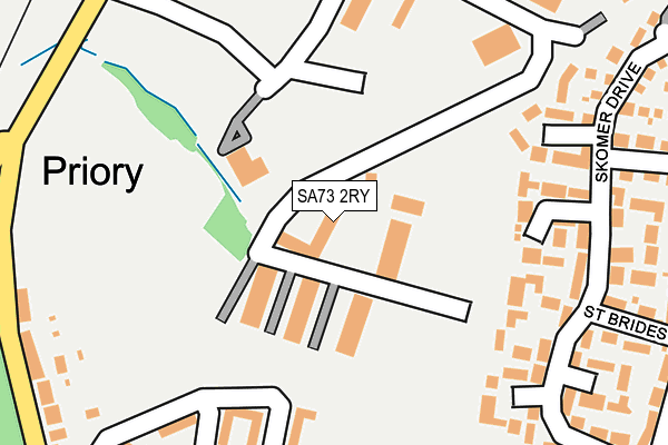
SA73 2RY is located in the Milford: North electoral ward, within the unitary authority of Pembrokeshire and the Welsh Parliamentary constituency of Preseli Pembrokeshire. The Local Health Board is Hywel Dda University and the police force is Dyfed-Powys. This postcode has been in use since August 1992.


GetTheData
Source: OS OpenMap – Local (Ordnance Survey)
Source: OS VectorMap District (Ordnance Survey)
Licence: Open Government Licence (requires attribution)
| Easting | 190694 |
| Northing | 207216 |
| Latitude | 51.724509 |
| Longitude | -5.031970 |
GetTheData
Source: Open Postcode Geo
Licence: Open Government Licence
| Country | Wales |
| Postcode District | SA73 |
➜ See where SA73 is on a map ➜ Where is Milford Haven? | |
GetTheData
Source: Land Registry Price Paid Data
Licence: Open Government Licence
Elevation or altitude of SA73 2RY as distance above sea level:
| Metres | Feet | |
|---|---|---|
| Elevation | 50m | 164ft |
Elevation is measured from the approximate centre of the postcode, to the nearest point on an OS contour line from OS Terrain 50, which has contour spacing of ten vertical metres.
➜ How high above sea level am I? Find the elevation of your current position using your device's GPS.
GetTheData
Source: Open Postcode Elevation
Licence: Open Government Licence
| Ward | Milford: North |
| Constituency | Preseli Pembrokeshire |
GetTheData
Source: ONS Postcode Database
Licence: Open Government Licence
| Marble Hall (Marble Hall Road) | Milford Haven | 440m |
| Leisure Centre (Priory Road) | Milford Haven | 648m |
| Bunkers Hill (Steynton Road) | Milford Haven | 730m |
| Philips Avenue (Steynton Road) | Milford Haven | 748m |
| Philips Avenue (Steynton Road) | Milford Haven | 751m |
| Milford Haven Station | 1.2km |
| Johnston (Pembrokeshire) Station | 4.4km |
GetTheData
Source: NaPTAN
Licence: Open Government Licence
GetTheData
Source: ONS Postcode Database
Licence: Open Government Licence


➜ Get more ratings from the Food Standards Agency
GetTheData
Source: Food Standards Agency
Licence: FSA terms & conditions
| Last Collection | |||
|---|---|---|---|
| Location | Mon-Fri | Sat | Distance |
| Rosemarket P O | 12:00 | 12:00 | 4,688m |
| Johnston P O | 17:15 | 12:00 | 4,956m |
| Mastlebridge | 12:00 | 12:00 | 4,992m |
GetTheData
Source: Dracos
Licence: Creative Commons Attribution-ShareAlike
The below table lists the International Territorial Level (ITL) codes (formerly Nomenclature of Territorial Units for Statistics (NUTS) codes) and Local Administrative Units (LAU) codes for SA73 2RY:
| ITL 1 Code | Name |
|---|---|
| TLL | Wales |
| ITL 2 Code | Name |
| TLL1 | West Wales and The Valleys |
| ITL 3 Code | Name |
| TLL14 | South West Wales |
| LAU 1 Code | Name |
| W06000009 | Pembrokeshire |
GetTheData
Source: ONS Postcode Directory
Licence: Open Government Licence
The below table lists the Census Output Area (OA), Lower Layer Super Output Area (LSOA), and Middle Layer Super Output Area (MSOA) for SA73 2RY:
| Code | Name | |
|---|---|---|
| OA | W00003172 | |
| LSOA | W01000593 | Pembrokeshire 010C |
| MSOA | W02000135 | Pembrokeshire 010 |
GetTheData
Source: ONS Postcode Directory
Licence: Open Government Licence
| SA73 2DA | Priory Park | 209m |
| SA73 2EL | Howarth Close | 214m |
| SA73 2RW | St Brides Way | 273m |
| SA73 2RF | Skomer Drive | 275m |
| SA73 2EN | Cromwell Road | 302m |
| SA73 2EH | Howarth Close | 304m |
| SA73 2RP | Skomer Drive | 324m |
| SA73 2ER | Priory Hill | 337m |
| SA73 2RQ | Ramsey Drive | 353m |
| SA73 2EQ | Cromwell Road | 355m |
GetTheData
Source: Open Postcode Geo; Land Registry Price Paid Data
Licence: Open Government Licence