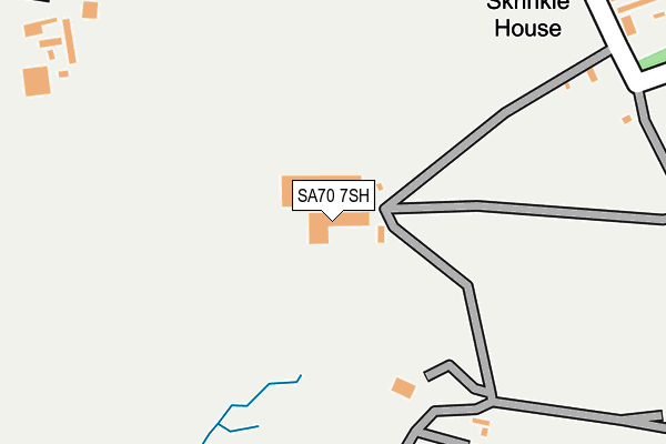
SA70 7SH is located in the Manorbier and Penally electoral ward, within the unitary authority of Pembrokeshire and the Welsh Parliamentary constituency of Carmarthen West and South Pembrokeshire. The Local Health Board is Hywel Dda University and the police force is Dyfed-Powys. This postcode has been in use since January 1980.


GetTheData
Source: OS OpenMap – Local (Ordnance Survey)
Source: OS VectorMap District (Ordnance Survey)
Licence: Open Government Licence (requires attribution)
| Easting | 207296 |
| Northing | 197241 |
| Latitude | 51.640869 |
| Longitude | -4.786366 |
GetTheData
Source: Open Postcode Geo
Licence: Open Government Licence
| Country | Wales |
| Postcode District | SA70 |
➜ See where SA70 is on a map | |
GetTheData
Source: Land Registry Price Paid Data
Licence: Open Government Licence
Elevation or altitude of SA70 7SH as distance above sea level:
| Metres | Feet | |
|---|---|---|
| Elevation | 70m | 230ft |
Elevation is measured from the approximate centre of the postcode, to the nearest point on an OS contour line from OS Terrain 50, which has contour spacing of ten vertical metres.
➜ How high above sea level am I? Find the elevation of your current position using your device's GPS.
GetTheData
Source: Open Postcode Elevation
Licence: Open Government Licence
| Ward | Manorbier And Penally |
| Constituency | Carmarthen West And South Pembrokeshire |
GetTheData
Source: ONS Postcode Database
Licence: Open Government Licence
| Skrinkle Estate (B4585) | Wind Hill | 800m |
| Skrinkle Estate (B4585) | Wind Hill | 811m |
| Vicarage Fields (B4585) | Manorbier | 832m |
| Castle Cottages (B4585) | Manorbier | 868m |
| Manorbier House (B4585) | Manorbier | 912m |
| Manorbier Station | 2.2km |
| Penally Station | 4.9km |
GetTheData
Source: NaPTAN
Licence: Open Government Licence
Estimated total energy consumption in SA70 7SH by fuel type, 2015.
| Consumption (kWh) | 159,153 |
|---|---|
| Meter count | 6 |
| Mean (kWh/meter) | 26,525 |
| Median (kWh/meter) | 24,197 |
GetTheData
Source: Postcode level gas estimates: 2015 (experimental)
Source: Postcode level electricity estimates: 2015 (experimental)
Licence: Open Government Licence
GetTheData
Source: ONS Postcode Database
Licence: Open Government Licence


➜ Get more ratings from the Food Standards Agency
GetTheData
Source: Food Standards Agency
Licence: FSA terms & conditions
The below table lists the International Territorial Level (ITL) codes (formerly Nomenclature of Territorial Units for Statistics (NUTS) codes) and Local Administrative Units (LAU) codes for SA70 7SH:
| ITL 1 Code | Name |
|---|---|
| TLL | Wales |
| ITL 2 Code | Name |
| TLL1 | West Wales and The Valleys |
| ITL 3 Code | Name |
| TLL14 | South West Wales |
| LAU 1 Code | Name |
| W06000009 | Pembrokeshire |
GetTheData
Source: ONS Postcode Directory
Licence: Open Government Licence
The below table lists the Census Output Area (OA), Lower Layer Super Output Area (LSOA), and Middle Layer Super Output Area (MSOA) for SA70 7SH:
| Code | Name | |
|---|---|---|
| OA | W00003126 | |
| LSOA | W01000584 | Pembrokeshire 014C |
| MSOA | W02000139 | Pembrokeshire 014 |
GetTheData
Source: ONS Postcode Directory
Licence: Open Government Licence
| SA70 7TS | Dewing Avenue | 669m |
| SA70 7TR | Gray Avenue | 736m |
| SA70 7TP | Hounsell Avenue | 779m |
| SA70 7TN | 821m | |
| SA70 7TJ | 867m | |
| SA70 7TE | 873m | |
| SA70 7SZ | 876m | |
| SA70 7TH | 880m | |
| SA70 7TL | Manor Crescent | 910m |
| SA70 7TD | 913m |
GetTheData
Source: Open Postcode Geo; Land Registry Price Paid Data
Licence: Open Government Licence