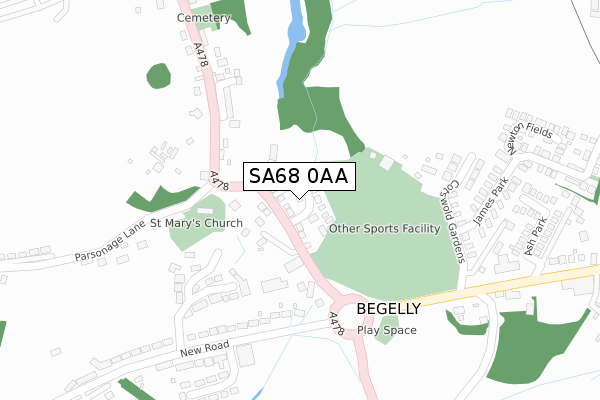
SA68 0AA is located in the Kilgetty and Begelly electoral ward, within the unitary authority of Pembrokeshire and the Welsh Parliamentary constituency of Carmarthen West and South Pembrokeshire. The Local Health Board is Hywel Dda University and the police force is Dyfed-Powys. This postcode has been in use since February 2018.


GetTheData
Source: OS Open Zoomstack (Ordnance Survey)
Licence: Open Government Licence (requires attribution)
Attribution: Contains OS data © Crown copyright and database right 2025
Source: Open Postcode Geo
Licence: Open Government Licence (requires attribution)
Attribution: Contains OS data © Crown copyright and database right 2025; Contains Royal Mail data © Royal Mail copyright and database right 2025; Source: Office for National Statistics licensed under the Open Government Licence v.3.0
| Easting | 211970 |
| Northing | 207328 |
| Latitude | 51.733053 |
| Longitude | -4.724367 |
GetTheData
Source: Open Postcode Geo
Licence: Open Government Licence
| Country | Wales |
| Postcode District | SA68 |
➜ See where SA68 is on a map ➜ Where is Begelly? | |
GetTheData
Source: Land Registry Price Paid Data
Licence: Open Government Licence
| Ward | Kilgetty And Begelly |
| Constituency | Carmarthen West And South Pembrokeshire |
GetTheData
Source: ONS Postcode Database
Licence: Open Government Licence
2020 18 DEC £250,000 |
30, PARK GARDENS, BEGELLY, KILGETTY, SA68 0AA 2018 14 DEC £210,000 |
28, PARK GARDENS, BEGELLY, KILGETTY, SA68 0AA 2018 23 NOV £254,880 |
29, PARK GARDENS, BEGELLY, KILGETTY, SA68 0AA 2018 16 NOV £210,000 |
27, PARK GARDENS, BEGELLY, KILGETTY, SA68 0AA 2018 9 NOV £210,000 |
26, PARK GARDENS, BEGELLY, KILGETTY, SA68 0AA 2018 12 OCT £217,000 |
22, PARK GARDENS, BEGELLY, KILGETTY, SA68 0AA 2018 5 JUL £222,240 |
2018 11 MAY £219,000 |
10, PARK GARDENS, BEGELLY, KILGETTY, SA68 0AA 2017 21 DEC £210,000 |
23, PARK GARDENS, BEGELLY, KILGETTY, SA68 0AA 2017 31 JAN £205,000 |
GetTheData
Source: HM Land Registry Price Paid Data
Licence: Contains HM Land Registry data © Crown copyright and database right 2025. This data is licensed under the Open Government Licence v3.0.
| Begelly (A478) | Begelly | 65m |
| Community Centre (Main Road) | Kilgetty | 312m |
| Kingsmoor Roundabout (A478) | Kilgetty | 370m |
| Co-op (Carmarthen Road) | Kilgetty | 498m |
| Ryelands Lane | Kilgetty | 693m |
| Kilgetty Station | 0.6km |
| Saundersfoot Station | 1.3km |
GetTheData
Source: NaPTAN
Licence: Open Government Licence
| Percentage of properties with Next Generation Access | 100.0% |
| Percentage of properties with Superfast Broadband | 100.0% |
| Percentage of properties with Ultrafast Broadband | 0.0% |
| Percentage of properties with Full Fibre Broadband | 0.0% |
Superfast Broadband is between 30Mbps and 300Mbps
Ultrafast Broadband is > 300Mbps
| Median download speed | 77.3Mbps |
| Average download speed | 59.3Mbps |
| Maximum download speed | 80.00Mbps |
| Median upload speed | 19.4Mbps |
| Average upload speed | 14.5Mbps |
| Maximum upload speed | 20.00Mbps |
| Percentage of properties unable to receive 2Mbps | 0.0% |
| Percentage of properties unable to receive 5Mbps | 0.0% |
| Percentage of properties unable to receive 10Mbps | 0.0% |
| Percentage of properties unable to receive 30Mbps | 0.0% |
GetTheData
Source: Ofcom
Licence: Ofcom Terms of Use (requires attribution)
GetTheData
Source: ONS Postcode Database
Licence: Open Government Licence


➜ Get more ratings from the Food Standards Agency
GetTheData
Source: Food Standards Agency
Licence: FSA terms & conditions
| Last Collection | |||
|---|---|---|---|
| Location | Mon-Fri | Sat | Distance |
| Broadmoor P O | 16:30 | 11:00 | 2,551m |
| Kilanow | 15:00 | 09:30 | 3,247m |
| Summerhill Stores | 15:30 | 08:00 | 3,306m |
GetTheData
Source: Dracos
Licence: Creative Commons Attribution-ShareAlike
The below table lists the International Territorial Level (ITL) codes (formerly Nomenclature of Territorial Units for Statistics (NUTS) codes) and Local Administrative Units (LAU) codes for SA68 0AA:
| ITL 1 Code | Name |
|---|---|
| TLL | Wales |
| ITL 2 Code | Name |
| TLL1 | West Wales and The Valleys |
| ITL 3 Code | Name |
| TLL14 | South West Wales |
| LAU 1 Code | Name |
| W06000009 | Pembrokeshire |
GetTheData
Source: ONS Postcode Directory
Licence: Open Government Licence
The below table lists the Census Output Area (OA), Lower Layer Super Output Area (LSOA), and Middle Layer Super Output Area (MSOA) for SA68 0AA:
| Code | Name | |
|---|---|---|
| OA | W00003084 | |
| LSOA | W01000576 | Pembrokeshire 011D |
| MSOA | W02000136 | Pembrokeshire 011 |
GetTheData
Source: ONS Postcode Directory
Licence: Open Government Licence
| SA68 0YH | 73m | |
| SA68 0YJ | 77m | |
| SA68 0YP | Church Close | 191m |
| SA68 0YQ | Cotswold Gardens | 260m |
| SA68 0YD | James Park | 299m |
| SA68 0YE | New Road | 351m |
| SA68 0YW | The Grove | 363m |
| SA68 0XY | Ash Park | 397m |
| SA68 0XE | 401m | |
| SA68 0YF | New Road | 403m |
GetTheData
Source: Open Postcode Geo; Land Registry Price Paid Data
Licence: Open Government Licence