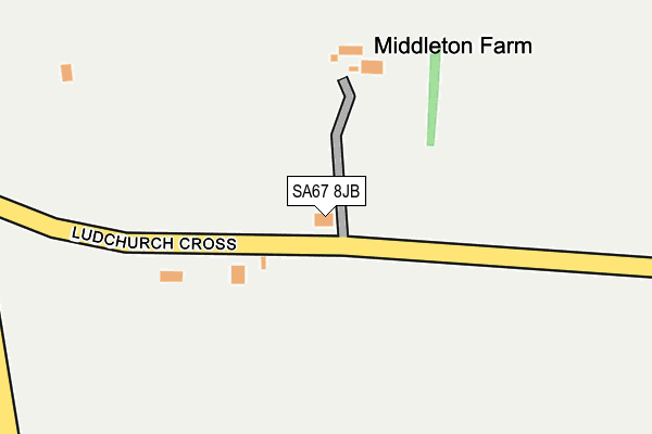
SA67 8JB is in Ludchurch, Narberth. SA67 8JB is located in the Lampeter Velfrey electoral ward, within the unitary authority of Pembrokeshire and the Welsh Parliamentary constituency of Carmarthen West and South Pembrokeshire. The Local Health Board is Hywel Dda University and the police force is Dyfed-Powys. This postcode has been in use since January 1980.


GetTheData
Source: OS OpenMap – Local (Ordnance Survey)
Source: OS VectorMap District (Ordnance Survey)
Licence: Open Government Licence (requires attribution)
| Easting | 214376 |
| Northing | 211438 |
| Latitude | 51.770758 |
| Longitude | -4.691731 |
GetTheData
Source: Open Postcode Geo
Licence: Open Government Licence
| Locality | Ludchurch |
| Town/City | Narberth |
| Country | Wales |
| Postcode District | SA67 |
➜ See where SA67 is on a map | |
GetTheData
Source: Land Registry Price Paid Data
Licence: Open Government Licence
Elevation or altitude of SA67 8JB as distance above sea level:
| Metres | Feet | |
|---|---|---|
| Elevation | 170m | 558ft |
Elevation is measured from the approximate centre of the postcode, to the nearest point on an OS contour line from OS Terrain 50, which has contour spacing of ten vertical metres.
➜ How high above sea level am I? Find the elevation of your current position using your device's GPS.
GetTheData
Source: Open Postcode Elevation
Licence: Open Government Licence
| Ward | Lampeter Velfrey |
| Constituency | Carmarthen West And South Pembrokeshire |
GetTheData
Source: ONS Postcode Database
Licence: Open Government Licence
| Crossroads (B4315) | Princes Gate | 1,561m |
| St Catherine`s Close (B4315) | Princes Gate | 1,605m |
| Narberth Station | 4km |
| Kilgetty Station | 4.6km |
GetTheData
Source: NaPTAN
Licence: Open Government Licence
| Percentage of properties with Next Generation Access | 40.0% |
| Percentage of properties with Superfast Broadband | 40.0% |
| Percentage of properties with Ultrafast Broadband | 40.0% |
| Percentage of properties with Full Fibre Broadband | 40.0% |
Superfast Broadband is between 30Mbps and 300Mbps
Ultrafast Broadband is > 300Mbps
| Percentage of properties unable to receive 2Mbps | 0.0% |
| Percentage of properties unable to receive 5Mbps | 0.0% |
| Percentage of properties unable to receive 10Mbps | 0.0% |
| Percentage of properties unable to receive 30Mbps | 60.0% |
GetTheData
Source: Ofcom
Licence: Ofcom Terms of Use (requires attribution)
GetTheData
Source: ONS Postcode Database
Licence: Open Government Licence


➜ Get more ratings from the Food Standards Agency
GetTheData
Source: Food Standards Agency
Licence: FSA terms & conditions
| Last Collection | |||
|---|---|---|---|
| Location | Mon-Fri | Sat | Distance |
| Longstone Cross | 15:00 | 09:00 | 1,677m |
| Kilanow | 15:00 | 09:30 | 3,118m |
| Boars Head | 15:45 | 09:30 | 3,170m |
GetTheData
Source: Dracos
Licence: Creative Commons Attribution-ShareAlike
The below table lists the International Territorial Level (ITL) codes (formerly Nomenclature of Territorial Units for Statistics (NUTS) codes) and Local Administrative Units (LAU) codes for SA67 8JB:
| ITL 1 Code | Name |
|---|---|
| TLL | Wales |
| ITL 2 Code | Name |
| TLL1 | West Wales and The Valleys |
| ITL 3 Code | Name |
| TLL14 | South West Wales |
| LAU 1 Code | Name |
| W06000009 | Pembrokeshire |
GetTheData
Source: ONS Postcode Directory
Licence: Open Government Licence
The below table lists the Census Output Area (OA), Lower Layer Super Output Area (LSOA), and Middle Layer Super Output Area (MSOA) for SA67 8JB:
| Code | Name | |
|---|---|---|
| OA | W00003087 | |
| LSOA | W01000577 | Pembrokeshire 007A |
| MSOA | W02000132 | Pembrokeshire 007 |
GetTheData
Source: ONS Postcode Directory
Licence: Open Government Licence
| SA67 8HZ | Quarry Park | 777m |
| SA67 8JA | 811m | |
| SA67 8JQ | Thornberry Gardens | 851m |
| SA67 8JE | 931m | |
| SA67 8JF | 931m | |
| SA67 8LG | 940m | |
| SA67 8TQ | 974m | |
| SA67 8HY | Egypt Meadow | 1005m |
| SA67 8LB | Abbey Stream | 1076m |
| SA67 8TG | 1140m |
GetTheData
Source: Open Postcode Geo; Land Registry Price Paid Data
Licence: Open Government Licence