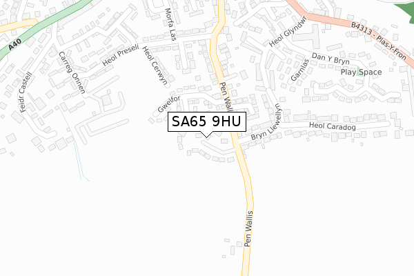
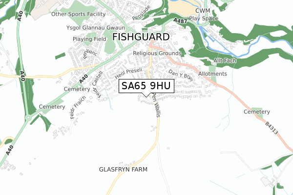
SA65 9HU is located in the Fishguard: North West electoral ward, within the unitary authority of Pembrokeshire and the Welsh Parliamentary constituency of Preseli Pembrokeshire. The Local Health Board is Hywel Dda University and the police force is Dyfed-Powys. This postcode has been in use since October 2018.


GetTheData
Source: OS Open Zoomstack (Ordnance Survey)
Licence: Open Government Licence (requires attribution)
Attribution: Contains OS data © Crown copyright and database right 2025
Source: Open Postcode Geo
Licence: Open Government Licence (requires attribution)
Attribution: Contains OS data © Crown copyright and database right 2025; Contains Royal Mail data © Royal Mail copyright and database right 2025; Source: Office for National Statistics licensed under the Open Government Licence v.3.0
| Easting | 195815 |
| Northing | 236488 |
| Latitude | 51.989229 |
| Longitude | -4.975226 |
GetTheData
Source: Open Postcode Geo
Licence: Open Government Licence
| Country | Wales |
| Postcode District | SA65 |
➜ See where SA65 is on a map ➜ Where is Fishguard? | |
GetTheData
Source: Land Registry Price Paid Data
Licence: Open Government Licence
| Ward | Fishguard: North West |
| Constituency | Preseli Pembrokeshire |
GetTheData
Source: ONS Postcode Database
Licence: Open Government Licence
| Wallis Street (Heol Preseli) | Fishguard | 256m |
| Heol Glyndwr | Lower Town | 321m |
| Pendre Inn (High Street) | Fishguard | 470m |
| Pendre Inn (High Street) | Fishguard | 489m |
| The Square | Fishguard | 509m |
| Fishguard & Goodwick Station | 2.1km |
| Fishguard Harbour Station | 2.6km |
GetTheData
Source: NaPTAN
Licence: Open Government Licence
| Percentage of properties with Next Generation Access | 100.0% |
| Percentage of properties with Superfast Broadband | 100.0% |
| Percentage of properties with Ultrafast Broadband | 96.6% |
| Percentage of properties with Full Fibre Broadband | 96.6% |
Superfast Broadband is between 30Mbps and 300Mbps
Ultrafast Broadband is > 300Mbps
| Percentage of properties unable to receive 2Mbps | 0.0% |
| Percentage of properties unable to receive 5Mbps | 0.0% |
| Percentage of properties unable to receive 10Mbps | 0.0% |
| Percentage of properties unable to receive 30Mbps | 0.0% |
GetTheData
Source: Ofcom
Licence: Ofcom Terms of Use (requires attribution)
GetTheData
Source: ONS Postcode Database
Licence: Open Government Licence


➜ Get more ratings from the Food Standards Agency
GetTheData
Source: Food Standards Agency
Licence: FSA terms & conditions
| Last Collection | |||
|---|---|---|---|
| Location | Mon-Fri | Sat | Distance |
| Plasyfron | 17:00 | 12:15 | 371m |
| Hamilton St | 12:30 | 12:30 | 482m |
| Penbanc | 17:00 | 12:15 | 698m |
GetTheData
Source: Dracos
Licence: Creative Commons Attribution-ShareAlike
The below table lists the International Territorial Level (ITL) codes (formerly Nomenclature of Territorial Units for Statistics (NUTS) codes) and Local Administrative Units (LAU) codes for SA65 9HU:
| ITL 1 Code | Name |
|---|---|
| TLL | Wales |
| ITL 2 Code | Name |
| TLL1 | West Wales and The Valleys |
| ITL 3 Code | Name |
| TLL14 | South West Wales |
| LAU 1 Code | Name |
| W06000009 | Pembrokeshire |
GetTheData
Source: ONS Postcode Directory
Licence: Open Government Licence
The below table lists the Census Output Area (OA), Lower Layer Super Output Area (LSOA), and Middle Layer Super Output Area (MSOA) for SA65 9HU:
| Code | Name | |
|---|---|---|
| OA | W00003017 | |
| LSOA | W01000566 | Pembrokeshire 002C |
| MSOA | W02000127 | Pembrokeshire 002 |
GetTheData
Source: ONS Postcode Directory
Licence: Open Government Licence
| SA65 9HS | Tlysfan | 79m |
| SA65 9HX | Jubilee Terrace | 86m |
| SA65 9AX | Bryn Llewellyn | 141m |
| SA65 9HR | Penwallis | 160m |
| SA65 9JB | Garn Ingli | 187m |
| SA65 9JE | Heol Cerwyn | 191m |
| SA65 9HY | Wallis Crescent | 205m |
| SA65 9LN | Heol Glyndwr | 245m |
| SA65 9JA | Heol Preseli | 259m |
| SA65 9JD | Heol Preseli | 271m |
GetTheData
Source: Open Postcode Geo; Land Registry Price Paid Data
Licence: Open Government Licence