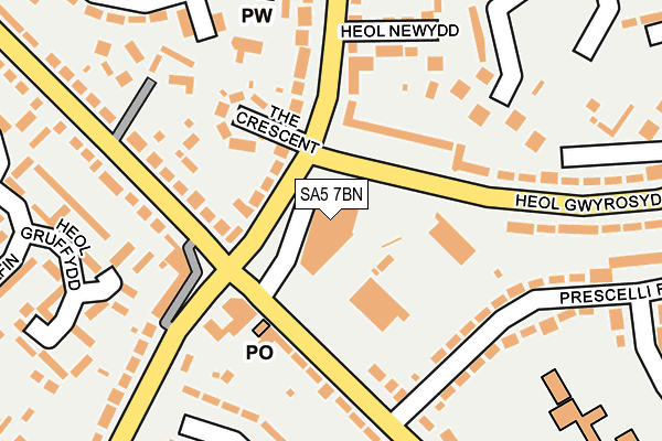
SA5 7BN is located in the Penderry electoral ward, within the unitary authority of Swansea and the Welsh Parliamentary constituency of Swansea East. The Local Health Board is Swansea Bay University and the police force is South Wales. This postcode has been in use since April 1986.


GetTheData
Source: OS OpenMap – Local (Ordnance Survey)
Source: OS VectorMap District (Ordnance Survey)
Licence: Open Government Licence (requires attribution)
| Easting | 263757 |
| Northing | 196065 |
| Latitude | 51.646827 |
| Longitude | -3.970558 |
GetTheData
Source: Open Postcode Geo
Licence: Open Government Licence
| Country | Wales |
| Postcode District | SA5 |
➜ See where SA5 is on a map ➜ Where is Swansea? | |
GetTheData
Source: Land Registry Price Paid Data
Licence: Open Government Licence
Elevation or altitude of SA5 7BN as distance above sea level:
| Metres | Feet | |
|---|---|---|
| Elevation | 130m | 427ft |
Elevation is measured from the approximate centre of the postcode, to the nearest point on an OS contour line from OS Terrain 50, which has contour spacing of ten vertical metres.
➜ How high above sea level am I? Find the elevation of your current position using your device's GPS.
GetTheData
Source: Open Postcode Elevation
Licence: Open Government Licence
| Ward | Penderry |
| Constituency | Swansea East |
GetTheData
Source: ONS Postcode Database
Licence: Open Government Licence
| First Cymru Depot (Heol Gwrosydd) | Ravenhill | 55m |
| First Cymru Depot (Heol Gwyosydd) | Penlan | 89m |
| Caereithin Cross (Pentregethin Road) | Caereithin | 100m |
| Caereithin Cross (Pentregethin Road) | Caereithin | 106m |
| Caereithin Cross (Ravenhill Road) | Caereithin | 161m |
| Swansea Station | 3.1km |
| Gowerton Station | 4.5km |
GetTheData
Source: NaPTAN
Licence: Open Government Licence
GetTheData
Source: ONS Postcode Database
Licence: Open Government Licence


➜ Get more ratings from the Food Standards Agency
GetTheData
Source: Food Standards Agency
Licence: FSA terms & conditions
| Last Collection | |||
|---|---|---|---|
| Location | Mon-Fri | Sat | Distance |
| Caereithin P O | 17:45 | 11:15 | 106m |
| Middle Road (Lower) | 17:30 | 13:00 | 658m |
| St. Johns Road | 18:15 | 13:00 | 1,027m |
GetTheData
Source: Dracos
Licence: Creative Commons Attribution-ShareAlike
The below table lists the International Territorial Level (ITL) codes (formerly Nomenclature of Territorial Units for Statistics (NUTS) codes) and Local Administrative Units (LAU) codes for SA5 7BN:
| ITL 1 Code | Name |
|---|---|
| TLL | Wales |
| ITL 2 Code | Name |
| TLL1 | West Wales and The Valleys |
| ITL 3 Code | Name |
| TLL18 | Swansea |
| LAU 1 Code | Name |
| W06000011 | Swansea |
GetTheData
Source: ONS Postcode Directory
Licence: Open Government Licence
The below table lists the Census Output Area (OA), Lower Layer Super Output Area (LSOA), and Middle Layer Super Output Area (MSOA) for SA5 7BN:
| Code | Name | |
|---|---|---|
| OA | W00004468 | |
| LSOA | W01000832 | Swansea 011B |
| MSOA | W02000178 | Swansea 011 |
GetTheData
Source: ONS Postcode Directory
Licence: Open Government Licence
| SA5 5AG | Mynydd Newydd Road | 113m |
| SA5 5AQ | The Crescent | 131m |
| SA5 8AB | Pentregethin Road | 144m |
| SA5 5AH | Ravenhill Road | 152m |
| SA5 5ET | Pentregethin Road | 154m |
| SA5 7BP | Heol Gwyrosydd | 165m |
| SA5 5AF | Heol Newydd | 168m |
| SA5 8AE | Prescelli Road | 206m |
| SA5 7AB | Rosewood Court | 213m |
| SA5 5EN | Heol Gruffydd | 220m |
GetTheData
Source: Open Postcode Geo; Land Registry Price Paid Data
Licence: Open Government Licence