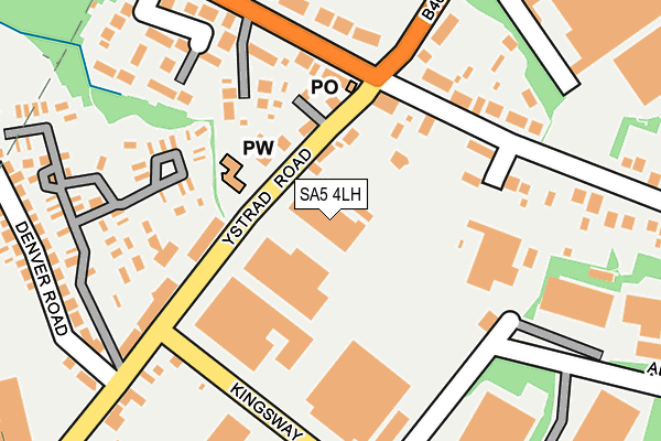
SA5 4LH is located in the Cockett electoral ward, within the unitary authority of Swansea and the Welsh Parliamentary constituency of Swansea West. The Local Health Board is Swansea Bay University and the police force is South Wales. This postcode has been in use since June 1998.


GetTheData
Source: OS OpenMap – Local (Ordnance Survey)
Source: OS VectorMap District (Ordnance Survey)
Licence: Open Government Licence (requires attribution)
| Easting | 262067 |
| Northing | 196336 |
| Latitude | 51.648855 |
| Longitude | -3.995094 |
GetTheData
Source: Open Postcode Geo
Licence: Open Government Licence
| Country | Wales |
| Postcode District | SA5 |
➜ See where SA5 is on a map ➜ Where is Swansea? | |
GetTheData
Source: Land Registry Price Paid Data
Licence: Open Government Licence
Elevation or altitude of SA5 4LH as distance above sea level:
| Metres | Feet | |
|---|---|---|
| Elevation | 40m | 131ft |
Elevation is measured from the approximate centre of the postcode, to the nearest point on an OS contour line from OS Terrain 50, which has contour spacing of ten vertical metres.
➜ How high above sea level am I? Find the elevation of your current position using your device's GPS.
GetTheData
Source: Open Postcode Elevation
Licence: Open Government Licence
| Ward | Cockett |
| Constituency | Swansea West |
GetTheData
Source: ONS Postcode Database
Licence: Open Government Licence
| St Illtyd's Church (Ystrad Road) | Fforestfach | 78m |
| Ystrad Road (Carmarthen Road) | Fforestfach | 142m |
| Ystrad Road (Carmarthen Road) | Fforestfach | 145m |
| Haven (Bruce Road) | Fforestfach | 278m |
| Hardings Gate (Carmarthen Road) | Fforestfach | 341m |
| Gowerton Station | 2.8km |
| Swansea Station | 4.5km |
GetTheData
Source: NaPTAN
Licence: Open Government Licence
GetTheData
Source: ONS Postcode Database
Licence: Open Government Licence


➜ Get more ratings from the Food Standards Agency
GetTheData
Source: Food Standards Agency
Licence: FSA terms & conditions
| Last Collection | |||
|---|---|---|---|
| Location | Mon-Fri | Sat | Distance |
| Ystrad Road P O | 17:30 | 12:00 | 128m |
| Mynydd Bach Y Glo | 17:45 | 11:45 | 956m |
| Middle Road (Lower) | 17:30 | 13:00 | 1,077m |
GetTheData
Source: Dracos
Licence: Creative Commons Attribution-ShareAlike
The below table lists the International Territorial Level (ITL) codes (formerly Nomenclature of Territorial Units for Statistics (NUTS) codes) and Local Administrative Units (LAU) codes for SA5 4LH:
| ITL 1 Code | Name |
|---|---|
| TLL | Wales |
| ITL 2 Code | Name |
| TLL1 | West Wales and The Valleys |
| ITL 3 Code | Name |
| TLL18 | Swansea |
| LAU 1 Code | Name |
| W06000011 | Swansea |
GetTheData
Source: ONS Postcode Directory
Licence: Open Government Licence
The below table lists the Census Output Area (OA), Lower Layer Super Output Area (LSOA), and Middle Layer Super Output Area (MSOA) for SA5 4LH:
| Code | Name | |
|---|---|---|
| OA | W00004078 | |
| LSOA | W01000760 | Swansea 013A |
| MSOA | W02000180 | Swansea 013 |
GetTheData
Source: ONS Postcode Directory
Licence: Open Government Licence
| SA5 4BT | Ystrad Road | 106m |
| SA5 4BP | Carmarthen Road | 158m |
| SA5 4BH | Pant Yr Helyg | 194m |
| SA5 4NU | Cynore Road | 201m |
| SA5 4BR | Carmarthen Road | 204m |
| SA5 4BU | Ystrad Road | 209m |
| SA5 4BW | Carmarthen Road | 223m |
| SA5 4BJ | Pant Yr Helyg | 232m |
| SA5 4DA | Denver Road | 257m |
| SA5 4NG | Heol Iscoed | 277m |
GetTheData
Source: Open Postcode Geo; Land Registry Price Paid Data
Licence: Open Government Licence