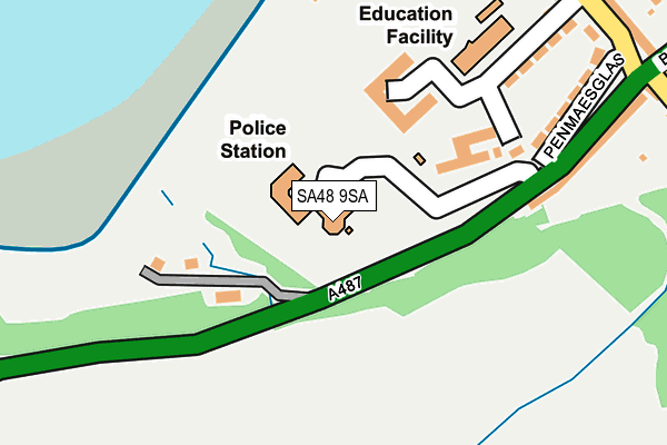
SA48 9SA is located in the Aberaeron and Aberarth electoral ward, within the unitary authority of Ceredigion and the Welsh Parliamentary constituency of Ceredigion. The Local Health Board is Hywel Dda University and the police force is Dyfed-Powys. This postcode has been in use since February 2005.


GetTheData
Source: OS OpenMap – Local (Ordnance Survey)
Source: OS VectorMap District (Ordnance Survey)
Licence: Open Government Licence (requires attribution)
| Easting | 245346 |
| Northing | 262574 |
| Latitude | 52.239582 |
| Longitude | -4.266399 |
GetTheData
Source: Open Postcode Geo
Licence: Open Government Licence
| Country | Wales |
| Postcode District | SA48 |
➜ See where SA48 is on a map ➜ Where is Aberaeron? | |
GetTheData
Source: Land Registry Price Paid Data
Licence: Open Government Licence
Elevation or altitude of SA48 9SA as distance above sea level:
| Metres | Feet | |
|---|---|---|
| Elevation | 20m | 66ft |
Elevation is measured from the approximate centre of the postcode, to the nearest point on an OS contour line from OS Terrain 50, which has contour spacing of ten vertical metres.
➜ How high above sea level am I? Find the elevation of your current position using your device's GPS.
GetTheData
Source: Open Postcode Elevation
Licence: Open Government Licence
| Ward | Aberaeron And Aberarth |
| Constituency | Ceredigion |
GetTheData
Source: ONS Postcode Database
Licence: Open Government Licence
| Ceredigion Council Office (A487) | Aberaeron | 171m |
| Newfoundland Terrace (A487) | Aberaeron | 221m |
| School (Godre Rhiwgoch) | Aberaeron | 606m |
| School (Godre Rhiwgoch) | Aberaeron | 633m |
| Alban Square (North Road) | Aberaeron | 640m |
GetTheData
Source: NaPTAN
Licence: Open Government Licence
GetTheData
Source: ONS Postcode Database
Licence: Open Government Licence


➜ Get more ratings from the Food Standards Agency
GetTheData
Source: Food Standards Agency
Licence: FSA terms & conditions
| Last Collection | |||
|---|---|---|---|
| Location | Mon-Fri | Sat | Distance |
| Aberaeron | 17:00 | 11:00 | 666m |
| Gwynfryn | 11:00 | 11:00 | 5,024m |
GetTheData
Source: Dracos
Licence: Creative Commons Attribution-ShareAlike
The below table lists the International Territorial Level (ITL) codes (formerly Nomenclature of Territorial Units for Statistics (NUTS) codes) and Local Administrative Units (LAU) codes for SA48 9SA:
| ITL 1 Code | Name |
|---|---|
| TLL | Wales |
| ITL 2 Code | Name |
| TLL1 | West Wales and The Valleys |
| ITL 3 Code | Name |
| TLL14 | South West Wales |
| LAU 1 Code | Name |
| W06000008 | Ceredigion |
GetTheData
Source: ONS Postcode Directory
Licence: Open Government Licence
The below table lists the Census Output Area (OA), Lower Layer Super Output Area (LSOA), and Middle Layer Super Output Area (MSOA) for SA48 9SA:
| Code | Name | |
|---|---|---|
| OA | W00002705 | |
| LSOA | W01000506 | Ceredigion 005A |
| MSOA | W02000120 | Ceredigion 005 |
GetTheData
Source: ONS Postcode Directory
Licence: Open Government Licence
| SA46 0ES | Newfoundland Terrace | 200m |
| SA46 0BQ | Wellington Gardens | 239m |
| SA46 0BL | Penmaesglas | 246m |
| SA46 0ER | Greenland Terrace | 265m |
| SA46 0BE | Beach Parade | 307m |
| SA46 0BG | Wellington Street | 320m |
| SA46 0AZ | Belle Vue Gardens | 354m |
| SA46 0BD | Vulcan Place | 357m |
| SA46 0EN | Panteg Road | 358m |
| SA46 0BB | Belle Vue Terrace | 369m |
GetTheData
Source: Open Postcode Geo; Land Registry Price Paid Data
Licence: Open Government Licence