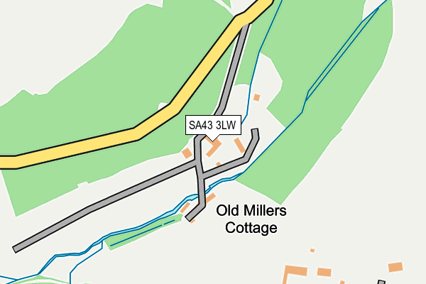
SA43 3LW is located in the St Dogmaels electoral ward, within the unitary authority of Pembrokeshire and the Welsh Parliamentary constituency of Preseli Pembrokeshire. The Local Health Board is Hywel Dda University and the police force is Dyfed-Powys. This postcode has been in use since June 2000.


GetTheData
Source: OS OpenMap – Local (Ordnance Survey)
Source: OS VectorMap District (Ordnance Survey)
Licence: Open Government Licence (requires attribution)
| Easting | 215109 |
| Northing | 248108 |
| Latitude | 52.100344 |
| Longitude | -4.700861 |
GetTheData
Source: Open Postcode Geo
Licence: Open Government Licence
| Country | Wales |
| Postcode District | SA43 |
➜ See where SA43 is on a map | |
GetTheData
Source: Land Registry Price Paid Data
Licence: Open Government Licence
Elevation or altitude of SA43 3LW as distance above sea level:
| Metres | Feet | |
|---|---|---|
| Elevation | 10m | 33ft |
Elevation is measured from the approximate centre of the postcode, to the nearest point on an OS contour line from OS Terrain 50, which has contour spacing of ten vertical metres.
➜ How high above sea level am I? Find the elevation of your current position using your device's GPS.
GetTheData
Source: Open Postcode Elevation
Licence: Open Government Licence
| Ward | St Dogmaels |
| Constituency | Preseli Pembrokeshire |
GetTheData
Source: ONS Postcode Database
Licence: Open Government Licence
| Car Park (B4546) | Poppit Sands | 451m |
| Gerizim Chapel (Main Road) | Cippyn | 1,272m |
| Gerizim Chapel (Main Road) | Cippyn | 1,281m |
| Patch Car Park (B4548) | Gwbert On Sea | 1,314m |
| Parch Car Park (B4548) | Gwbert On Sea | 1,325m |
GetTheData
Source: NaPTAN
Licence: Open Government Licence
GetTheData
Source: ONS Postcode Database
Licence: Open Government Licence


➜ Get more ratings from the Food Standards Agency
GetTheData
Source: Food Standards Agency
Licence: FSA terms & conditions
| Last Collection | |||
|---|---|---|---|
| Location | Mon-Fri | Sat | Distance |
| Webbley Hotel | 11:30 | 09:30 | 769m |
| Cliff Hotel | 11:00 | 08:45 | 2,071m |
| Feidr Fair (Mapstone) | 16:30 | 12:30 | 3,301m |
GetTheData
Source: Dracos
Licence: Creative Commons Attribution-ShareAlike
The below table lists the International Territorial Level (ITL) codes (formerly Nomenclature of Territorial Units for Statistics (NUTS) codes) and Local Administrative Units (LAU) codes for SA43 3LW:
| ITL 1 Code | Name |
|---|---|
| TLL | Wales |
| ITL 2 Code | Name |
| TLL1 | West Wales and The Valleys |
| ITL 3 Code | Name |
| TLL14 | South West Wales |
| LAU 1 Code | Name |
| W06000009 | Pembrokeshire |
GetTheData
Source: ONS Postcode Directory
Licence: Open Government Licence
The below table lists the Census Output Area (OA), Lower Layer Super Output Area (LSOA), and Middle Layer Super Output Area (MSOA) for SA43 3LW:
| Code | Name | |
|---|---|---|
| OA | W00003295 | |
| LSOA | W01000613 | Pembrokeshire 001E |
| MSOA | W02000126 | Pembrokeshire 001 |
GetTheData
Source: ONS Postcode Directory
Licence: Open Government Licence
| SA43 3LN | 450m | |
| SA43 3LS | 503m | |
| SA43 3LL | 699m | |
| SA43 3LT | 918m | |
| SA43 3LP | 1238m | |
| SA43 3LH | Glanteifion | 1685m |
| SA43 3LJ | The Moorings | 1743m |
| SA43 1PP | 1788m | |
| SA43 3GF | The Moorings | 1794m |
| SA43 3LD | Maesydre | 1884m |
GetTheData
Source: Open Postcode Geo; Land Registry Price Paid Data
Licence: Open Government Licence