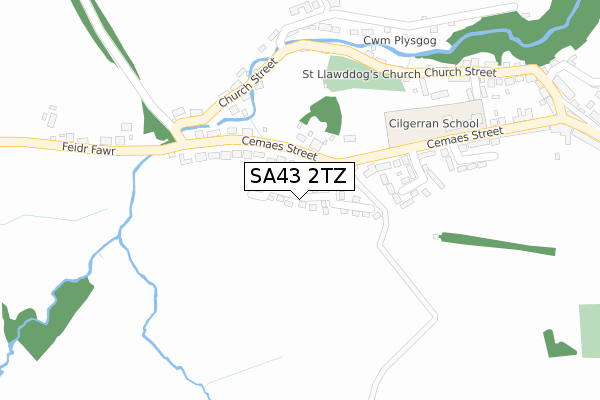
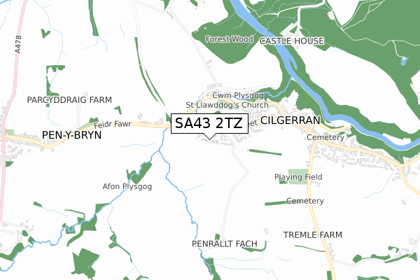
SA43 2TZ is located in the Cilgerran and Eglwyswrw electoral ward, within the unitary authority of Pembrokeshire and the Welsh Parliamentary constituency of Preseli Pembrokeshire. The Local Health Board is Hywel Dda University and the police force is Dyfed-Powys. This postcode has been in use since August 2019.


GetTheData
Source: OS Open Zoomstack (Ordnance Survey)
Licence: Open Government Licence (requires attribution)
Attribution: Contains OS data © Crown copyright and database right 2024
Source: Open Postcode Geo
Licence: Open Government Licence (requires attribution)
Attribution: Contains OS data © Crown copyright and database right 2024; Contains Royal Mail data © Royal Mail copyright and database right 2024; Source: Office for National Statistics licensed under the Open Government Licence v.3.0
| Easting | 219034 |
| Northing | 242860 |
| Latitude | 52.054509 |
| Longitude | -4.640837 |
GetTheData
Source: Open Postcode Geo
Licence: Open Government Licence
| Country | Wales |
| Postcode District | SA43 |
➜ See where SA43 is on a map ➜ Where is Cilgerran? | |
GetTheData
Source: Land Registry Price Paid Data
Licence: Open Government Licence
| Ward | Cilgerran And Eglwyswrw |
| Constituency | Preseli Pembrokeshire |
GetTheData
Source: ONS Postcode Database
Licence: Open Government Licence
2024 28 JUN £325,000 |
2022 28 OCT £342,500 |
2021 23 JUL £255,000 |
2020 20 NOV £235,000 |
2020 4 SEP £215,000 |
25, MAES RHEITHORDY, CILGERRAN, CARDIGAN, SA43 2TZ 2020 31 JUL £200,000 |
30, MAES RHEITHORDY, CILGERRAN, CARDIGAN, SA43 2TZ 2020 25 JUN £225,000 |
2020 10 JUN £222,000 |
22, MAES RHEITHORDY, CILGERRAN, CARDIGAN, SA43 2TZ 2020 1 APR £204,950 |
23, MAES RHEITHORDY, CILGERRAN, CARDIGAN, SA43 2TZ 2020 28 FEB £204,950 |
GetTheData
Source: HM Land Registry Price Paid Data
Licence: Contains HM Land Registry data © Crown copyright and database right 2024. This data is licensed under the Open Government Licence v3.0.
| Castle Square (Cemaes Street) | Cilgerran | 385m |
| Castle Square (Cemaes Street) | Cilgerran | 393m |
| Cardiff Arms (High Street) | Cilgerran | 465m |
| Cardiff Arms (High Street) | Cilgerran | 472m |
| Garage (High Street) | Cilgerran | 707m |
GetTheData
Source: NaPTAN
Licence: Open Government Licence
GetTheData
Source: ONS Postcode Database
Licence: Open Government Licence


➜ Get more ratings from the Food Standards Agency
GetTheData
Source: Food Standards Agency
Licence: FSA terms & conditions
| Last Collection | |||
|---|---|---|---|
| Location | Mon-Fri | Sat | Distance |
| Bridell | 12:00 | 12:00 | 1,529m |
| Castle Street | 16:30 | 12:30 | 3,121m |
| Cardigan Delivery Office | 17:15 | 13:00 | 3,164m |
GetTheData
Source: Dracos
Licence: Creative Commons Attribution-ShareAlike
The below table lists the International Territorial Level (ITL) codes (formerly Nomenclature of Territorial Units for Statistics (NUTS) codes) and Local Administrative Units (LAU) codes for SA43 2TZ:
| ITL 1 Code | Name |
|---|---|
| TLL | Wales |
| ITL 2 Code | Name |
| TLL1 | West Wales and The Valleys |
| ITL 3 Code | Name |
| TLL14 | South West Wales |
| LAU 1 Code | Name |
| W06000009 | Pembrokeshire |
GetTheData
Source: ONS Postcode Directory
Licence: Open Government Licence
The below table lists the Census Output Area (OA), Lower Layer Super Output Area (LSOA), and Middle Layer Super Output Area (MSOA) for SA43 2TZ:
| Code | Name | |
|---|---|---|
| OA | W00002978 | |
| LSOA | W01000558 | Pembrokeshire 001A |
| MSOA | W02000126 | Pembrokeshire 001 |
GetTheData
Source: ONS Postcode Directory
Licence: Open Government Licence
| SA43 2RZ | Penllyn | 112m |
| SA43 2SH | Castell Corrwg | 157m |
| SA43 2TD | Cwmplysgog | 243m |
| SA43 2SA | Maesllawddog | 253m |
| SA43 2SX | Maesgerran | 258m |
| SA43 2SZ | Cwmplysgog | 296m |
| SA43 2TA | Cwmplysgog | 311m |
| SA43 2SY | Ger Y Llan | 330m |
| SA43 2SU | Church Street | 333m |
| SA43 2RY | Penllyn | 351m |
GetTheData
Source: Open Postcode Geo; Land Registry Price Paid Data
Licence: Open Government Licence