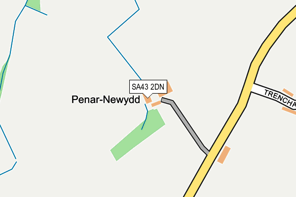
SA43 2DN is in Parcllyn, Cardigan. SA43 2DN is located in the Aberporth and Y Ferwig electoral ward, within the unitary authority of Ceredigion and the Welsh Parliamentary constituency of Ceredigion. The Local Health Board is Hywel Dda University and the police force is Dyfed-Powys. This postcode has been in use since January 1980.


GetTheData
Source: OS OpenMap – Local (Ordnance Survey)
Source: OS VectorMap District (Ordnance Survey)
Licence: Open Government Licence (requires attribution)
| Easting | 224152 |
| Northing | 251109 |
| Latitude | 52.130246 |
| Longitude | -4.570529 |
GetTheData
Source: Open Postcode Geo
Licence: Open Government Licence
| Locality | Parcllyn |
| Town/City | Cardigan |
| Country | Wales |
| Postcode District | SA43 |
➜ See where SA43 is on a map | |
GetTheData
Source: Land Registry Price Paid Data
Licence: Open Government Licence
Elevation or altitude of SA43 2DN as distance above sea level:
| Metres | Feet | |
|---|---|---|
| Elevation | 130m | 427ft |
Elevation is measured from the approximate centre of the postcode, to the nearest point on an OS contour line from OS Terrain 50, which has contour spacing of ten vertical metres.
➜ How high above sea level am I? Find the elevation of your current position using your device's GPS.
GetTheData
Source: Open Postcode Elevation
Licence: Open Government Licence
| Ward | Aberporth And Y Ferwig |
| Constituency | Ceredigion |
GetTheData
Source: ONS Postcode Database
Licence: Open Government Licence
| Hillfield Place (Hillfield Road) | Parc-llyn | 397m |
| Hillfield Place (Hillfield Road) | Parc-llyn | 443m |
| Hillfield Road Q (Main Road) | Parc-llyn | 446m |
| Dera (Erwlas) | Parc-llyn | 691m |
| Dera (Erwlas) | Parc-llyn | 697m |
GetTheData
Source: NaPTAN
Licence: Open Government Licence
| Percentage of properties with Next Generation Access | 100.0% |
| Percentage of properties with Superfast Broadband | 100.0% |
| Percentage of properties with Ultrafast Broadband | 0.0% |
| Percentage of properties with Full Fibre Broadband | 0.0% |
Superfast Broadband is between 30Mbps and 300Mbps
Ultrafast Broadband is > 300Mbps
| Percentage of properties unable to receive 2Mbps | 0.0% |
| Percentage of properties unable to receive 5Mbps | 0.0% |
| Percentage of properties unable to receive 10Mbps | 0.0% |
| Percentage of properties unable to receive 30Mbps | 0.0% |
GetTheData
Source: Ofcom
Licence: Ofcom Terms of Use (requires attribution)
GetTheData
Source: ONS Postcode Database
Licence: Open Government Licence


➜ Get more ratings from the Food Standards Agency
GetTheData
Source: Food Standards Agency
Licence: FSA terms & conditions
| Last Collection | |||
|---|---|---|---|
| Location | Mon-Fri | Sat | Distance |
| Parcllyn P O | 12:30 | 11:00 | 744m |
| Aberporth P O | 15:30 | 11:00 | 1,990m |
| Penparc P O | 16:15 | 11:00 | 4,080m |
GetTheData
Source: Dracos
Licence: Creative Commons Attribution-ShareAlike
The below table lists the International Territorial Level (ITL) codes (formerly Nomenclature of Territorial Units for Statistics (NUTS) codes) and Local Administrative Units (LAU) codes for SA43 2DN:
| ITL 1 Code | Name |
|---|---|
| TLL | Wales |
| ITL 2 Code | Name |
| TLL1 | West Wales and The Valleys |
| ITL 3 Code | Name |
| TLL14 | South West Wales |
| LAU 1 Code | Name |
| W06000008 | Ceredigion |
GetTheData
Source: ONS Postcode Directory
Licence: Open Government Licence
The below table lists the Census Output Area (OA), Lower Layer Super Output Area (LSOA), and Middle Layer Super Output Area (MSOA) for SA43 2DN:
| Code | Name | |
|---|---|---|
| OA | W00002710 | |
| LSOA | W01000508 | Ceredigion 009B |
| MSOA | W02000124 | Ceredigion 009 |
GetTheData
Source: ONS Postcode Directory
Licence: Open Government Licence
| SA43 2DL | Trenchard Estate | 316m |
| SA43 2DJ | Hillfield Place | 437m |
| SA43 2DH | Hillfield Road | 454m |
| SA43 2DX | Parc Y Delyn | 521m |
| SA43 2DR | 605m | |
| SA43 2DQ | Erwlas | 664m |
| SA43 2DP | 756m | |
| SA43 2DS | 763m | |
| SA43 2BT | 996m | |
| SA43 2DG | Pennar Road | 1066m |
GetTheData
Source: Open Postcode Geo; Land Registry Price Paid Data
Licence: Open Government Licence