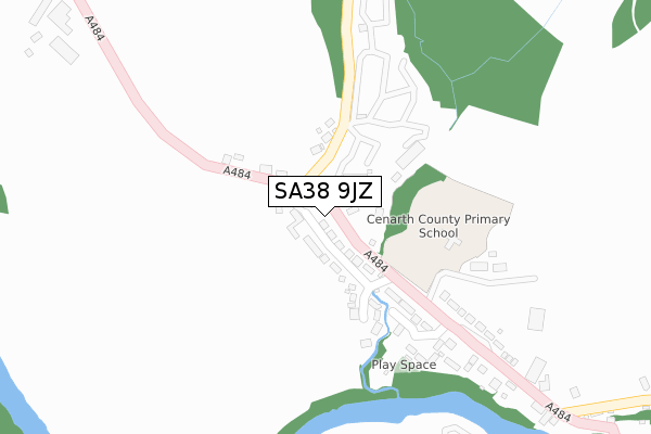
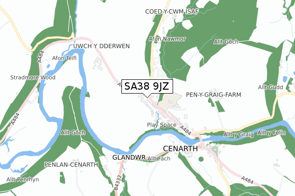
SA38 9JZ is located in the Beulah and Llangoedmor electoral ward, within the unitary authority of Ceredigion and the Welsh Parliamentary constituency of Ceredigion. The Local Health Board is Hywel Dda University and the police force is Dyfed-Powys. This postcode has been in use since January 2019.


GetTheData
Source: OS Open Zoomstack (Ordnance Survey)
Licence: Open Government Licence (requires attribution)
Attribution: Contains OS data © Crown copyright and database right 2025
Source: Open Postcode Geo
Licence: Open Government Licence (requires attribution)
Attribution: Contains OS data © Crown copyright and database right 2025; Contains Royal Mail data © Royal Mail copyright and database right 2025; Source: Office for National Statistics licensed under the Open Government Licence v.3.0
| Easting | 226457 |
| Northing | 241931 |
| Latitude | 52.048539 |
| Longitude | -4.532217 |
GetTheData
Source: Open Postcode Geo
Licence: Open Government Licence
| Country | Wales |
| Postcode District | SA38 |
➜ See where SA38 is on a map ➜ Where is Cenarth? | |
GetTheData
Source: Land Registry Price Paid Data
Licence: Open Government Licence
| Ward | Beulah And Llangoedmor |
| Constituency | Ceredigion |
GetTheData
Source: ONS Postcode Database
Licence: Open Government Licence
| Primary School (A484) | Cenarth | 202m |
| Primary School (A484) | Cenarth | 216m |
| Post Office (A484) | Cenarth | 603m |
| St Llawddog's Church (A484) | Cenarth | 701m |
GetTheData
Source: NaPTAN
Licence: Open Government Licence
| Percentage of properties with Next Generation Access | 100.0% |
| Percentage of properties with Superfast Broadband | 100.0% |
| Percentage of properties with Ultrafast Broadband | 0.0% |
| Percentage of properties with Full Fibre Broadband | 0.0% |
Superfast Broadband is between 30Mbps and 300Mbps
Ultrafast Broadband is > 300Mbps
| Percentage of properties unable to receive 2Mbps | 0.0% |
| Percentage of properties unable to receive 5Mbps | 0.0% |
| Percentage of properties unable to receive 10Mbps | 0.0% |
| Percentage of properties unable to receive 30Mbps | 0.0% |
GetTheData
Source: Ofcom
Licence: Ofcom Terms of Use (requires attribution)
GetTheData
Source: ONS Postcode Database
Licence: Open Government Licence


➜ Get more ratings from the Food Standards Agency
GetTheData
Source: Food Standards Agency
Licence: FSA terms & conditions
| Last Collection | |||
|---|---|---|---|
| Location | Mon-Fri | Sat | Distance |
| Penrherber P O | 11:00 | 11:00 | 3,877m |
| Danyrhelyg | 11:00 | 11:00 | 3,918m |
GetTheData
Source: Dracos
Licence: Creative Commons Attribution-ShareAlike
The below table lists the International Territorial Level (ITL) codes (formerly Nomenclature of Territorial Units for Statistics (NUTS) codes) and Local Administrative Units (LAU) codes for SA38 9JZ:
| ITL 1 Code | Name |
|---|---|
| TLL | Wales |
| ITL 2 Code | Name |
| TLL1 | West Wales and The Valleys |
| ITL 3 Code | Name |
| TLL14 | South West Wales |
| LAU 1 Code | Name |
| W06000008 | Ceredigion |
GetTheData
Source: ONS Postcode Directory
Licence: Open Government Licence
The below table lists the Census Output Area (OA), Lower Layer Super Output Area (LSOA), and Middle Layer Super Output Area (MSOA) for SA38 9JZ:
| Code | Name | |
|---|---|---|
| OA | W00002774 | |
| LSOA | W01000519 | Ceredigion 010A |
| MSOA | W02000125 | Ceredigion 010 |
GetTheData
Source: ONS Postcode Directory
Licence: Open Government Licence
| SA38 9JJ | Spring Meadow | 72m |
| SA38 9JS | 132m | |
| SA38 9JR | Glanyrafon | 221m |
| SA38 9JP | 286m | |
| SA38 9JT | 578m | |
| SA38 9JU | 592m | |
| SA38 9JL | 602m | |
| SA38 9JN | Penlan Holiday Village | 667m |
| SA38 9PG | 910m | |
| SA38 9PH | 1248m |
GetTheData
Source: Open Postcode Geo; Land Registry Price Paid Data
Licence: Open Government Licence