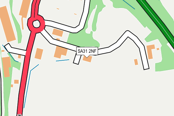
SA31 2NF is located in the Llangunnor electoral ward, within the unitary authority of Carmarthenshire and the Welsh Parliamentary constituency of Carmarthen East and Dinefwr. The Local Health Board is Hywel Dda University and the police force is Dyfed-Powys. This postcode has been in use since August 1993.


GetTheData
Source: OS OpenMap – Local (Ordnance Survey)
Source: OS VectorMap District (Ordnance Survey)
Licence: Open Government Licence (requires attribution)
| Easting | 241272 |
| Northing | 218683 |
| Latitude | 51.844131 |
| Longitude | -4.305628 |
GetTheData
Source: Open Postcode Geo
Licence: Open Government Licence
| Country | Wales |
| Postcode District | SA31 |
➜ See where SA31 is on a map ➜ Where is Carmarthen? | |
GetTheData
Source: Land Registry Price Paid Data
Licence: Open Government Licence
Elevation or altitude of SA31 2NF as distance above sea level:
| Metres | Feet | |
|---|---|---|
| Elevation | 20m | 66ft |
Elevation is measured from the approximate centre of the postcode, to the nearest point on an OS contour line from OS Terrain 50, which has contour spacing of ten vertical metres.
➜ How high above sea level am I? Find the elevation of your current position using your device's GPS.
GetTheData
Source: Open Postcode Elevation
Licence: Open Government Licence
| Ward | Llangunnor |
| Constituency | Carmarthen East And Dinefwr |
GetTheData
Source: ONS Postcode Database
Licence: Open Government Licence
| Morrisons Store (Grounds) | Pensarn | 260m |
| Morrisons (A484) | Tre-gynwer | 313m |
| Morrisons (A484) | Tre-gynwer | 335m |
| Pibyrlwyd (A484) | Pibwrlwyd | 518m |
| Pibyrlwyd (A484) | Pibwrlwyd | 545m |
| Carmarthen Station | 1km |
GetTheData
Source: NaPTAN
Licence: Open Government Licence
GetTheData
Source: ONS Postcode Database
Licence: Open Government Licence


➜ Get more ratings from the Food Standards Agency
GetTheData
Source: Food Standards Agency
Licence: FSA terms & conditions
| Last Collection | |||
|---|---|---|---|
| Location | Mon-Fri | Sat | Distance |
| Safeway | 17:30 | 12:00 | 255m |
| Carmarthen Delivery Office | 18:30 | 12:15 | 774m |
| Carmarthen Do | 18:30 | 12:15 | 774m |
GetTheData
Source: Dracos
Licence: Creative Commons Attribution-ShareAlike
The below table lists the International Territorial Level (ITL) codes (formerly Nomenclature of Territorial Units for Statistics (NUTS) codes) and Local Administrative Units (LAU) codes for SA31 2NF:
| ITL 1 Code | Name |
|---|---|
| TLL | Wales |
| ITL 2 Code | Name |
| TLL1 | West Wales and The Valleys |
| ITL 3 Code | Name |
| TLL14 | South West Wales |
| LAU 1 Code | Name |
| W06000010 | Carmarthenshire |
GetTheData
Source: ONS Postcode Directory
Licence: Open Government Licence
The below table lists the Census Output Area (OA), Lower Layer Super Output Area (LSOA), and Middle Layer Super Output Area (MSOA) for SA31 2NF:
| Code | Name | |
|---|---|---|
| OA | W00003726 | |
| LSOA | W01000694 | Carmarthenshire 008D |
| MSOA | W02000149 | Carmarthenshire 008 |
GetTheData
Source: ONS Postcode Directory
Licence: Open Government Licence
| SA31 2NH | 437m | |
| SA31 2NG | Myrtle Hill | 451m |
| SA31 2DL | Emlyn Terrace | 511m |
| SA31 2DJ | Babell Hill | 528m |
| SA31 2NT | Rhodfa Morgan Drive | 531m |
| SA31 2NQ | Tycoch Cottages | 543m |
| SA31 2DD | Pensarn Road | 566m |
| SA31 2PJ | Roman Park | 569m |
| SA31 2NX | Rhodfa Morgan Drive | 574m |
| SA31 2JY | Babell Road | 577m |
GetTheData
Source: Open Postcode Geo; Land Registry Price Paid Data
Licence: Open Government Licence