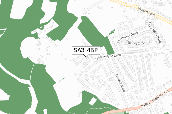
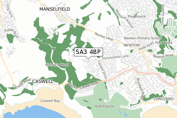
SA3 4BP is located in the Mumbles electoral ward, within the unitary authority of Swansea and the Welsh Parliamentary constituency of Gower. The Local Health Board is Swansea Bay University and the police force is South Wales. This postcode has been in use since June 2019.


GetTheData
Source: OS Open Zoomstack (Ordnance Survey)
Licence: Open Government Licence (requires attribution)
Attribution: Contains OS data © Crown copyright and database right 2025
Source: Open Postcode Geo
Licence: Open Government Licence (requires attribution)
Attribution: Contains OS data © Crown copyright and database right 2025; Contains Royal Mail data © Royal Mail copyright and database right 2025; Source: Office for National Statistics licensed under the Open Government Licence v.3.0
| Easting | 259653 |
| Northing | 188090 |
| Latitude | 51.574161 |
| Longitude | -4.026659 |
GetTheData
Source: Open Postcode Geo
Licence: Open Government Licence
| Country | Wales |
| Postcode District | SA3 |
➜ See where SA3 is on a map ➜ Where is Swansea? | |
GetTheData
Source: Land Registry Price Paid Data
Licence: Open Government Licence
| Ward | Mumbles |
| Constituency | Gower |
GetTheData
Source: ONS Postcode Database
Licence: Open Government Licence
2022 14 JAN £615,000 |
2021 1 DEC £735,995 |
25, BISHOPS WOOD GROVE, NEWTON, SWANSEA, SA3 4BP 2021 8 SEP £399,995 |
23, BISHOPS WOOD GROVE, NEWTON, SWANSEA, SA3 4BP 2021 30 JUL £530,000 |
35, BISHOPS WOOD GROVE, NEWTON, SWANSEA, SA3 4BP 2021 25 JUN £559,995 |
37, BISHOPS WOOD GROVE, NEWTON, SWANSEA, SA3 4BP 2021 28 MAY £559,995 |
30, BISHOPS WOOD GROVE, NEWTON, SWANSEA, SA3 4BP 2021 21 MAY £728,495 |
39, BISHOPS WOOD GROVE, NEWTON, SWANSEA, SA3 4BP 2021 19 MAY £735,995 |
24, BISHOPS WOOD GROVE, NEWTON, SWANSEA, SA3 4BP 2021 30 APR £535,995 |
41, BISHOPS WOOD GROVE, NEWTON, SWANSEA, SA3 4BP 2021 30 APR £735,995 |
GetTheData
Source: HM Land Registry Price Paid Data
Licence: Contains HM Land Registry data © Crown copyright and database right 2025. This data is licensed under the Open Government Licence v3.0.
| Summerland Lane (Caswell Drive) | Newton | 199m |
| Long Shepherds Drive (Summerland Lane) | Newton | 226m |
| Long Shepherds Drive (Summerland Lane) | Newton | 230m |
| Woollacott Drive | Newton | 323m |
| Woollacott Drive | Newton | 326m |
GetTheData
Source: NaPTAN
Licence: Open Government Licence
GetTheData
Source: ONS Postcode Database
Licence: Open Government Licence


➜ Get more ratings from the Food Standards Agency
GetTheData
Source: Food Standards Agency
Licence: FSA terms & conditions
| Last Collection | |||
|---|---|---|---|
| Location | Mon-Fri | Sat | Distance |
| Highmead Av | 17:45 | 13:00 | 719m |
| Newton P O | 17:45 | 11:30 | 799m |
| Murton P O | 17:45 | 11:30 | 1,448m |
GetTheData
Source: Dracos
Licence: Creative Commons Attribution-ShareAlike
The below table lists the International Territorial Level (ITL) codes (formerly Nomenclature of Territorial Units for Statistics (NUTS) codes) and Local Administrative Units (LAU) codes for SA3 4BP:
| ITL 1 Code | Name |
|---|---|
| TLL | Wales |
| ITL 2 Code | Name |
| TLL1 | West Wales and The Valleys |
| ITL 3 Code | Name |
| TLL18 | Swansea |
| LAU 1 Code | Name |
| W06000011 | Swansea |
GetTheData
Source: ONS Postcode Directory
Licence: Open Government Licence
The below table lists the Census Output Area (OA), Lower Layer Super Output Area (LSOA), and Middle Layer Super Output Area (MSOA) for SA3 4BP:
| Code | Name | |
|---|---|---|
| OA | W00004406 | |
| LSOA | W01000823 | Swansea 031A |
| MSOA | W02000198 | Swansea 031 |
GetTheData
Source: ONS Postcode Directory
Licence: Open Government Licence
| SA3 4RS | Summerland Lane | 160m |
| SA3 4RT | 176m | |
| SA3 4RL | Havergal Close | 194m |
| SA3 4RZ | Woolacott Mews | 217m |
| SA3 4RN | Caswell Drive | 235m |
| SA3 4LA | 241m | |
| SA3 4RR | Woollacott Drive | 311m |
| SA3 4RG | Briarwood Gardens | 318m |
| SA3 4RP | Long Shepherds Drive | 340m |
| SA3 4RJ | Caswell Drive | 346m |
GetTheData
Source: Open Postcode Geo; Land Registry Price Paid Data
Licence: Open Government Licence