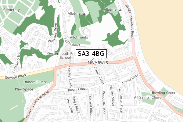
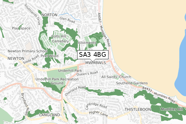
SA3 4BG is located in the Mumbles electoral ward, within the unitary authority of Swansea and the Welsh Parliamentary constituency of Gower. The Local Health Board is Swansea Bay University and the police force is South Wales. This postcode has been in use since August 2017.


GetTheData
Source: OS Open Zoomstack (Ordnance Survey)
Licence: Open Government Licence (requires attribution)
Attribution: Contains OS data © Crown copyright and database right 2025
Source: Open Postcode Geo
Licence: Open Government Licence (requires attribution)
Attribution: Contains OS data © Crown copyright and database right 2025; Contains Royal Mail data © Royal Mail copyright and database right 2025; Source: Office for National Statistics licensed under the Open Government Licence v.3.0
| Easting | 261347 |
| Northing | 188201 |
| Latitude | 51.575578 |
| Longitude | -4.002274 |
GetTheData
Source: Open Postcode Geo
Licence: Open Government Licence
| Country | Wales |
| Postcode District | SA3 |
➜ See where SA3 is on a map | |
GetTheData
Source: Land Registry Price Paid Data
Licence: Open Government Licence
| Ward | Mumbles |
| Constituency | Gower |
GetTheData
Source: ONS Postcode Database
Licence: Open Government Licence
| Newton Road | Oystermouth | 81m |
| Newton Road | Oystermouth | 139m |
| School (Newton Road) | Oystermouth | 158m |
| Underhill Park (Langland Road) | Oystermouth | 206m |
| Oystermouth Square (Mumbles Road) | Mumbles | 242m |
GetTheData
Source: NaPTAN
Licence: Open Government Licence
GetTheData
Source: ONS Postcode Database
Licence: Open Government Licence


➜ Get more ratings from the Food Standards Agency
GetTheData
Source: Food Standards Agency
Licence: FSA terms & conditions
| Last Collection | |||
|---|---|---|---|
| Location | Mon-Fri | Sat | Distance |
| Mumbles P O | 18:30 | 12:30 | 287m |
| Thistleboon | 17:30 | 13:00 | 893m |
| Newton P O | 17:45 | 11:30 | 899m |
GetTheData
Source: Dracos
Licence: Creative Commons Attribution-ShareAlike
The below table lists the International Territorial Level (ITL) codes (formerly Nomenclature of Territorial Units for Statistics (NUTS) codes) and Local Administrative Units (LAU) codes for SA3 4BG:
| ITL 1 Code | Name |
|---|---|
| TLL | Wales |
| ITL 2 Code | Name |
| TLL1 | West Wales and The Valleys |
| ITL 3 Code | Name |
| TLL18 | Swansea |
| LAU 1 Code | Name |
| W06000011 | Swansea |
GetTheData
Source: ONS Postcode Directory
Licence: Open Government Licence
The below table lists the Census Output Area (OA), Lower Layer Super Output Area (LSOA), and Middle Layer Super Output Area (MSOA) for SA3 4BG:
| Code | Name | |
|---|---|---|
| OA | W00004427 | |
| LSOA | W01000827 | Swansea 031E |
| MSOA | W02000198 | Swansea 031 |
GetTheData
Source: ONS Postcode Directory
Licence: Open Government Licence
| SA3 4BQ | Newton Road | 1m |
| SA3 4BL | Newton Road | 35m |
| SA3 4BE | Newton Road | 67m |
| SA3 4BH | Castle Street | 75m |
| SA3 4BJ | Castle Square | 82m |
| SA3 4BD | Newton Road | 87m |
| SA3 4NQ | Victoria Avenue | 97m |
| SA3 4NH | Chapel Street | 97m |
| SA3 4BA | Castle Avenue | 106m |
| SA3 4BN | Newton Road | 114m |
GetTheData
Source: Open Postcode Geo; Land Registry Price Paid Data
Licence: Open Government Licence