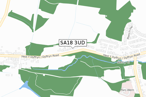
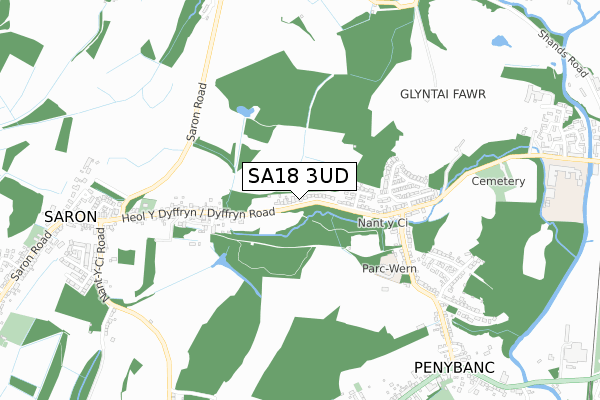
SA18 3UD is located in the Saron electoral ward, within the unitary authority of Carmarthenshire and the Welsh Parliamentary constituency of Carmarthen East and Dinefwr. The Local Health Board is Hywel Dda University and the police force is Dyfed-Powys. This postcode has been in use since May 2018.


GetTheData
Source: OS Open Zoomstack (Ordnance Survey)
Licence: Open Government Licence (requires attribution)
Attribution: Contains OS data © Crown copyright and database right 2025
Source: Open Postcode Geo
Licence: Open Government Licence (requires attribution)
Attribution: Contains OS data © Crown copyright and database right 2025; Contains Royal Mail data © Royal Mail copyright and database right 2025; Source: Office for National Statistics licensed under the Open Government Licence v.3.0
| Easting | 261110 |
| Northing | 212539 |
| Latitude | 51.794215 |
| Longitude | -4.015384 |
GetTheData
Source: Open Postcode Geo
Licence: Open Government Licence
| Country | Wales |
| Postcode District | SA18 |
➜ See where SA18 is on a map | |
GetTheData
Source: Land Registry Price Paid Data
Licence: Open Government Licence
| Ward | Saron |
| Constituency | Carmarthen East And Dinefwr |
GetTheData
Source: ONS Postcode Database
Licence: Open Government Licence
| Maes-y-dail (Heol Y Dyffryn) | Tir-y-dail | 246m |
| Maes-y-dail (Heol Y Dyffryn) | Tir-y-dail | 249m |
| Dyffryn Road | Saron | 367m |
| Dyffryn Road | Saron | 385m |
| Parklands Road (Dyffryn Road) | Tir-y-dail | 385m |
| Ammanford Station | 1.3km |
| Pantyffynnon Station | 2.1km |
| Llandybie Station | 3.1km |
GetTheData
Source: NaPTAN
Licence: Open Government Licence
GetTheData
Source: ONS Postcode Database
Licence: Open Government Licence


➜ Get more ratings from the Food Standards Agency
GetTheData
Source: Food Standards Agency
Licence: FSA terms & conditions
| Last Collection | |||
|---|---|---|---|
| Location | Mon-Fri | Sat | Distance |
| Dyffryn Road | 16:00 | 08:00 | 433m |
| Moriah Chapel | 16:15 | 11:00 | 786m |
| Penybanc P O | 17:15 | 11:30 | 952m |
GetTheData
Source: Dracos
Licence: Creative Commons Attribution-ShareAlike
The below table lists the International Territorial Level (ITL) codes (formerly Nomenclature of Territorial Units for Statistics (NUTS) codes) and Local Administrative Units (LAU) codes for SA18 3UD:
| ITL 1 Code | Name |
|---|---|
| TLL | Wales |
| ITL 2 Code | Name |
| TLL1 | West Wales and The Valleys |
| ITL 3 Code | Name |
| TLL14 | South West Wales |
| LAU 1 Code | Name |
| W06000010 | Carmarthenshire |
GetTheData
Source: ONS Postcode Directory
Licence: Open Government Licence
The below table lists the Census Output Area (OA), Lower Layer Super Output Area (LSOA), and Middle Layer Super Output Area (MSOA) for SA18 3UD:
| Code | Name | |
|---|---|---|
| OA | W00003894 | |
| LSOA | W01000725 | Carmarthenshire 011D |
| MSOA | W02000152 | Carmarthenshire 011 |
GetTheData
Source: ONS Postcode Directory
Licence: Open Government Licence
| SA18 3TH | Dyffryn Road | 170m |
| SA18 3TL | Maes Y Dail | 249m |
| SA18 3TW | Dyffryn Road | 384m |
| SA18 3TS | Maes Yr Haf | 426m |
| SA18 3TR | Maes Yr Haf | 472m |
| SA18 3TB | Dyffryn Road | 514m |
| SA18 3TD | Parklands Road | 518m |
| SA18 3TN | Dyffryn Road | 536m |
| SA18 3TX | Newtown Close | 640m |
| SA18 3TQ | Waunfawr | 648m |
GetTheData
Source: Open Postcode Geo; Land Registry Price Paid Data
Licence: Open Government Licence