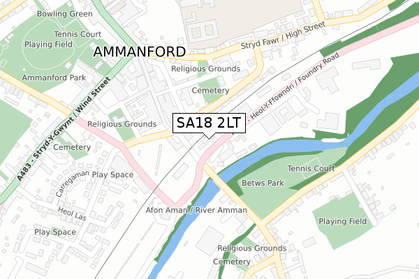
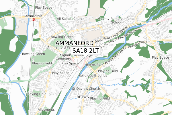
SA18 2LT lies on Foundry Row in Ammanford. SA18 2LT is located in the Ammanford electoral ward, within the unitary authority of Carmarthenshire and the Welsh Parliamentary constituency of Carmarthen East and Dinefwr. The Local Health Board is Hywel Dda University and the police force is Dyfed-Powys. This postcode has been in use since November 2018.


GetTheData
Source: OS Open Zoomstack (Ordnance Survey)
Licence: Open Government Licence (requires attribution)
Attribution: Contains OS data © Crown copyright and database right 2025
Source: Open Postcode Geo
Licence: Open Government Licence (requires attribution)
Attribution: Contains OS data © Crown copyright and database right 2025; Contains Royal Mail data © Royal Mail copyright and database right 2025; Source: Office for National Statistics licensed under the Open Government Licence v.3.0
| Easting | 263154 |
| Northing | 212124 |
| Latitude | 51.790990 |
| Longitude | -3.985600 |
GetTheData
Source: Open Postcode Geo
Licence: Open Government Licence
| Street | Foundry Row |
| Town/City | Ammanford |
| Country | Wales |
| Postcode District | SA18 |
➜ See where SA18 is on a map ➜ Where is Ammanford? | |
GetTheData
Source: Land Registry Price Paid Data
Licence: Open Government Licence
| Ward | Ammanford |
| Constituency | Carmarthen East And Dinefwr |
GetTheData
Source: ONS Postcode Database
Licence: Open Government Licence
| Carregamman Carpark (Heol Wallasey) | Ammanford | 116m |
| Carregamman Carpark (Heol Wallasey) | Ammanford | 160m |
| Wilkinson's Store (Ffordd William Walker) | Ammanford | 170m |
| Wilkinson's Store (Ffordd William Walker) | Ammanford | 188m |
| High Street Wine Bar (High Street) | Ammanford | 198m |
| Ammanford Station | 0.9km |
| Pantyffynnon Station | 1.6km |
| Llandybie Station | 3.6km |
GetTheData
Source: NaPTAN
Licence: Open Government Licence
| Percentage of properties with Next Generation Access | 100.0% |
| Percentage of properties with Superfast Broadband | 100.0% |
| Percentage of properties with Ultrafast Broadband | 0.0% |
| Percentage of properties with Full Fibre Broadband | 0.0% |
Superfast Broadband is between 30Mbps and 300Mbps
Ultrafast Broadband is > 300Mbps
| Percentage of properties unable to receive 2Mbps | 0.0% |
| Percentage of properties unable to receive 5Mbps | 0.0% |
| Percentage of properties unable to receive 10Mbps | 0.0% |
| Percentage of properties unable to receive 30Mbps | 0.0% |
GetTheData
Source: Ofcom
Licence: Ofcom Terms of Use (requires attribution)
GetTheData
Source: ONS Postcode Database
Licence: Open Government Licence


➜ Get more ratings from the Food Standards Agency
GetTheData
Source: Food Standards Agency
Licence: FSA terms & conditions
| Last Collection | |||
|---|---|---|---|
| Location | Mon-Fri | Sat | Distance |
| Ammanford Sorting Office | 18:30 | 123m | |
| Ammanford Delivery Office | 18:30 | 12:45 | 126m |
| Ammanford P O | 18:30 | 12:15 | 213m |
GetTheData
Source: Dracos
Licence: Creative Commons Attribution-ShareAlike
The below table lists the International Territorial Level (ITL) codes (formerly Nomenclature of Territorial Units for Statistics (NUTS) codes) and Local Administrative Units (LAU) codes for SA18 2LT:
| ITL 1 Code | Name |
|---|---|
| TLL | Wales |
| ITL 2 Code | Name |
| TLL1 | West Wales and The Valleys |
| ITL 3 Code | Name |
| TLL14 | South West Wales |
| LAU 1 Code | Name |
| W06000010 | Carmarthenshire |
GetTheData
Source: ONS Postcode Directory
Licence: Open Government Licence
The below table lists the Census Output Area (OA), Lower Layer Super Output Area (LSOA), and Middle Layer Super Output Area (MSOA) for SA18 2LT:
| Code | Name | |
|---|---|---|
| OA | W00003362 | |
| LSOA | W01000626 | Carmarthenshire 013B |
| MSOA | W02000154 | Carmarthenshire 013 |
GetTheData
Source: ONS Postcode Directory
Licence: Open Government Licence
| SA18 3EN | Quay Street | 66m |
| SA18 2LU | Heol Wallasey | 99m |
| SA18 3BW | Hall Street | 152m |
| SA18 3BS | Quay Street | 164m |
| SA18 3DA | Baptist Lane | 200m |
| SA18 3DB | Quay Street | 219m |
| SA18 2LY | High Street | 234m |
| SA18 2ET | Park Street | 244m |
| SA18 2NB | High Street | 298m |
| SA18 3EH | Carregamman | 299m |
GetTheData
Source: Open Postcode Geo; Land Registry Price Paid Data
Licence: Open Government Licence