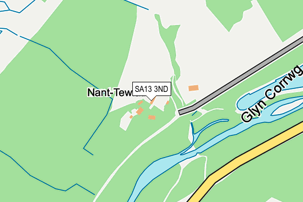
SA13 3ND is located in the Cymer and Glyncorrwg electoral ward, within the unitary authority of Neath Port Talbot and the Welsh Parliamentary constituency of Aberavon. The Local Health Board is Swansea Bay University and the police force is South Wales. This postcode has been in use since June 2000.


GetTheData
Source: OS OpenMap – Local (Ordnance Survey)
Source: OS VectorMap District (Ordnance Survey)
Licence: Open Government Licence (requires attribution)
| Easting | 286486 |
| Northing | 197968 |
| Latitude | 51.668983 |
| Longitude | -3.642827 |
GetTheData
Source: Open Postcode Geo
Licence: Open Government Licence
| Country | Wales |
| Postcode District | SA13 |
➜ See where SA13 is on a map | |
GetTheData
Source: Land Registry Price Paid Data
Licence: Open Government Licence
Elevation or altitude of SA13 3ND as distance above sea level:
| Metres | Feet | |
|---|---|---|
| Elevation | 210m | 689ft |
Elevation is measured from the approximate centre of the postcode, to the nearest point on an OS contour line from OS Terrain 50, which has contour spacing of ten vertical metres.
➜ How high above sea level am I? Find the elevation of your current position using your device's GPS.
GetTheData
Source: Open Postcode Elevation
Licence: Open Government Licence
| Ward | Cymer And Glyncorrwg |
| Constituency | Aberavon |
GetTheData
Source: ONS Postcode Database
Licence: Open Government Licence
| Heol-y-glyn (Cymmer Road) | Heol-y-glyn | 438m |
| Heol-y-glyn (Cymmer Road) | Glyncorrwg | 451m |
| Playing Field (Cymmer Road) | Glyncorrwg | 709m |
| Playing Field (Cymmer Road) | Glyncorrwg | 724m |
| Heol-y-glyn (Unclassified) | Heol-y-glyn | 729m |
GetTheData
Source: NaPTAN
Licence: Open Government Licence
GetTheData
Source: ONS Postcode Database
Licence: Open Government Licence


➜ Get more ratings from the Food Standards Agency
GetTheData
Source: Food Standards Agency
Licence: FSA terms & conditions
The below table lists the International Territorial Level (ITL) codes (formerly Nomenclature of Territorial Units for Statistics (NUTS) codes) and Local Administrative Units (LAU) codes for SA13 3ND:
| ITL 1 Code | Name |
|---|---|
| TLL | Wales |
| ITL 2 Code | Name |
| TLL1 | West Wales and The Valleys |
| ITL 3 Code | Name |
| TLL17 | Bridgend and Neath Port Talbot |
| LAU 1 Code | Name |
| W06000012 | Neath Port Talbot |
GetTheData
Source: ONS Postcode Directory
Licence: Open Government Licence
The below table lists the Census Output Area (OA), Lower Layer Super Output Area (LSOA), and Middle Layer Super Output Area (MSOA) for SA13 3ND:
| Code | Name | |
|---|---|---|
| OA | W00004896 | |
| LSOA | W01000920 | Neath Port Talbot 011A |
| MSOA | W02000209 | Neath Port Talbot 011 |
GetTheData
Source: ONS Postcode Directory
Licence: Open Government Licence
| SA13 3NB | Heol Y Glyn | 504m |
| SA13 3NA | Heol Y Glyn | 976m |
| SA13 3LY | Sunnyside Terrace | 1223m |
| SA13 3AA | 1247m | |
| SA13 3DS | Park Street | 1303m |
| SA13 3DR | Nursery Road | 1329m |
| SA13 3DP | Waun Avenue | 1385m |
| SA13 3AE | Cavell Street | 1460m |
| SA13 3BT | Heol Y Mynydd | 1471m |
| SA13 3BS | Woodland Road | 1494m |
GetTheData
Source: Open Postcode Geo; Land Registry Price Paid Data
Licence: Open Government Licence