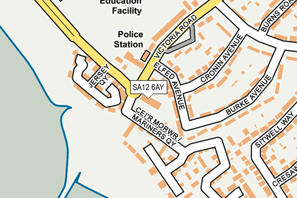
SA12 6AY is located in the Sandfields East electoral ward, within the unitary authority of Neath Port Talbot and the Welsh Parliamentary constituency of Aberavon. The Local Health Board is Swansea Bay University and the police force is South Wales. This postcode has been in use since January 1980.


GetTheData
Source: OS OpenMap – Local (Ordnance Survey)
Source: OS VectorMap District (Ordnance Survey)
Licence: Open Government Licence (requires attribution)
| Easting | 274901 |
| Northing | 189220 |
| Latitude | 51.587904 |
| Longitude | -3.807135 |
GetTheData
Source: Open Postcode Geo
Licence: Open Government Licence
| Country | Wales |
| Postcode District | SA12 |
➜ See where SA12 is on a map ➜ Where is Port Talbot? | |
GetTheData
Source: Land Registry Price Paid Data
Licence: Open Government Licence
Elevation or altitude of SA12 6AY as distance above sea level:
| Metres | Feet | |
|---|---|---|
| Elevation | 10m | 33ft |
Elevation is measured from the approximate centre of the postcode, to the nearest point on an OS contour line from OS Terrain 50, which has contour spacing of ten vertical metres.
➜ How high above sea level am I? Find the elevation of your current position using your device's GPS.
GetTheData
Source: Open Postcode Elevation
Licence: Open Government Licence
| Ward | Sandfields East |
| Constituency | Aberavon |
GetTheData
Source: ONS Postcode Database
Licence: Open Government Licence
| Victoria Road | Aberavon | 42m |
| Jersey Beach Hotel (The Princess Margaret Way) | Aberavon | 72m |
| Victoria Road | Aberavon | 223m |
| Cronin Avenue (Lake Road) | Aberavon | 228m |
| Cronin Avenue (Lake Road) | Aberavon | 243m |
| Port Talbot Parkway Station | 1.8km |
| Baglan Station | 3.1km |
GetTheData
Source: NaPTAN
Licence: Open Government Licence
GetTheData
Source: ONS Postcode Database
Licence: Open Government Licence


➜ Get more ratings from the Food Standards Agency
GetTheData
Source: Food Standards Agency
Licence: FSA terms & conditions
| Last Collection | |||
|---|---|---|---|
| Location | Mon-Fri | Sat | Distance |
| Tanygroes Street Post Office | 17:45 | 11:30 | 2,104m |
| Sunny Croft Road | 17:30 | 07:30 | 3,164m |
| Mayberry Road Post Office | 17:30 | 11:30 | 4,050m |
GetTheData
Source: Dracos
Licence: Creative Commons Attribution-ShareAlike
The below table lists the International Territorial Level (ITL) codes (formerly Nomenclature of Territorial Units for Statistics (NUTS) codes) and Local Administrative Units (LAU) codes for SA12 6AY:
| ITL 1 Code | Name |
|---|---|
| TLL | Wales |
| ITL 2 Code | Name |
| TLL1 | West Wales and The Valleys |
| ITL 3 Code | Name |
| TLL17 | Bridgend and Neath Port Talbot |
| LAU 1 Code | Name |
| W06000012 | Neath Port Talbot |
GetTheData
Source: ONS Postcode Directory
Licence: Open Government Licence
The below table lists the Census Output Area (OA), Lower Layer Super Output Area (LSOA), and Middle Layer Super Output Area (MSOA) for SA12 6AY:
| Code | Name | |
|---|---|---|
| OA | W00009941 | |
| LSOA | W01000959 | Neath Port Talbot 017E |
| MSOA | W02000215 | Neath Port Talbot 017 |
GetTheData
Source: ONS Postcode Directory
Licence: Open Government Licence
| SA12 6AU | The Queens Court | 18m |
| SA12 6AT | Victoria Road | 35m |
| SA12 6AS | Elfed Avenue | 49m |
| SA12 6QJ | Victoria Road | 122m |
| SA12 6QN | Jersey Quay | 126m |
| SA12 6AN | Mariners Quay | 130m |
| SA12 6AR | Victoria Road | 131m |
| SA12 6BE | Cronin Avenue | 133m |
| SA12 6BD | Burke Avenue | 177m |
| SA12 6BB | Burke Avenue | 197m |
GetTheData
Source: Open Postcode Geo; Land Registry Price Paid Data
Licence: Open Government Licence