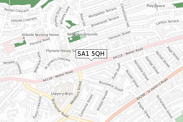
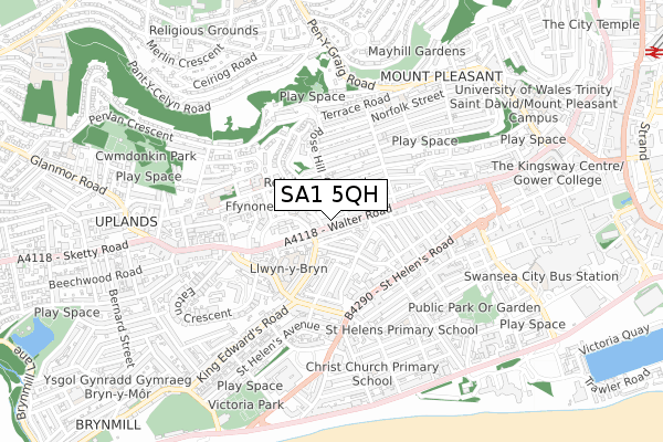
SA1 5QH is located in the Uplands electoral ward, within the unitary authority of Swansea and the Welsh Parliamentary constituency of Swansea West. The Local Health Board is Swansea Bay University and the police force is South Wales. This postcode has been in use since January 2020.


GetTheData
Source: OS Open Zoomstack (Ordnance Survey)
Licence: Open Government Licence (requires attribution)
Attribution: Contains OS data © Crown copyright and database right 2025
Source: Open Postcode Geo
Licence: Open Government Licence (requires attribution)
Attribution: Contains OS data © Crown copyright and database right 2025; Contains Royal Mail data © Royal Mail copyright and database right 2025; Source: Office for National Statistics licensed under the Open Government Licence v.3.0
| Easting | 264541 |
| Northing | 192979 |
| Latitude | 51.619291 |
| Longitude | -3.958057 |
GetTheData
Source: Open Postcode Geo
Licence: Open Government Licence
| Country | Wales |
| Postcode District | SA1 |
➜ See where SA1 is on a map ➜ Where is Swansea? | |
GetTheData
Source: Land Registry Price Paid Data
Licence: Open Government Licence
| Ward | Uplands |
| Constituency | Swansea West |
GetTheData
Source: ONS Postcode Database
Licence: Open Government Licence
| St George Hotel (Walter Road) | Swansea | 158m |
| St George Hotel (Walter Road) | Swansea | 193m |
| St James Church (Walter Road) | Uplands | 245m |
| Belgrave Court (Walter Road) | Uplands | 297m |
| Brunel Court (Walter Road) | Swansea | 299m |
| Swansea Station | 1.3km |
GetTheData
Source: NaPTAN
Licence: Open Government Licence
GetTheData
Source: ONS Postcode Database
Licence: Open Government Licence


➜ Get more ratings from the Food Standards Agency
GetTheData
Source: Food Standards Agency
Licence: FSA terms & conditions
| Last Collection | |||
|---|---|---|---|
| Location | Mon-Fri | Sat | Distance |
| Walter Road P O | 18:30 | 12:00 | 290m |
| St Helens Road | 17:45 | 11:15 | 301m |
| St Helens Cres | 18:00 | 11:30 | 472m |
GetTheData
Source: Dracos
Licence: Creative Commons Attribution-ShareAlike
The below table lists the International Territorial Level (ITL) codes (formerly Nomenclature of Territorial Units for Statistics (NUTS) codes) and Local Administrative Units (LAU) codes for SA1 5QH:
| ITL 1 Code | Name |
|---|---|
| TLL | Wales |
| ITL 2 Code | Name |
| TLL1 | West Wales and The Valleys |
| ITL 3 Code | Name |
| TLL18 | Swansea |
| LAU 1 Code | Name |
| W06000011 | Swansea |
GetTheData
Source: ONS Postcode Directory
Licence: Open Government Licence
The below table lists the Census Output Area (OA), Lower Layer Super Output Area (LSOA), and Middle Layer Super Output Area (MSOA) for SA1 5QH:
| Code | Name | |
|---|---|---|
| OA | W00004638 | |
| LSOA | W01000871 | Swansea 026B |
| MSOA | W02000193 | Swansea 026 |
GetTheData
Source: ONS Postcode Directory
Licence: Open Government Licence
| SA1 5QF | Walter Road | 7m |
| SA1 5QE | Walter Road | 24m |
| SA1 5PW | Walter Road | 40m |
| SA1 5PN | Walter Road | 50m |
| SA1 5PY | Walter Road | 55m |
| SA1 5PZ | Walter Road | 70m |
| SA1 6BP | Hanover Street | 75m |
| SA1 5QQ | Walter Road | 77m |
| SA1 6BW | Burman Street | 85m |
| SA1 4HT | Caswell Street | 91m |
GetTheData
Source: Open Postcode Geo; Land Registry Price Paid Data
Licence: Open Government Licence