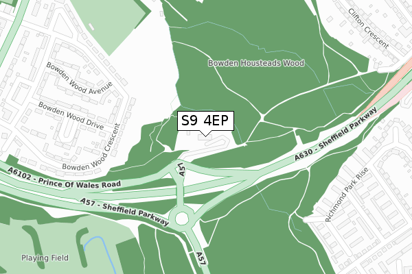
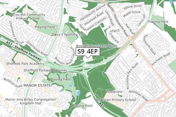
S9 4EP is located in the Darnall electoral ward, within the metropolitan district of Sheffield and the English Parliamentary constituency of Sheffield South East. The Sub Integrated Care Board (ICB) Location is NHS South Yorkshire ICB - 03N and the police force is South Yorkshire. This postcode has been in use since November 2017.


GetTheData
Source: OS Open Zoomstack (Ordnance Survey)
Licence: Open Government Licence (requires attribution)
Attribution: Contains OS data © Crown copyright and database right 2025
Source: Open Postcode Geo
Licence: Open Government Licence (requires attribution)
Attribution: Contains OS data © Crown copyright and database right 2025; Contains Royal Mail data © Royal Mail copyright and database right 2025; Source: Office for National Statistics licensed under the Open Government Licence v.3.0
| Easting | 439641 |
| Northing | 386708 |
| Latitude | 53.375766 |
| Longitude | -1.405608 |
GetTheData
Source: Open Postcode Geo
Licence: Open Government Licence
| Country | England |
| Postcode District | S9 |
➜ See where S9 is on a map ➜ Where is Sheffield? | |
GetTheData
Source: Land Registry Price Paid Data
Licence: Open Government Licence
| Ward | Darnall |
| Constituency | Sheffield South East |
GetTheData
Source: ONS Postcode Database
Licence: Open Government Licence
| Bowden Wood Road (Bowden Wood Crescent) | Darnall Littledale | 216m |
| Bowden Wood Road (Bowden Wood Crescent) | Darnall Littledale | 417m |
| Bowden Wood Close (Bowden Wood Crescent) | Darnall Littledale | 433m |
| Bowden Wood Crescent (Prince Of Wales Road) | Darnall Littledale | 512m |
| Mather Road (Prince Of Wales Road) | Darnall Littledale | 550m |
| Darnall Station | 1.1km |
| Woodhouse Station | 3.5km |
| Sheffield Station | 3.8km |
GetTheData
Source: NaPTAN
Licence: Open Government Licence
GetTheData
Source: ONS Postcode Database
Licence: Open Government Licence


➜ Get more ratings from the Food Standards Agency
GetTheData
Source: Food Standards Agency
Licence: FSA terms & conditions
| Last Collection | |||
|---|---|---|---|
| Location | Mon-Fri | Sat | Distance |
| Bowden Wood Crescent | 18:00 | 11:00 | 446m |
| 619 Prince Of Wales Road | 18:00 | 10:30 | 572m |
| 57 Houstead Road | 17:45 | 09:00 | 586m |
GetTheData
Source: Dracos
Licence: Creative Commons Attribution-ShareAlike
The below table lists the International Territorial Level (ITL) codes (formerly Nomenclature of Territorial Units for Statistics (NUTS) codes) and Local Administrative Units (LAU) codes for S9 4EP:
| ITL 1 Code | Name |
|---|---|
| TLE | Yorkshire and The Humber |
| ITL 2 Code | Name |
| TLE3 | South Yorkshire |
| ITL 3 Code | Name |
| TLE32 | Sheffield |
| LAU 1 Code | Name |
| E08000019 | Sheffield |
GetTheData
Source: ONS Postcode Directory
Licence: Open Government Licence
The below table lists the Census Output Area (OA), Lower Layer Super Output Area (LSOA), and Middle Layer Super Output Area (MSOA) for S9 4EP:
| Code | Name | |
|---|---|---|
| OA | E00040068 | |
| LSOA | E01007910 | Sheffield 037A |
| MSOA | E02001647 | Sheffield 037 |
GetTheData
Source: ONS Postcode Directory
Licence: Open Government Licence
| S9 4EB | Bowden Wood Crescent | 304m |
| S9 4EG | Bowden Wood Drive | 324m |
| S9 4EF | Bowden Wood Avenue | 331m |
| S13 8HE | Richmond Park Rise | 349m |
| S9 4EH | Bowden Wood Place | 351m |
| S9 4EE | Bowden Wood Crescent | 356m |
| S9 4ED | Bowden Wood Crescent | 356m |
| S13 8HD | Richmond Park Rise | 403m |
| S9 4EA | Bowden Wood Crescent | 407m |
| S9 4BQ | Handsworth Crescent | 408m |
GetTheData
Source: Open Postcode Geo; Land Registry Price Paid Data
Licence: Open Government Licence