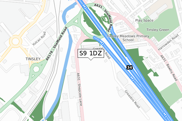
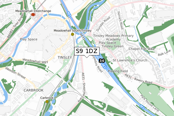
S9 1DZ is located in the Darnall electoral ward, within the metropolitan district of Sheffield and the English Parliamentary constituency of Sheffield South East. The Sub Integrated Care Board (ICB) Location is NHS South Yorkshire ICB - 03N and the police force is South Yorkshire. This postcode has been in use since December 2019.


GetTheData
Source: OS Open Zoomstack (Ordnance Survey)
Licence: Open Government Licence (requires attribution)
Attribution: Contains OS data © Crown copyright and database right 2025
Source: Open Postcode Geo
Licence: Open Government Licence (requires attribution)
Attribution: Contains OS data © Crown copyright and database right 2025; Contains Royal Mail data © Royal Mail copyright and database right 2025; Source: Office for National Statistics licensed under the Open Government Licence v.3.0
| Easting | 439894 |
| Northing | 390372 |
| Latitude | 53.408679 |
| Longitude | -1.401344 |
GetTheData
Source: Open Postcode Geo
Licence: Open Government Licence
| Country | England |
| Postcode District | S9 |
➜ See where S9 is on a map ➜ Where is Sheffield? | |
GetTheData
Source: Land Registry Price Paid Data
Licence: Open Government Licence
| Ward | Darnall |
| Constituency | Sheffield South East |
GetTheData
Source: ONS Postcode Database
Licence: Open Government Licence
| Outokumpu (Shepcote Lane) | Tinsley | 92m |
| Outokumpu (Shepcote Lane) | Tinsley | 103m |
| Greasbrough Road (Shepcote Lane) | Tinsley | 259m |
| Railway Bridge (Shepcote Lane) | Tinsley | 318m |
| Greasbrough Road (Shepcote Lane) | Tinsley | 320m |
| Meadowhall South - Tinsley (Sheffield Supertram) (Off Meadowhall Way) | Meadowhall | 666m |
| Carbrook (Sheffield Supertram) (Off Sheffield Road - Attercliffe Road) | Carbrook | 721m |
| Valley Centertainment (Sheffield Supertram) (Off Greenland Road) | Carbrook | 1,042m |
| Meadowhall Interchange (Sheffield Supertram) (Off Meadowhall Road) | Meadowhall | 1,233m |
| Arena - Don Valley (Sheffield Supertram) (Off Coleridge Road) | Don Valley | 1,726m |
| Meadowhall Station | 1.2km |
| Darnall Station | 2.8km |
| Rotherham Central Station | 3.8km |
GetTheData
Source: NaPTAN
Licence: Open Government Licence
GetTheData
Source: ONS Postcode Database
Licence: Open Government Licence


➜ Get more ratings from the Food Standards Agency
GetTheData
Source: Food Standards Agency
Licence: FSA terms & conditions
| Last Collection | |||
|---|---|---|---|
| Location | Mon-Fri | Sat | Distance |
| Bawtry Road | 17:30 | 09:30 | 439m |
| Tinsley Post Office | 17:10 | 12:10 | 660m |
| Lockhouse Road | 18:30 | 769m | |
GetTheData
Source: Dracos
Licence: Creative Commons Attribution-ShareAlike
The below table lists the International Territorial Level (ITL) codes (formerly Nomenclature of Territorial Units for Statistics (NUTS) codes) and Local Administrative Units (LAU) codes for S9 1DZ:
| ITL 1 Code | Name |
|---|---|
| TLE | Yorkshire and The Humber |
| ITL 2 Code | Name |
| TLE3 | South Yorkshire |
| ITL 3 Code | Name |
| TLE32 | Sheffield |
| LAU 1 Code | Name |
| E08000019 | Sheffield |
GetTheData
Source: ONS Postcode Directory
Licence: Open Government Licence
The below table lists the Census Output Area (OA), Lower Layer Super Output Area (LSOA), and Middle Layer Super Output Area (MSOA) for S9 1DZ:
| Code | Name | |
|---|---|---|
| OA | E00040038 | |
| LSOA | E01007913 | Sheffield 018C |
| MSOA | E02001628 | Sheffield 018 |
GetTheData
Source: ONS Postcode Directory
Licence: Open Government Licence
| S9 1UQ | Greasbro Road | 339m |
| S9 1WZ | Ingfield Avenue | 383m |
| S9 1UR | Newburn Drive | 422m |
| S9 1WB | Bawtry Road | 443m |
| S9 1UN | Siemens Close | 472m |
| S9 1UE | Bawtry Road | 475m |
| S9 1UL | Harrowden Road | 511m |
| S9 1WN | Highgate | 513m |
| S9 1WD | Bawtry Road | 520m |
| S9 1UZ | Bawtry Road | 521m |
GetTheData
Source: Open Postcode Geo; Land Registry Price Paid Data
Licence: Open Government Licence