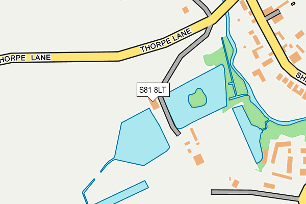
S81 8LT is located in the Worksop North West electoral ward, within the local authority district of Bassetlaw and the English Parliamentary constituency of Bassetlaw. The Sub Integrated Care Board (ICB) Location is NHS Nottingham and Nottinghamshire ICB - 02Q and the police force is Nottinghamshire. This postcode has been in use since January 1980.


GetTheData
Source: OS OpenMap – Local (Ordnance Survey)
Source: OS VectorMap District (Ordnance Survey)
Licence: Open Government Licence (requires attribution)
| Easting | 455152 |
| Northing | 380711 |
| Latitude | 53.320461 |
| Longitude | -1.173524 |
GetTheData
Source: Open Postcode Geo
Licence: Open Government Licence
| Country | England |
| Postcode District | S81 |
➜ See where S81 is on a map ➜ Where is Shireoaks? | |
GetTheData
Source: Land Registry Price Paid Data
Licence: Open Government Licence
Elevation or altitude of S81 8LT as distance above sea level:
| Metres | Feet | |
|---|---|---|
| Elevation | 50m | 164ft |
Elevation is measured from the approximate centre of the postcode, to the nearest point on an OS contour line from OS Terrain 50, which has contour spacing of ten vertical metres.
➜ How high above sea level am I? Find the elevation of your current position using your device's GPS.
GetTheData
Source: Open Postcode Elevation
Licence: Open Government Licence
| Ward | Worksop North West |
| Constituency | Bassetlaw |
GetTheData
Source: ONS Postcode Database
Licence: Open Government Licence
| Newton House (Shireoaks Road) | Shireoaks | 263m |
| Newton House (Shireoaks Road) | Shireoaks | 268m |
| St Lukes Church (Shireoaks Common) | Shireoaks | 345m |
| St Lukes Church (Shireoaks Common) | Shireoaks | 347m |
| Spring Lane (Shireoaks Road) | Shireoaks | 367m |
| Shireoaks Station | 0.6km |
| Worksop Station | 3.5km |
| Kiveton Park Station | 4.8km |
GetTheData
Source: NaPTAN
Licence: Open Government Licence
GetTheData
Source: ONS Postcode Database
Licence: Open Government Licence


➜ Get more ratings from the Food Standards Agency
GetTheData
Source: Food Standards Agency
Licence: FSA terms & conditions
| Last Collection | |||
|---|---|---|---|
| Location | Mon-Fri | Sat | Distance |
| Shireoaks Row | 16:00 | 10:00 | 334m |
| Shireoaks Post Office | 16:00 | 10:15 | 799m |
| Thorpe Lane | 16:00 | 09:00 | 1,216m |
GetTheData
Source: Dracos
Licence: Creative Commons Attribution-ShareAlike
The below table lists the International Territorial Level (ITL) codes (formerly Nomenclature of Territorial Units for Statistics (NUTS) codes) and Local Administrative Units (LAU) codes for S81 8LT:
| ITL 1 Code | Name |
|---|---|
| TLF | East Midlands (England) |
| ITL 2 Code | Name |
| TLF1 | Derbyshire and Nottinghamshire |
| ITL 3 Code | Name |
| TLF15 | North Nottinghamshire |
| LAU 1 Code | Name |
| E07000171 | Bassetlaw |
GetTheData
Source: ONS Postcode Directory
Licence: Open Government Licence
The below table lists the Census Output Area (OA), Lower Layer Super Output Area (LSOA), and Middle Layer Super Output Area (MSOA) for S81 8LT:
| Code | Name | |
|---|---|---|
| OA | E00142976 | |
| LSOA | E01028056 | Bassetlaw 009B |
| MSOA | E02005843 | Bassetlaw 009 |
GetTheData
Source: ONS Postcode Directory
Licence: Open Government Licence
| S81 8LU | Shireoaks Road | 261m |
| S81 8LX | Shireoaks Road | 298m |
| S81 8LR | Bethel Terrace | 324m |
| S81 8LY | Spring Lane | 324m |
| S81 8LP | Shireoaks Row | 412m |
| S81 8NB | Shireoaks Road | 518m |
| S81 8NA | Shireoaks Road | 537m |
| S81 8LQ | St Lukes View | 539m |
| S81 8NR | Cinder Hill | 595m |
| S81 8PX | Middle Meadow | 642m |
GetTheData
Source: Open Postcode Geo; Land Registry Price Paid Data
Licence: Open Government Licence