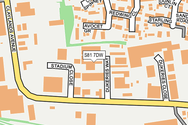
S81 7DW is located in the Worksop North West electoral ward, within the local authority district of Bassetlaw and the English Parliamentary constituency of Bassetlaw. The Sub Integrated Care Board (ICB) Location is NHS Nottingham and Nottinghamshire ICB - 02Q and the police force is Nottinghamshire. This postcode has been in use since April 1986.


GetTheData
Source: OS OpenMap – Local (Ordnance Survey)
Source: OS VectorMap District (Ordnance Survey)
Licence: Open Government Licence (requires attribution)
| Easting | 457149 |
| Northing | 380779 |
| Latitude | 53.320881 |
| Longitude | -1.143537 |
GetTheData
Source: Open Postcode Geo
Licence: Open Government Licence
| Country | England |
| Postcode District | S81 |
➜ See where S81 is on a map ➜ Where is Worksop? | |
GetTheData
Source: Land Registry Price Paid Data
Licence: Open Government Licence
Elevation or altitude of S81 7DW as distance above sea level:
| Metres | Feet | |
|---|---|---|
| Elevation | 50m | 164ft |
Elevation is measured from the approximate centre of the postcode, to the nearest point on an OS contour line from OS Terrain 50, which has contour spacing of ten vertical metres.
➜ How high above sea level am I? Find the elevation of your current position using your device's GPS.
GetTheData
Source: Open Postcode Elevation
Licence: Open Government Licence
| Ward | Worksop North West |
| Constituency | Bassetlaw |
GetTheData
Source: ONS Postcode Database
Licence: Open Government Licence
| Dukeries Way (Claylands Avenue) | Worksop | 121m |
| Dukeries Way (Claylands Avenue) | Worksop | 131m |
| Seafield (Claylands Avenue) | Worksop | 248m |
| Seafield (Claylands Avenue) | Worksop | 258m |
| Fulmar Way | Gateford | 329m |
| Shireoaks Station | 1.7km |
| Worksop Station | 1.7km |
| Whitwell (Derbys) Station | 5.9km |
GetTheData
Source: NaPTAN
Licence: Open Government Licence
| Median download speed | 7.1Mbps |
| Average download speed | 5.8Mbps |
| Maximum download speed | 10.21Mbps |
| Median upload speed | 0.9Mbps |
| Average upload speed | 0.9Mbps |
| Maximum upload speed | 1.26Mbps |
GetTheData
Source: Ofcom
Licence: Ofcom Terms of Use (requires attribution)
GetTheData
Source: ONS Postcode Database
Licence: Open Government Licence


➜ Get more ratings from the Food Standards Agency
GetTheData
Source: Food Standards Agency
Licence: FSA terms & conditions
| Last Collection | |||
|---|---|---|---|
| Location | Mon-Fri | Sat | Distance |
| Dukeries Industrial Estate | 18:15 | 524m | |
| Dukeries Industrial Estate | 18:15 | 648m | |
| Lady Walk | 16:00 | 10:30 | 674m |
GetTheData
Source: Dracos
Licence: Creative Commons Attribution-ShareAlike
The below table lists the International Territorial Level (ITL) codes (formerly Nomenclature of Territorial Units for Statistics (NUTS) codes) and Local Administrative Units (LAU) codes for S81 7DW:
| ITL 1 Code | Name |
|---|---|
| TLF | East Midlands (England) |
| ITL 2 Code | Name |
| TLF1 | Derbyshire and Nottinghamshire |
| ITL 3 Code | Name |
| TLF15 | North Nottinghamshire |
| LAU 1 Code | Name |
| E07000171 | Bassetlaw |
GetTheData
Source: ONS Postcode Directory
Licence: Open Government Licence
The below table lists the Census Output Area (OA), Lower Layer Super Output Area (LSOA), and Middle Layer Super Output Area (MSOA) for S81 7DW:
| Code | Name | |
|---|---|---|
| OA | E00142960 | |
| LSOA | E01028058 | Bassetlaw 009C |
| MSOA | E02005843 | Bassetlaw 009 |
GetTheData
Source: ONS Postcode Directory
Licence: Open Government Licence
| S81 7FA | Dukeries Way | 47m |
| S81 8UQ | Avocet Grove | 97m |
| S81 8UR | Redwing Close | 189m |
| S81 8UN | Lark Spinney | 195m |
| S81 8UU | Starling Grove | 222m |
| S81 8UP | Heron Glade | 259m |
| S81 8UT | Dunlin Court | 291m |
| S81 7BE | Claylands Avenue | 323m |
| S81 8UF | Fulmar Way | 324m |
| S81 8UG | Goldcrest Rise | 338m |
GetTheData
Source: Open Postcode Geo; Land Registry Price Paid Data
Licence: Open Government Licence