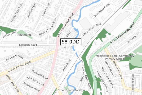
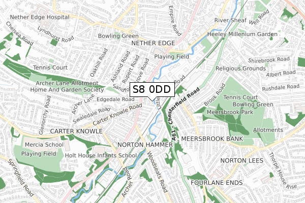
S8 0DD is located in the Nether Edge and Sharrow electoral ward, within the metropolitan district of Sheffield and the English Parliamentary constituency of Sheffield Central. The Sub Integrated Care Board (ICB) Location is NHS South Yorkshire ICB - 03N and the police force is South Yorkshire. This postcode has been in use since January 2018.


GetTheData
Source: OS Open Zoomstack (Ordnance Survey)
Licence: Open Government Licence (requires attribution)
Attribution: Contains OS data © Crown copyright and database right 2024
Source: Open Postcode Geo
Licence: Open Government Licence (requires attribution)
Attribution: Contains OS data © Crown copyright and database right 2024; Contains Royal Mail data © Royal Mail copyright and database right 2024; Source: Office for National Statistics licensed under the Open Government Licence v.3.0
| Easting | 434428 |
| Northing | 384307 |
| Latitude | 53.354550 |
| Longitude | -1.484223 |
GetTheData
Source: Open Postcode Geo
Licence: Open Government Licence
| Country | England |
| Postcode District | S8 |
➜ See where S8 is on a map ➜ Where is Sheffield? | |
GetTheData
Source: Land Registry Price Paid Data
Licence: Open Government Licence
| Ward | Nether Edge And Sharrow |
| Constituency | Sheffield Central |
GetTheData
Source: ONS Postcode Database
Licence: Open Government Licence
| Edgedale Road (Abbeydale Road) | Nether Edge | 90m |
| Carter Knowle Road (Abbeydale Road) | Nether Edge | 134m |
| Abbeydale Road (Carter Knowle Road) | Nether Edge | 151m |
| Abbeydale Road (Carter Knowle Road) | Nether Edge | 152m |
| Marden Road (Abbeydale Road) | Nether Edge | 186m |
| Sheffield Station | 3km |
| Dore & Totley Station | 3.6km |
| Darnall Station | 5.8km |
GetTheData
Source: NaPTAN
Licence: Open Government Licence
| Percentage of properties with Next Generation Access | 100.0% |
| Percentage of properties with Superfast Broadband | 100.0% |
| Percentage of properties with Ultrafast Broadband | 100.0% |
| Percentage of properties with Full Fibre Broadband | 100.0% |
Superfast Broadband is between 30Mbps and 300Mbps
Ultrafast Broadband is > 300Mbps
| Percentage of properties unable to receive 2Mbps | 0.0% |
| Percentage of properties unable to receive 5Mbps | 0.0% |
| Percentage of properties unable to receive 10Mbps | 0.0% |
| Percentage of properties unable to receive 30Mbps | 0.0% |
GetTheData
Source: Ofcom
Licence: Ofcom Terms of Use (requires attribution)
GetTheData
Source: ONS Postcode Database
Licence: Open Government Licence


➜ Get more ratings from the Food Standards Agency
GetTheData
Source: Food Standards Agency
Licence: FSA terms & conditions
| Last Collection | |||
|---|---|---|---|
| Location | Mon-Fri | Sat | Distance |
| 3 Carter Knowle Road | 17:30 | 10:30 | 210m |
| Chesterfield Road | 17:30 | 11:00 | 231m |
| 50 Rupert Road | 17:30 | 11:30 | 298m |
GetTheData
Source: Dracos
Licence: Creative Commons Attribution-ShareAlike
| Risk of S8 0DD flooding from rivers and sea | Medium |
| ➜ S8 0DD flood map | |
GetTheData
Source: Open Flood Risk by Postcode
Licence: Open Government Licence
The below table lists the International Territorial Level (ITL) codes (formerly Nomenclature of Territorial Units for Statistics (NUTS) codes) and Local Administrative Units (LAU) codes for S8 0DD:
| ITL 1 Code | Name |
|---|---|
| TLE | Yorkshire and The Humber |
| ITL 2 Code | Name |
| TLE3 | South Yorkshire |
| ITL 3 Code | Name |
| TLE32 | Sheffield |
| LAU 1 Code | Name |
| E08000019 | Sheffield |
GetTheData
Source: ONS Postcode Directory
Licence: Open Government Licence
The below table lists the Census Output Area (OA), Lower Layer Super Output Area (LSOA), and Middle Layer Super Output Area (MSOA) for S8 0DD:
| Code | Name | |
|---|---|---|
| OA | E00040798 | |
| LSOA | E01008042 | Sheffield 050A |
| MSOA | E02001660 | Sheffield 050 |
GetTheData
Source: ONS Postcode Directory
Licence: Open Government Licence
| S8 0UU | Coniston Terrace | 29m |
| S8 0UQ | Langdale Road | 62m |
| S8 0UX | Arnside Road | 64m |
| S8 0UT | Coniston Road | 68m |
| S7 2BE | Abbeydale Road | 87m |
| S8 0UY | Arnside Terrace | 94m |
| S8 0UP | Windermere Road | 95m |
| S7 2BA | Abbeydale Road | 121m |
| S8 0US | Rydal Road | 134m |
| S8 0UN | Thirlmere Road | 141m |
GetTheData
Source: Open Postcode Geo; Land Registry Price Paid Data
Licence: Open Government Licence